MyTopo
Catawba Virginia US Topo Map
Couldn't load pickup availability
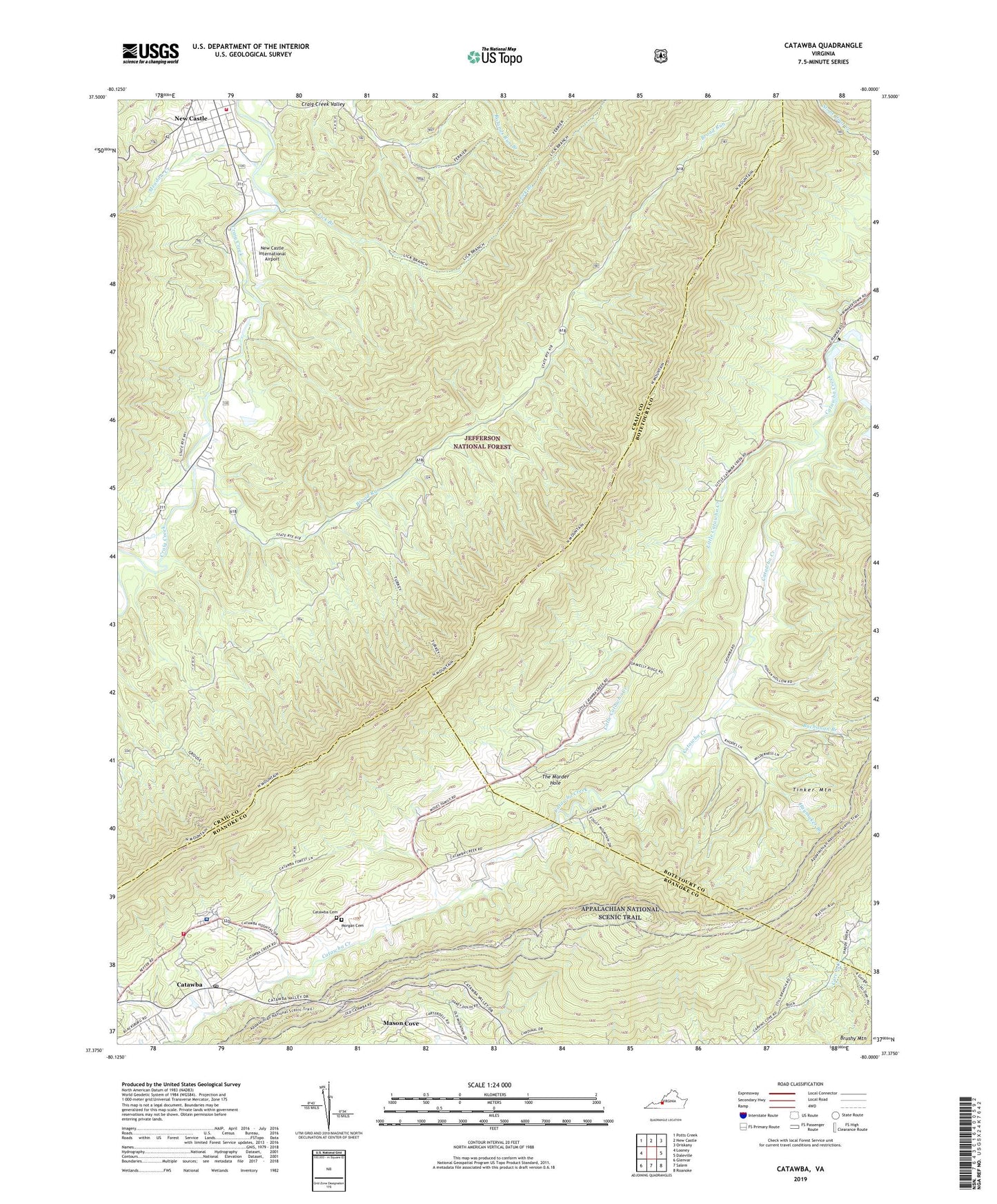
2019 topographic map quadrangle Catawba in the state of Virginia. Scale: 1:24000. Based on the newly updated USGS 7.5' US Topo map series, this map is in the following counties: Craig, Botetourt, Roanoke. The map contains contour data, water features, and other items you are used to seeing on USGS maps, but also has updated roads and other features. This is the next generation of topographic maps. Printed on high-quality waterproof paper with UV fade-resistant inks.
Quads adjacent to this one:
West: Looney
Northwest: Potts Creek
North: New Castle
Northeast: Oriskany
East: Daleville
Southeast: Roanoke
South: Salem
Southwest: Glenvar
Contains the following named places: Broad Run, Broad Run Mountain, Buchanan Branch, Catawba, Catawba Cemetery, Catawba Elementary School, Catawba Hospital, Catawba Mountain, Catawba Post Office, Catawba Valley Church, Gravelly Ridge, Haymaker Branch, Lick Branch, Lick Mountain, Little Catawba Creek, McAfee Knob, Meadow Creek, Medley Camp, Morgan Cemetery, Mountain View Church, New Castle International Airport, New Castle Volunteer Fire Department, New Hope Church, North Mountain, North Mountain Trail, Roanoke County Fire and Rescue Station 4 - Catawba Fire Department, Roanoke County Sheriffs Office, Roanoke Red Sulphur Springs, Spesard Knob, The Murder Hole, Tinker