MyTopo
Deatonville Virginia US Topo Map
Couldn't load pickup availability
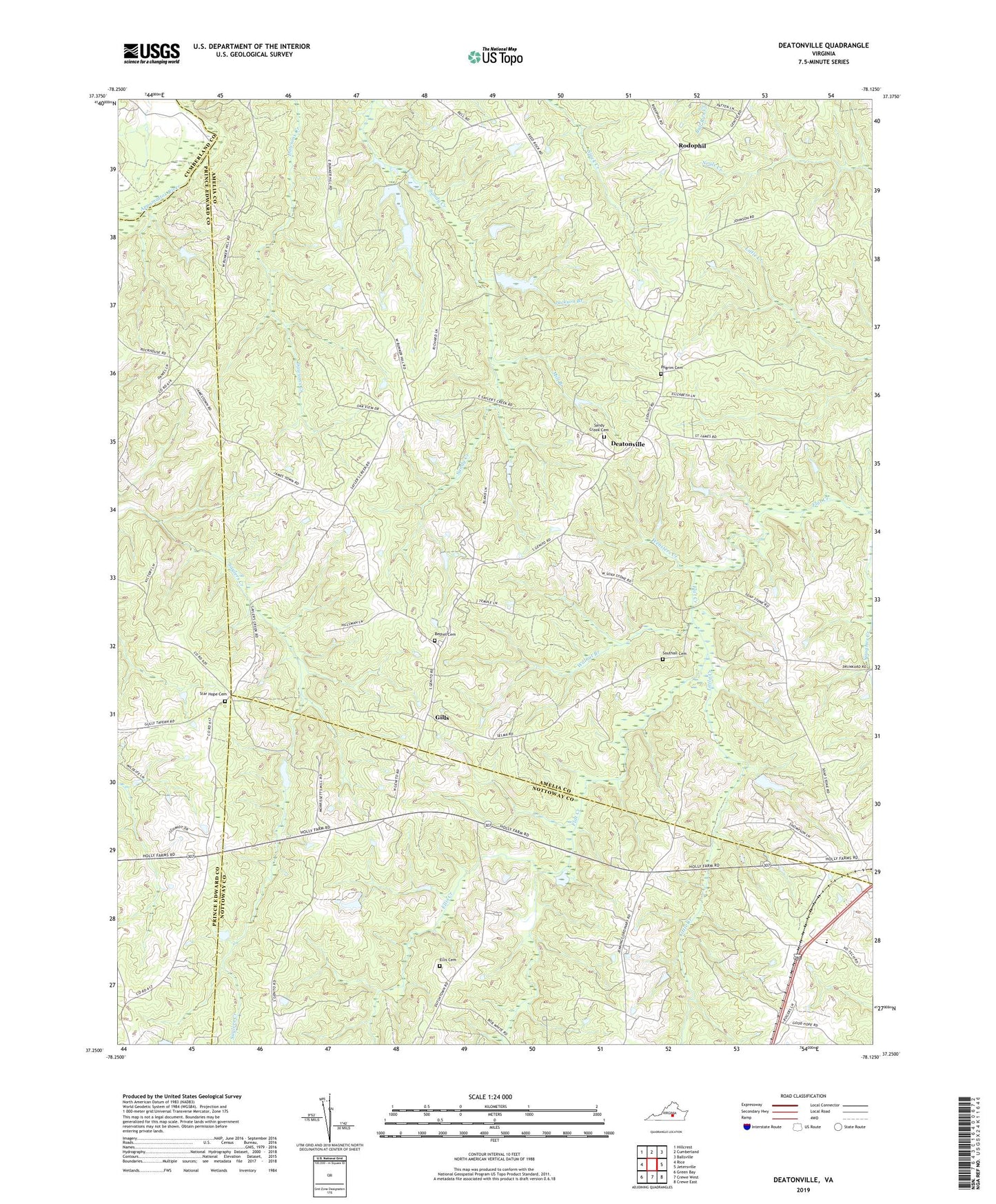
2019 topographic map quadrangle Deatonville in the state of Virginia. Scale: 1:24000. Based on the newly updated USGS 7.5' US Topo map series, this map is in the following counties: Amelia, Nottoway, Prince Edward, Cumberland. The map contains contour data, water features, and other items you are used to seeing on USGS maps, but also has updated roads and other features. This is the next generation of topographic maps. Printed on high-quality waterproof paper with UV fade-resistant inks.
Quads adjacent to this one:
West: Rice
Northwest: Hillcrest
North: Cumberland
Northeast: Ballsville
East: Jetersville
Southeast: Crewe East
South: Crewe West
Southwest: Green Bay
Contains the following named places: Amelia - Nottoway Technical Center and Piedmont Alternative School, Amelia Church, Bethel Cemetery, Bethel Church, Deatonville, District 1, Ellis Cemetery, Ellis Creek, Farmers Mill, Gills, Gills Mill, Gravel Hill Church, Hillsman House, J S Locketts Mill, Jackson Branch, Little Creek, Lockett House, Macedonia Church, Mill Branch, Perron Dam, Piedmont Alternative School, Pilgrim Cemetery, Pilgrim Church, Rodophil, Sandy Creek Baptist Church Cemetery, Sandy Creek Church, Saylers Creek Battlefield State Park, Southall Cemetery, Star Hope Cemetery, Terzs Dam, Walnut Branch, Websters Creek