MyTopo
Crewe East Virginia US Topo Map
Couldn't load pickup availability
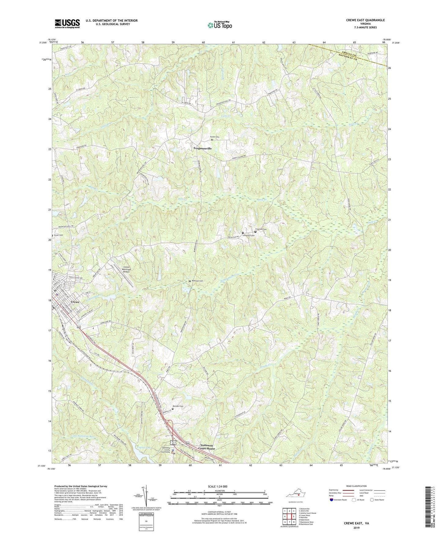
2022 topographic map quadrangle Crewe East in the state of Virginia. Scale: 1:24000. Based on the newly updated USGS 7.5' US Topo map series, this map is in the following counties: Nottoway, Amelia. The map contains contour data, water features, and other items you are used to seeing on USGS maps, but also has updated roads and other features. This is the next generation of topographic maps. Printed on high-quality waterproof paper with UV fade-resistant inks.
Quads adjacent to this one:
West: Crewe West
Northwest: Deatonville
North: Jetersville
Northeast: Amelia Court House
East: Wellville
Southeast: Blackstone East
South: Blackstone West
Southwest: Rubermont
This map covers the same area as the classic USGS quad with code o37078b1.
Contains the following named places: Arnolds Dam, Austins Dam, Belfast Church, Bethesda Church, Blendon Cemetery, Crewe, Crewe Baptist Church, Crewe Christian Church, Crewe High School, Crewe Municipal Airport, Crewe Police Department, Crewe Post Office, Crewe Primary School, Crewe United Methodist Church, Crystal Lake, District 2, District 3, Eleven Oaks Church, Fergusonville, Fourth Mount Zion Church, Freeman Cemetery, Gibson Memorial Church, Hendersonville, Hendersonville School, Lazaretto Creek, Liberty Church, Little West Creek, Lunsalord Cemetery, Mount Calvary Church, New Poplar Mountain Church, Nottoway County, Nottoway County Emergency Squad, Nottoway County Sheriff's Office, Nottoway Court House, Nottoway Court House Census Designated Place, Nottoway Post Office, Old Poplar Mountain Church, Pryor Memorial Presbyterian Church, Robinson Cemetery, Saint Johns Church, Saint Matthews Church, Sharon Church, Sheltons Dam, Southside Skill Center, Strum Cemetery, Towler Cemetery, Watson Creek, Watson Elementary School, Winningham Creek, ZIP Code: 23930