MyTopo
Jetersville Virginia US Topo Map
Couldn't load pickup availability
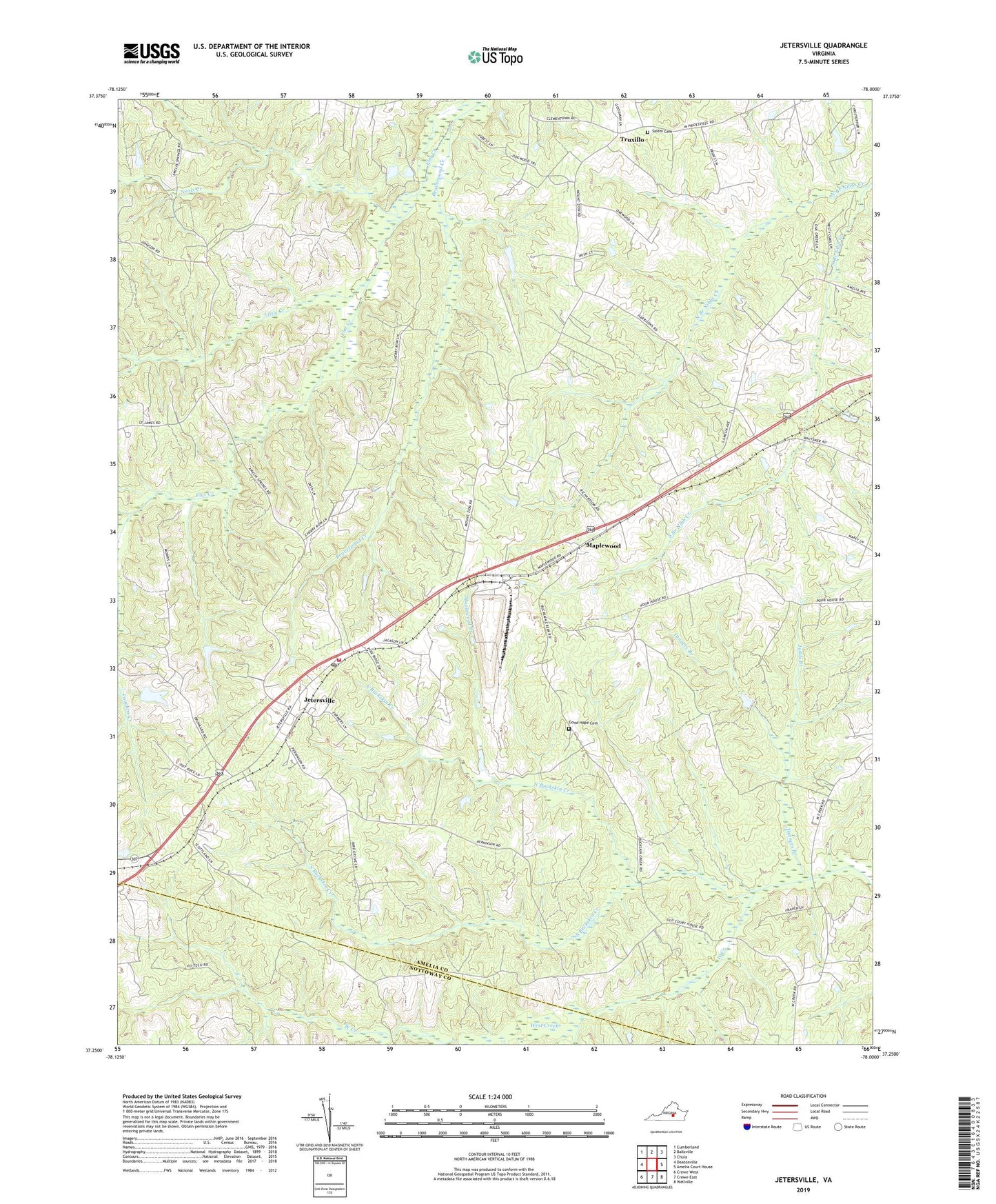
2022 topographic map quadrangle Jetersville in the state of Virginia. Scale: 1:24000. Based on the newly updated USGS 7.5' US Topo map series, this map is in the following counties: Amelia, Nottoway. The map contains contour data, water features, and other items you are used to seeing on USGS maps, but also has updated roads and other features. This is the next generation of topographic maps. Printed on high-quality waterproof paper with UV fade-resistant inks.
Quads adjacent to this one:
West: Deatonville
Northwest: Cumberland
North: Ballsville
Northeast: Chula
East: Amelia Court House
Southeast: Wellville
South: Crewe East
Southwest: Crewe West
This map covers the same area as the classic USGS quad with code o37078c1.
Contains the following named places: Amelia County Volunteer Fire Department Company 3 Jetersville, Amelia Springs, Beaverpond Creek, Bultje Dam, Calvary Branch, Easter Field, Ebenezer Church, Good Hope Baptist Church, Good Hope Cemetery, Holtes Dam, Jeters Mill, Jetersville, Jetersville Company 3, Jetersville Post Office, Jetersville School, Judds Branch, Little Creek, Manns Dam, Maplewood, Maplewood Branch, Neals Creek, North Branch Nibbs Creek, North Buckskin Creek, Saint James Church, Saint James School, Salem Cemetery, Salem Church, Sanderson Dam, South Branch Nibb Creek, South Buckskin Creek, Tanners Branch, Truxillo, Union Branch Church, Vaughns Creek, Zion Hill Church, ZIP Code: 23083