MyTopo
Franktown Virginia US Topo Map
Couldn't load pickup availability
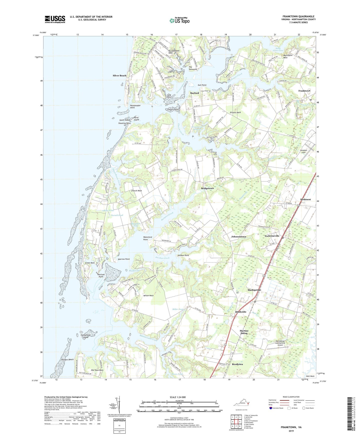
2019 topographic map quadrangle Franktown in the state of Virginia. Scale: 1:24000. Based on the newly updated USGS 7.5' US Topo map series, this map is in the following counties: Northampton. The map contains contour data, water features, and other items you are used to seeing on USGS maps, but also has updated roads and other features. This is the next generation of topographic maps. Printed on high-quality waterproof paper with UV fade-resistant inks.
Quads adjacent to this one:
West: West of Franktown
Northwest: West of Jamesville
North: Jamesville
Northeast: Exmore
East: Nassawadox
Southeast: Cobb Island
South: Cheriton
Southwest: Cape Charles
Contains the following named places: Antioch Church, Barlow Creek, Bayford, Bayleys Neck Farm, Bethel Church, Birdsnest, Birdsnest Post Office, Bridgetown, Campbell Field, Cardinal Estates, Chatham Vineyards and Winery, Church Creek, Church Creek Point, Church Neck, Church Point, Deerfield Estates, Downings Beach, Elliotts Neck, Franktown, Franktown Census Designated Place, Franktown Methodist Church, Franktown Post Office, Great Neck, Gull Point, Harbour Point, Hideaway Cove, Holly Grove Cove, Holly Grove Vineyards, Honeymoon Island, Horse Island, Hungars Beach, Hungars Church, Hungars Creek, Hungars Point, Hungars Wharf, Jacobus Creek, Jacobus Point, Johnsons Church, Johnsontown, Long Point, Machipongo, Machipongo Elementary School, Machipongo International Airport, Machipongo Post Office, Martins Siding, Masden Gut, Mattawoman Creek, Mears Dam, Miller Dam, Miller Pond, Mount Zion Church, Nassawadox Creek, Nassawadox Point, Northampton County Department of Emergency Medical Services, Northampton Middle School, Oldtown Neck Fort, Paraplane Cove, Peaceful Beach Estates, Reedtown, Shadyside, Shooting Point, Shorters Chapel African Methodist Episcopal Church, Silver Beach, Solitude Trails, South Island, Sparrow Point, Taylor Wharf, The Saltworks, The T E C H Center School, Treherneville, Vaucluse Point, Vaucluse Shores, Warehouse Creek, Waterford Point, Weirwood Fairgrounds, Wellington Neck, Westerhouse Creek, Westerhouse Woods, Wilson Neck, ZIP Codes: 23354, 23405