MyTopo
Green Bay Virginia US Topo Map
Couldn't load pickup availability
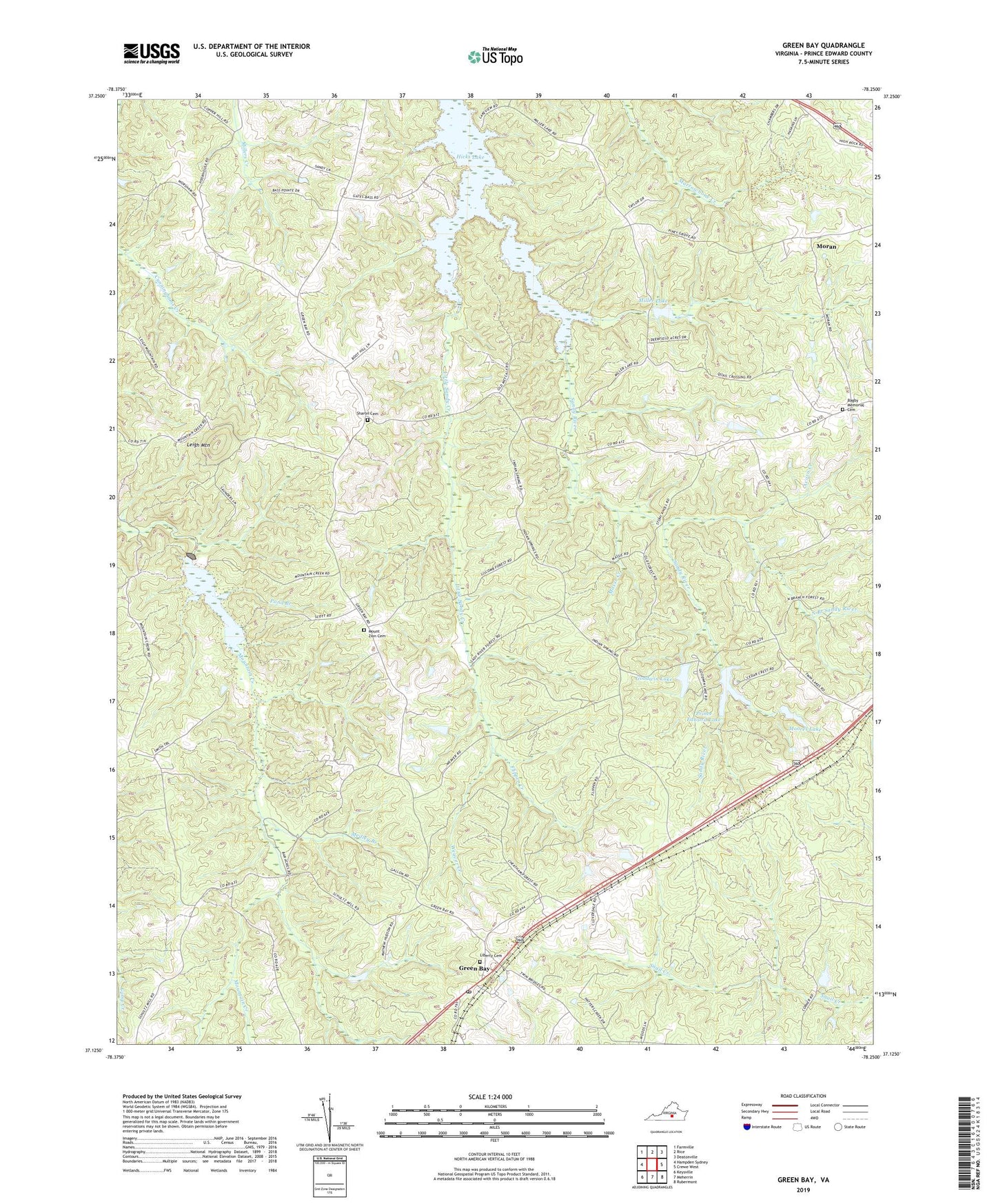
2019 topographic map quadrangle Green Bay in the state of Virginia. Scale: 1:24000. Based on the newly updated USGS 7.5' US Topo map series, this map is in the following counties: Prince Edward. The map contains contour data, water features, and other items you are used to seeing on USGS maps, but also has updated roads and other features. This is the next generation of topographic maps. Printed on high-quality waterproof paper with UV fade-resistant inks.
Quads adjacent to this one:
West: Hampden Sydney
Northwest: Farmville
North: Rice
Northeast: Deatonville
East: Crewe West
Southeast: Rubermont
South: Meherrin
Southwest: Keysville
Contains the following named places: Acorn Creek, Bagby Memorial Cemetery, Borum Dam, Calvary Church, District 301, Flippen Creek, Gallion State Forest, Goodwin Dam, Goodwin Lake, Green Bay, Green Bay High School, Green Bay Post Office, Hicks Lake, High Rock, High Rock Baptist Church, Leigh Mountain, Liberty Cemetery, Liberty Church, Little Sandy Creek, Medley Branch, Miller Lake, Miller Lake Dam, Moores Dam, Moores Lake, Moran, Mosse Creek, Mount Leigh School, Mount Zion Baptist Church, Mount Zion Cemetery, North Branch Sandy River, Pond Branch, Prince Edward Dam, Prince Edward Lake, Prince Edward State Forest, Sharon Cemetery, Sharon Church, Twin Lakes, Twin Lakes State Park, Weaver Creek, ZIP Code: 23942