MyTopo
Rubermont Virginia US Topo Map
Couldn't load pickup availability
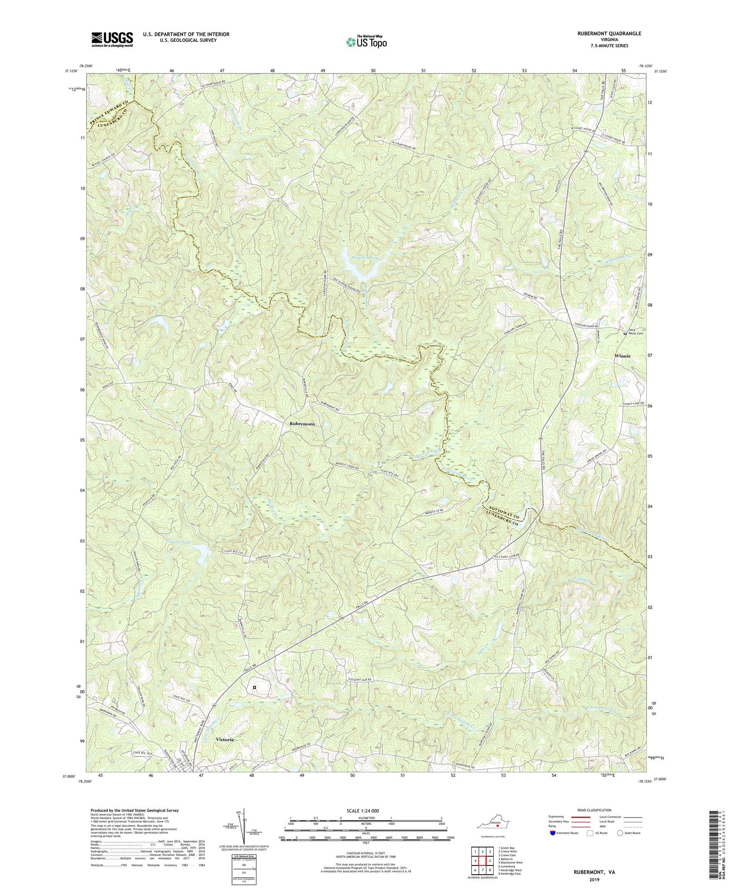
2022 topographic map quadrangle Rubermont in the state of Virginia. Scale: 1:24000. Based on the newly updated USGS 7.5' US Topo map series, this map is in the following counties: Lunenburg, Nottoway, Prince Edward. The map contains contour data, water features, and other items you are used to seeing on USGS maps, but also has updated roads and other features. This is the next generation of topographic maps. Printed on high-quality waterproof paper with UV fade-resistant inks.
Quads adjacent to this one:
West: Meherrin
Northwest: Green Bay
North: Crewe West
Northeast: Crewe East
East: Blackstone West
Southeast: Kenbridge East
South: Kenbridge West
Southwest: Lunenburg
This map covers the same area as the classic USGS quad with code o37078a2.
Contains the following named places: Bethel Church, Dickerson Creek, Dry Creek, Falls Creek, Hamilton Dam, Hamilton Lake, Horsepen Branch, Jeffress Store, Laurel Hill Church, Lunenburg Correctional Center, Martins Corner, Modest Creek, Modest Creek Dam, Mount Olive Church, Mount Zion Church, Northside Chapel, Nottoway Falls Dam, Nottoway Falls Reservoir, Pleasant Oak Church, Plymouth, Plymouth District, Rubermont, Saint Marks Cemetery, Saint Marks Church, Saint Pauls Church, Snail Creek, Spraggins Dairy Farm, The Falls, Thrift Chapel, Victoria Lake, Winnie, Zion Hill Church