MyTopo
Keysville Virginia US Topo Map
Couldn't load pickup availability
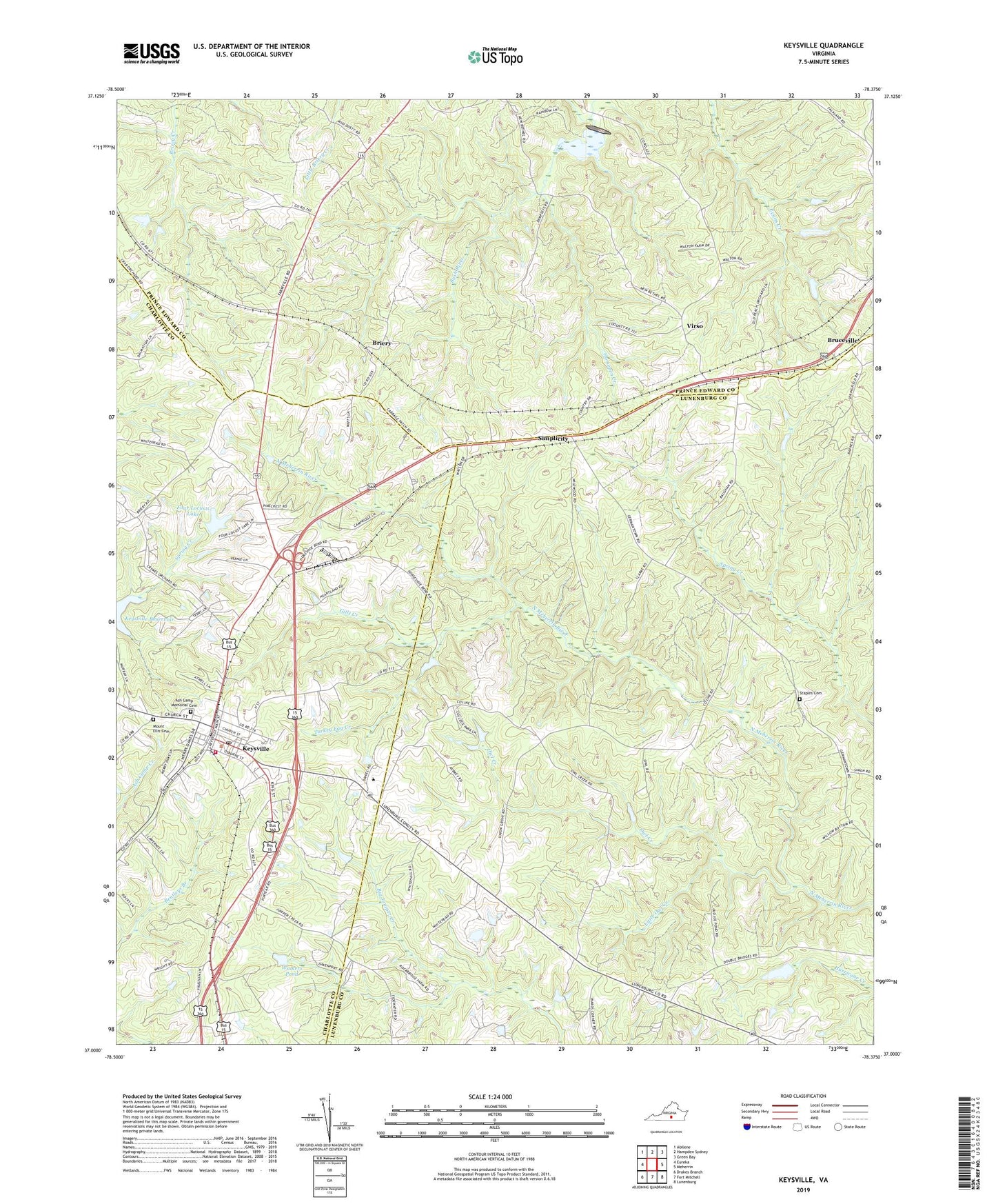
2022 topographic map quadrangle Keysville in the state of Virginia. Scale: 1:24000. Based on the newly updated USGS 7.5' US Topo map series, this map is in the following counties: Lunenburg, Prince Edward, Charlotte. The map contains contour data, water features, and other items you are used to seeing on USGS maps, but also has updated roads and other features. This is the next generation of topographic maps. Printed on high-quality waterproof paper with UV fade-resistant inks.
Quads adjacent to this one:
West: Eureka
Northwest: Abilene
North: Hampden Sydney
Northeast: Green Bay
East: Meherrin
Southeast: Lunenburg
South: Fort Mitchell
Southwest: Drakes Branch
This map covers the same area as the classic USGS quad with code o37078a4.
Contains the following named places: Antioch Church, Ash Camp Church, Ash Camp Memorial Cemetery, Briery, Briery Church, Briery Country Club, Bruceville, Charlotte County Volunteer Rescue Squad Station 1, Forest Church, Four Locusts Dam, Four Locusts Lake, Gentry Dam, Gill Hill Church, Gills Creek, Herzig Dam, Horsepen Creek, Keysville, Keysville Airport, Keysville Post Office, Keysville Volunteer Fire Department, Little Owl Creek, Lone Oak Church, Meherrin Church, Mount Ellis Cemetery, Mount Ellis Church, Owl Creek, Simplicity, Southside Virginia Community College - John H Daniel Campus, Staples Cemetery, Town of Keysville, Turkey Egg Creek, Union Grove Church, Virso, Virso School, Walkers Pond, ZIP Codes: 23947, 23954