MyTopo
Hillcrest Virginia US Topo Map
Couldn't load pickup availability
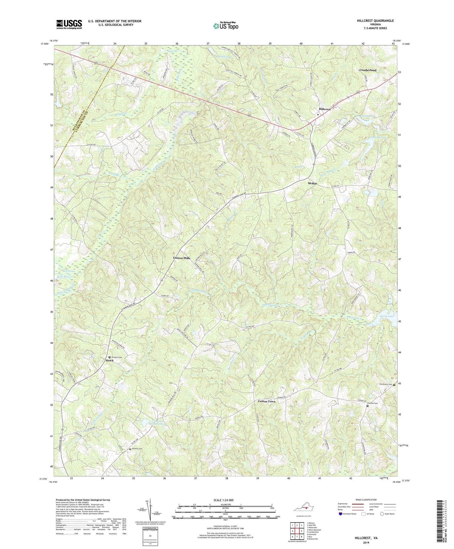
2019 topographic map quadrangle Hillcrest in the state of Virginia. Scale: 1:24000. Based on the newly updated USGS 7.5' US Topo map series, this map is in the following counties: Cumberland, Buckingham. The map contains contour data, water features, and other items you are used to seeing on USGS maps, but also has updated roads and other features. This is the next generation of topographic maps. Printed on high-quality waterproof paper with UV fade-resistant inks.
Quads adjacent to this one:
West: Willis Mountain
Northwest: Dillwyn
North: Gold Hill
Northeast: Whiteville
East: Cumberland
Southeast: Deatonville
South: Rice
Southwest: Farmville
Contains the following named places: Amos Dairy Farm, Antioch Cemetery, Antioch Church, Bish Dam, Boston Branch, Browns Cemetery, Browns Church, Browns Store, Ca Ira, Ca Ira Pond, Camp Branch, Centenary Cemetery, Centenary Church, Clements Dam, Clements Lake, Collins Dam, Collins Lake, Corner Stone Church, Cotton Town, Cumberland Census Designated Place, Cumberland County Middle School, Cumberland Volunteer Rescue Squad, District 4, Gnegy Dam, Grace Church, Guinea Cemetery, Guinea Church, Guinea Mills, Hawk, Hillcrest, Holmans Mill, Horsepen Creek, House of Prayer, Ivy Branch, John Randolph High School, Jones Dam, Landis Dam, Little Guinea Creek, Little Willis River, McRae, Midway Church, Morton School, Oak Hill Lake, Payne Creek, Rock Creek, Swans Lake, T Edward Stimpson Dam, T Edward Stimpson Pond, Tear Wallet Church, Tearwallet Baptist Church, Wilcks Dam, Willis River Number Nine Dam