MyTopo
Holiday Lake Virginia US Topo Map
Couldn't load pickup availability
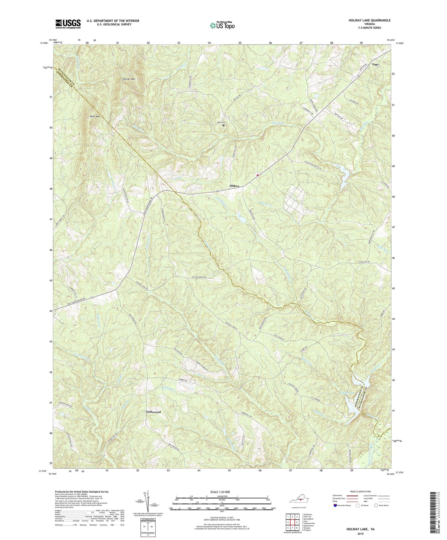
2022 topographic map quadrangle Holiday Lake in the state of Virginia. Scale: 1:24000. Based on the newly updated USGS 7.5' US Topo map series, this map is in the following counties: Appomattox, Buckingham. The map contains contour data, water features, and other items you are used to seeing on USGS maps, but also has updated roads and other features. This is the next generation of topographic maps. Printed on high-quality waterproof paper with UV fade-resistant inks.
Quads adjacent to this one:
West: Vera
Northwest: Gladstone
North: Saint Joy
Northeast: Buckingham
East: Andersonville
Southeast: Prospect
South: Pamplin
Southwest: Appomattox
This map covers the same area as the classic USGS quad with code o37078d6.
Contains the following named places: Appomattox Buckingham State Forest, Bear Branch, Bethlehem Church, Cemetery Creek, Forbes, Forbes Creek, Fore Store, Four H Club, Gunner Mountain, Hog Branch, Holiday Creek, Holiday Dam, Holiday Lake, Holiday Lake Lookout Tower, Holiday Lake State Park, Holiday Lake State Recreation Area, Hollywood, Jamison Creek, Kyles Mountain, Long Branch, Mann Cemetery, North Fork Wolf Creek, North Holiday Creek, Pleasant Grove Church, Ragby Branch, Rose Bower, Sanders Creek, Sliders, Stillhouse Creek, Toga, Toga Airport, Toga Volunteer Fire Department, Union Church, Webb Mill Creek