MyTopo
Ingram Virginia US Topo Map
Couldn't load pickup availability
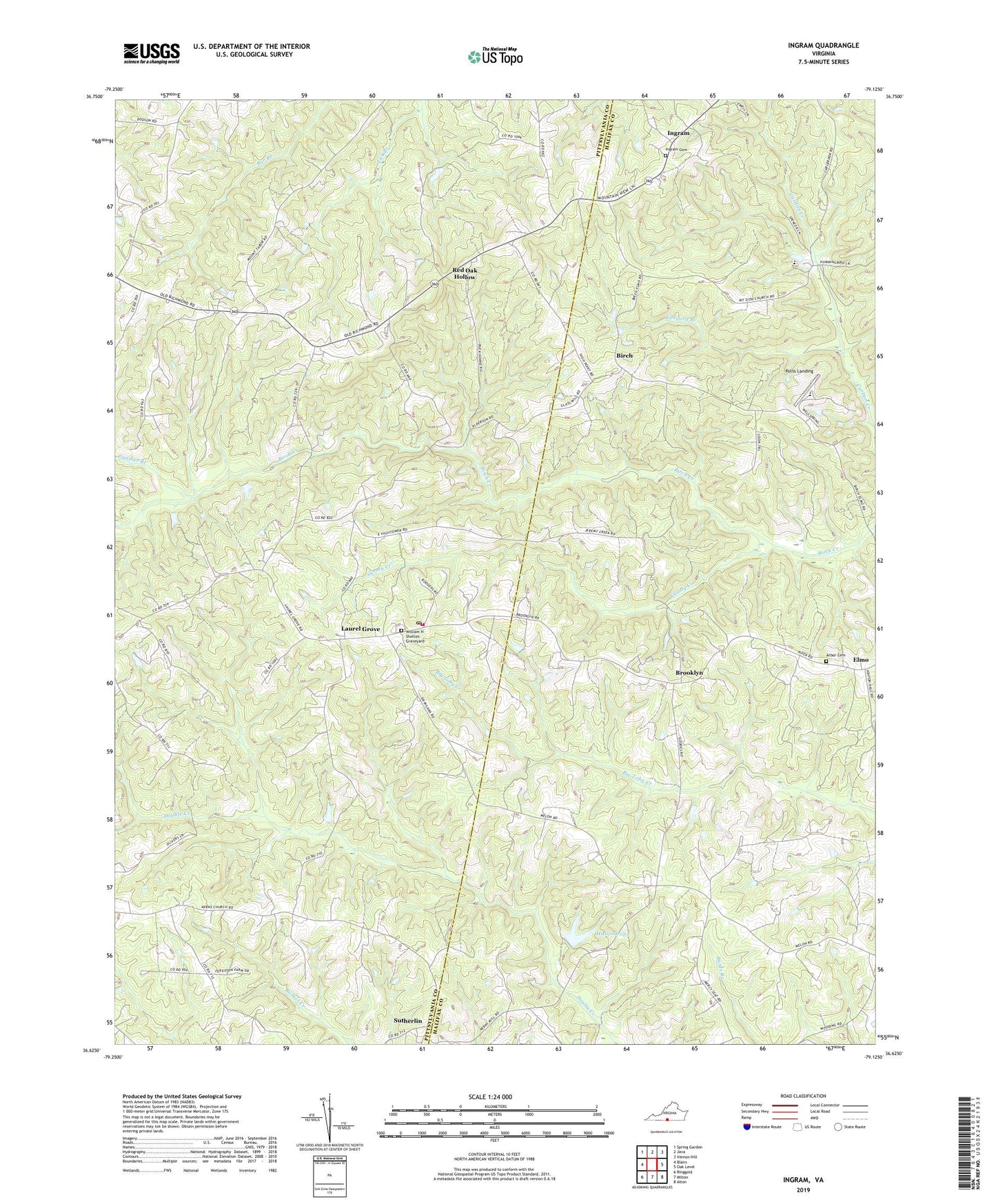
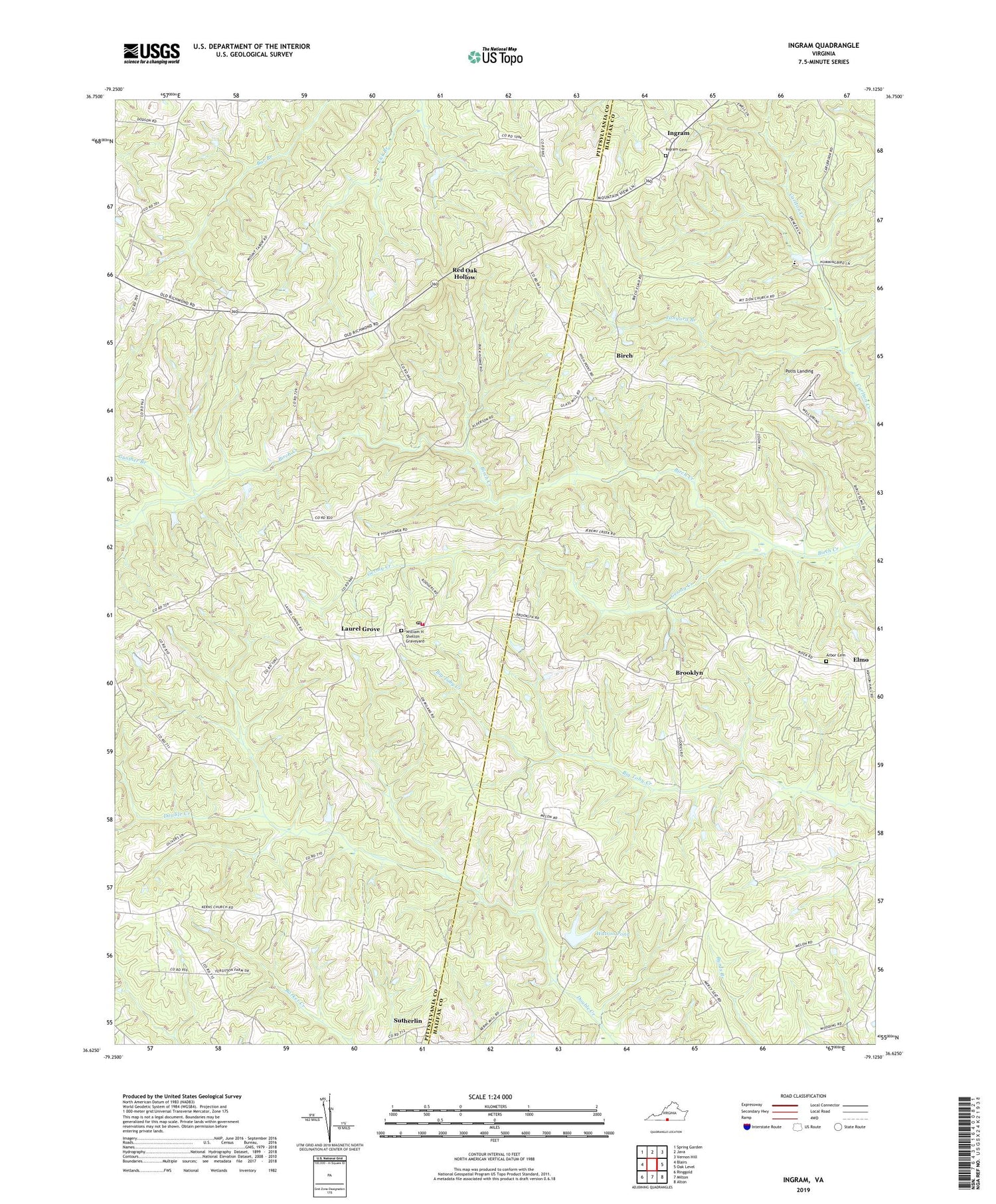
2019 topographic map quadrangle Ingram in the state of Virginia. Scale: 1:24000. Based on the newly updated USGS 7.5' US Topo map series, this map is in the following counties: Pittsylvania, Halifax. The map contains contour data, water features, and other items you are used to seeing on USGS maps, but also has updated roads and other features. This is the next generation of topographic maps. Printed on high-quality waterproof paper with UV fade-resistant inks.
Quads adjacent to this one:
West: Blairs
Northwest: Spring Garden
North: Java
Northeast: Vernon Hill
East: Oak Level
Southeast: Alton
South: Milton
Southwest: Ringgold
Contains the following named places: Arbor Cemetery, Arbor Church, Birch, Birch School, Birchland Park, Brooklyn, Double Creek School, Germy Creek, Gunther Branch, Ingram, Ingram Cemetery, Ingram United Church of Christ, Kerns Memorial Church, Laurel Grove, Laurel Grove Church, Laurel Grove Volunteer Fire and Rescue, Mount Zion Church, Old Mill Church, Old Mine Creek Church, Potts Landing, Red Oak Hollow, Rol Dam, Roxboro School, Sutherlin Post Office, Tanyard Branch, The Mount Church, Watson Dam, Watson Pond, Wellspring Academy, White Oak Church, White Oak School, William H Shelton Graveyard, ZIP Code: 24594