MyTopo
Blairs Virginia US Topo Map
Couldn't load pickup availability
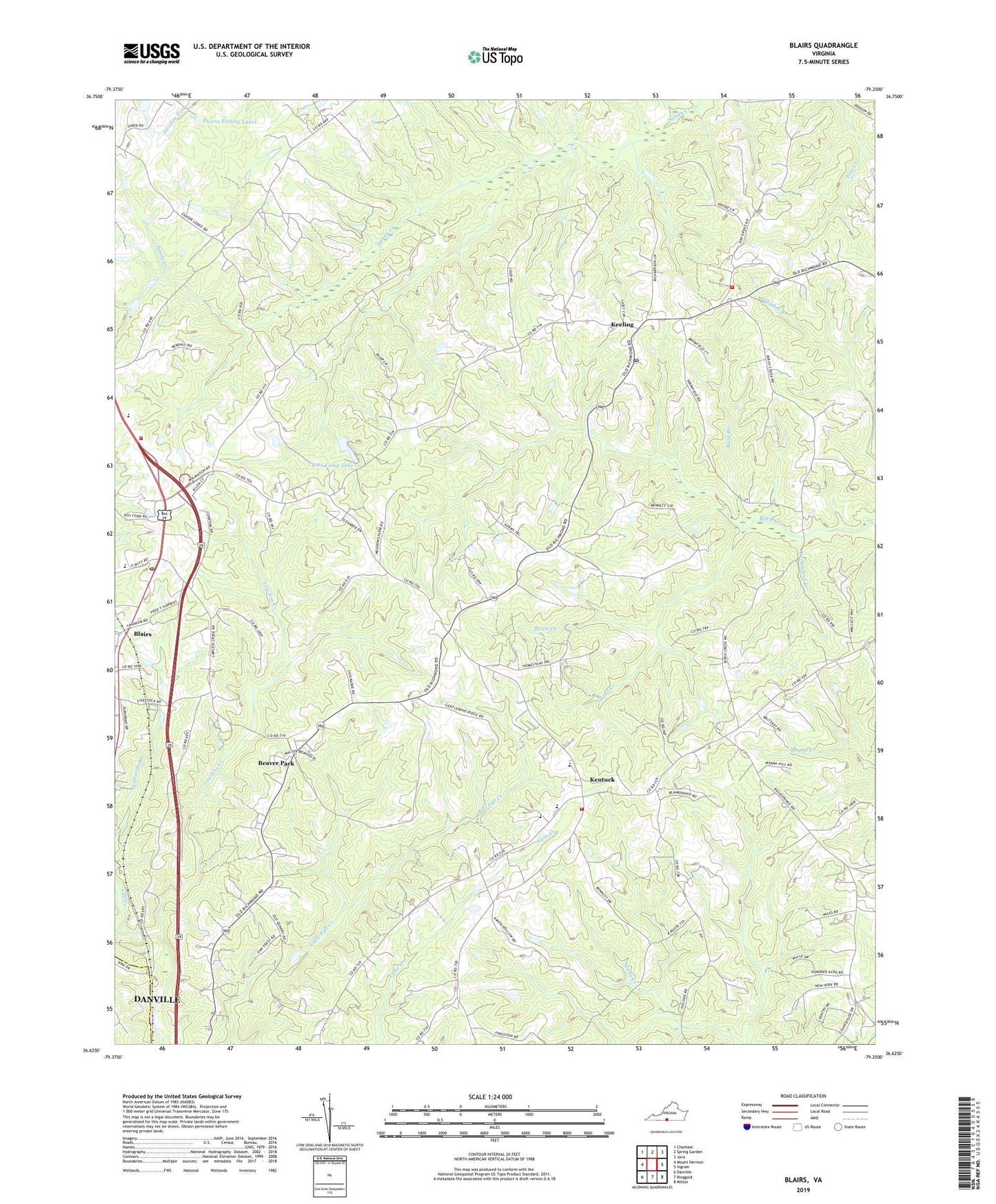
2022 topographic map quadrangle Blairs in the state of Virginia. Scale: 1:24000. Based on the newly updated USGS 7.5' US Topo map series, this map is in the following counties: Pittsylvania, Danville (city). The map contains contour data, water features, and other items you are used to seeing on USGS maps, but also has updated roads and other features. This is the next generation of topographic maps. Printed on high-quality waterproof paper with UV fade-resistant inks.
Quads adjacent to this one:
West: Mount Hermon
Northwest: Chatham
North: Spring Garden
Northeast: Java
East: Ingram
Southeast: Milton
South: Ringgold
Southwest: Danville
This map covers the same area as the classic USGS quad with code o36079f3.
Contains the following named places: Back Branch, Beaver Park, Beaver School, Bennetts Store, Bethel Church, Blairs, Blairs Post Office, Blairs Volunteer Fire Department, Chestnut Level, Chestnut Level School, Dan River District, Dan River Elementary School, Dan River High School, Dan River Middle School, Evans Store, Faith Home for Children, Gibsons Store, Grassy Branch, Kadesh School, Keeling, Keeling Post Office, Keeling Volunteer Fire Department, Kentuck, Kentuck Church, Kentuck Elementary School, Kentuck Volunteer Fire Department, KOA Camp Dam, KOA Camp Lake, Lawless Creek, Malmaison Church, Oak Grove Church, Oak Grove School, Oliver Creek, Owens Fishing Lakes, Pittston School, Rock Springs Church, Sanderson School, Sandy Creek Church, Southside Elementary School, Thornton Dam, Turkeyfoot Branch, White Oak School, ZIP Codes: 24527, 24566