MyTopo
Irving Virginia US Topo Map
Couldn't load pickup availability
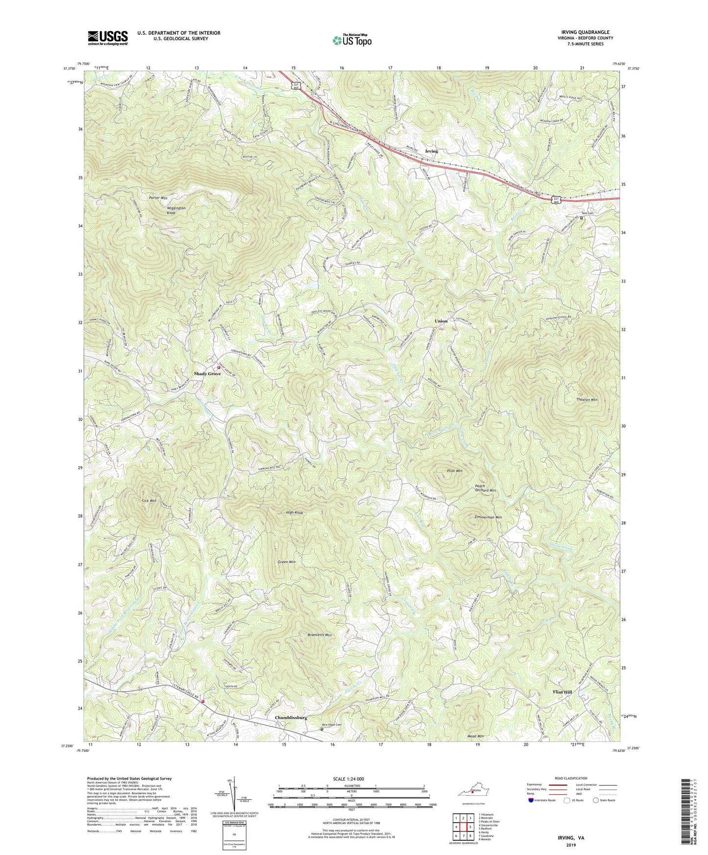
2019 topographic map quadrangle Irving in the state of Virginia. Scale: 1:24000. Based on the newly updated USGS 7.5' US Topo map series, this map is in the following counties: Bedford. The map contains contour data, water features, and other items you are used to seeing on USGS maps, but also has updated roads and other features. This is the next generation of topographic maps. Printed on high-quality waterproof paper with UV fade-resistant inks.
Quads adjacent to this one:
West: Stewartsville
Northwest: Villamont
North: Montvale
Northeast: Peaks of Otter
East: Bedford
Southeast: Moneta
South: Goodview
Southwest: Hardy
Contains the following named places: Beaverdam Church, Blue Ridge District, Bore Auger Creek, Bramletts Mountain, Chamblissburg, Chamblissburg First Aid and Rescue Squad, Coonsville, Cragged Branch, District 6, East Fork Beaverdam Creek, Elk Creek, Enochs Creek, Flint Hill, Franklin School, Green Mountain, High Knob, Irving, Lick Mountain, Lick Run, Middle Fork Beaverdam Creek, Mount Zion Baptist Church, New Hope Cemetery, New Hope Church, North Fork Goose Creek, Parris Chapel, Peach Orchard Mountain, Pilot Mountain, Porter Mountain, Reed Creek, Rocky Ford, Saunders Grove Church, Shady Grove, Shady Grove Church, Shady Grove Volunteer Fire Department, Shockoe Creek, South Fork Goose Creek, Stewartsville - Chamblissburg Volunteer Fire Department Station 2, Tate Cemetery, Thaxton Mountain, Union, Union Methodist Church, Wiggington Knob, WJPR-TV (Lynchburg), WSET-TV (Lynchburg), WYMY-FM (Bedford), Zimmerman Mountain, ZIP Code: 24174