
MyTopo
Java Virginia US Topo Map
Couldn't load pickup availability
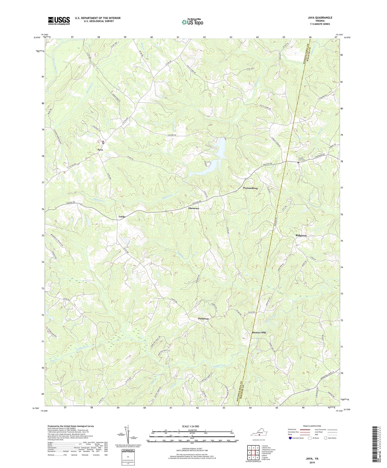
2019 topographic map quadrangle Java in the state of Virginia. Scale: 1:24000. Based on the newly updated USGS 7.5' US Topo map series, this map is in the following counties: Pittsylvania, Halifax. The map contains contour data, water features, and other items you are used to seeing on USGS maps, but also has updated roads and other features. This is the next generation of topographic maps. Printed on high-quality waterproof paper with UV fade-resistant inks.
Quads adjacent to this one:
West: Spring Garden
Northwest: Gretna
North: Mount Airy
Northeast: Republican Grove
East: Vernon Hill
Southeast: Oak Level
South: Ingram
Southwest: Blairs
Contains the following named places: Bar Branch, Chaneys Store, County Line Cemetery, County Line Church, Ebenezer, Ebenezer Baptist Church, Elkhorn Dam, Elkhorn Lake, Gregory Dam, Haymes School, Henrys Mill, Holy Tabernacle Church, Ingram School, Java, Java Post Office, Johns Run, Lick Branch, Lipford School, Lucks, Mount Tabor Church, Peytonsburg, Pickaway, Pine Creek, Providence Church, Riceville - Java Volunteer Fire Department, Ridgeway, Saint Pauls Church, Waller School, Whitethorn Creek, Womacks Chapel, Zion Chapel, ZIP Code: 24565


