MyTopo
Gretna Virginia US Topo Map
Couldn't load pickup availability
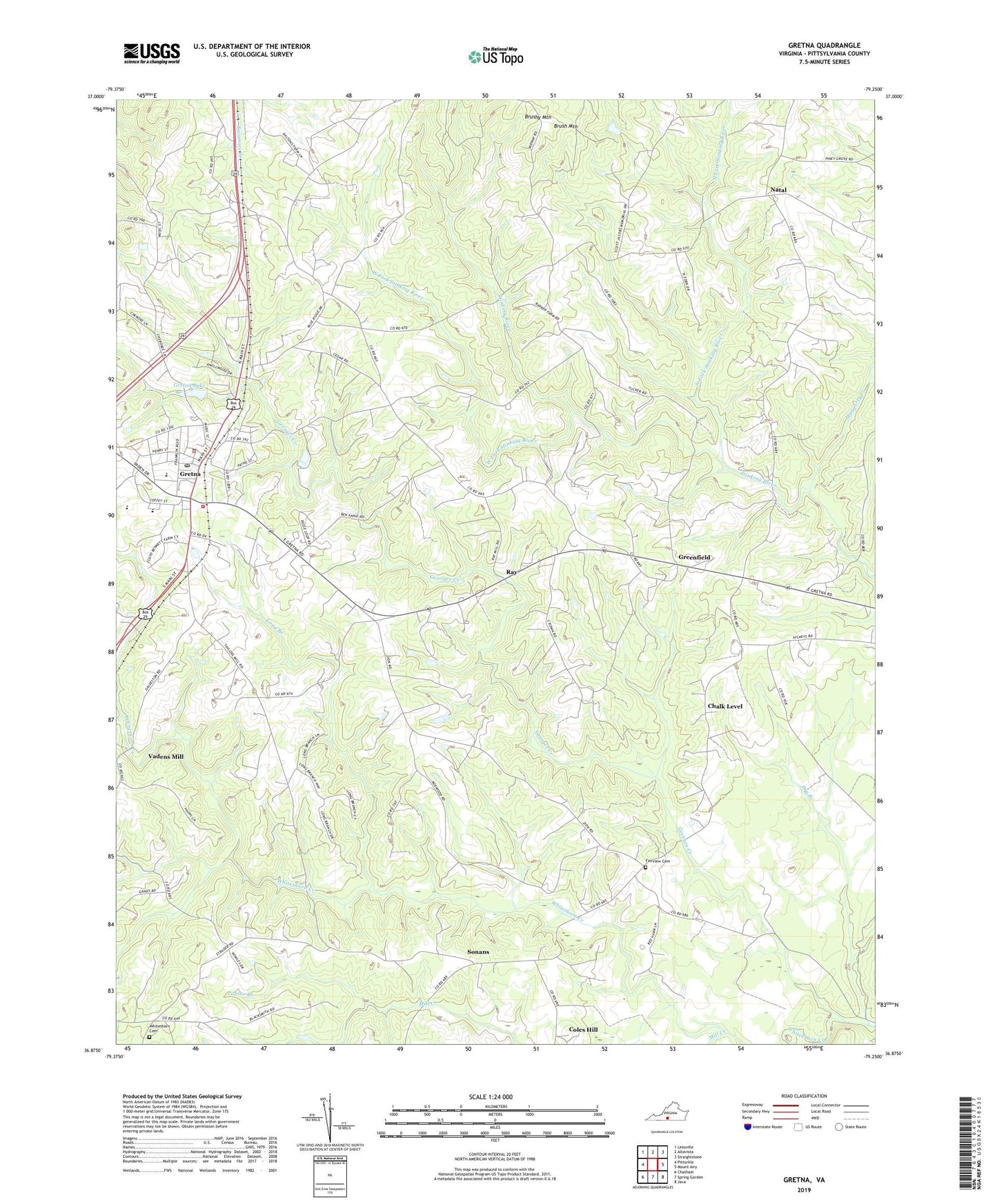
2022 topographic map quadrangle Gretna in the state of Virginia. Scale: 1:24000. Based on the newly updated USGS 7.5' US Topo map series, this map is in the following counties: Pittsylvania. The map contains contour data, water features, and other items you are used to seeing on USGS maps, but also has updated roads and other features. This is the next generation of topographic maps. Printed on high-quality waterproof paper with UV fade-resistant inks.
Quads adjacent to this one:
West: Pittsville
Northwest: Leesville
North: Altavista
Northeast: Straightstone
East: Mount Airy
Southeast: Java
South: Spring Garden
Southwest: Chatham
This map covers the same area as the classic USGS quad with code o36079h3.
Contains the following named places: Chalk Level, Coles Hill, Dalton School, Dry Branch, Fairview Cemetery, Fairview Church, Faith Hope Church, Galveston School, Georges Creek, Greenfield, Greenfield Baptist Church, Gretna, Gretna Dam, Gretna Elementary School, Gretna First Baptist Church, Gretna High School, Gretna Industrial Park, Gretna Lake, Gretna Middle School, Gretna Police Department, Gretna Post Office, Gretna Rescue Squad, Gretna Rolling Mill, Gretna Station, Gretna Town Park, Gretna Volunteer Fire Department, Long Branch, Meadow School, Midway Church, Midway School, Mill Creek, Mount Nebo School, Mount Zion Baptist Church, Natal, North Fork Stinking River, Poplar Branch, Ray, Ray School, Rockford School, Shelton Dam, Sonans, Sonans School, Springfield Church, Tates Mill, Town of Gretna, Vadens Mill, West Fork Stinking River, Whitethorn Cemetery, Whitethorn School, WMNA-AM (Gretna), WMNA-FM (Gretna), Yates Tavern, Zion Church, ZIP Code: 24557