MyTopo
Lawrenceville Virginia US Topo Map
Couldn't load pickup availability
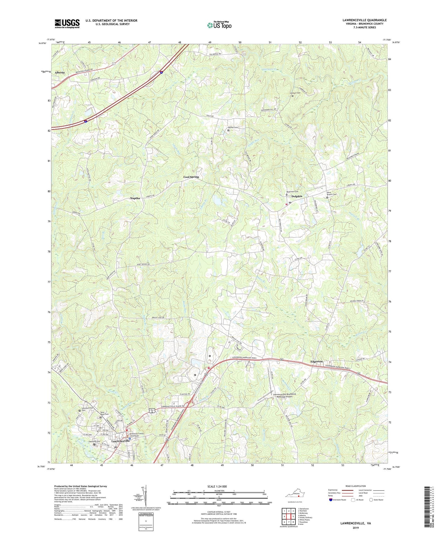
2019 topographic map quadrangle Lawrenceville in the state of Virginia. Scale: 1:24000. Based on the newly updated USGS 7.5' US Topo map series, this map is in the following counties: Brunswick. The map contains contour data, water features, and other items you are used to seeing on USGS maps, but also has updated roads and other features. This is the next generation of topographic maps. Printed on high-quality waterproof paper with UV fade-resistant inks.
Quads adjacent to this one:
West: Alberta
Northwest: Danieltown
North: Warfield
Northeast: McKenney
East: Smoky Ordinary
Southeast: Ante
South: Powellton
Southwest: White Plains
Contains the following named places: Abernathy School, Barnes Cemetery, Brunswick Academy, Brunswick Correctional Center Fire Department, Brunswick County, Brunswick County Courthouse, Brunswick County Jail, Brunswick County Poor Farm, Brunswick County Public Schools Office, Brunswick County Sheriff's Office, Brunswick High School, Brunswick Volunteer Rescue Squad, Brunswick Work Center, Cedar Grove Church, Cool Spring, Dolphin, Dolphin Baptist Church, Dolphin Post Office, Dolphin Volunteer Fire Department, Dukes Branch, Edgerton, Flatrock Branch, Flatrock Pond, Flatrock Pond Dam, Huckleberry Branch, James S Russell Middle School, James Solomon Russell Memorial Library, Johnson Cemetery, Johnson Grove Church, Lawrenceville, Lawrenceville Baptist Church, Lawrenceville Cemetery, Lawrenceville Correctional Center, Lawrenceville High School, Lawrenceville Police Chief, Lawrenceville Police Department, Lawrenceville Post Office, Lawrenceville Presbyterian Church, Lawrenceville Quarry, Lawrenceville Volunteer Fire Department Company 7, Lawrenceville/Brunswick Municipal Airport, Letcher Memorial Hospital, Liberty Branch, Liberty Church, Lloyds Run, Meherrin Regional Library, Naptha, Oakwood Cemetery, Olive Branch Cemetery, Olive Branch Church, Perkinson Cemetery, Pleasant Hill Church, Pleasant Hill School, Poyners Academy, Rocky Ford, Rocky Run, Russell High School, Saint Andrews Episcopal Church, Saint Bernard Church, Saint James African Methodist Episcopal Church, Saint Pauls Cemetery, Saint Paul's College, Saint Pauls Memorial Chapel, Sandy Branch, Shart Chapel, Soloman Creek, Sturgeon District, Tain Branch, Thomasburg School, Totaro Elementary School, Town of Lawrenceville, Union African Methodist Episcopal Zion Church, Union Bethel Church, Virginia Department of Forestry Brunswick County, Wesson, Westward School, WHFD-FM (Lawrenceville), Wilson Chapel, Wilson Chapel School, WLES-AM (Lawrenceville), ZIP Code: 23843