MyTopo
White Plains Virginia US Topo Map
Couldn't load pickup availability
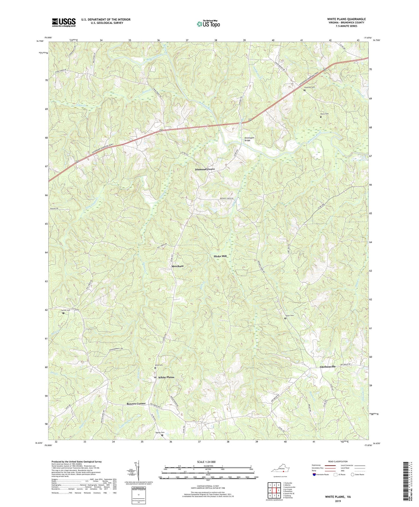
2022 topographic map quadrangle White Plains in the state of Virginia. Scale: 1:24000. Based on the newly updated USGS 7.5' US Topo map series, this map is in the following counties: Brunswick. The map contains contour data, water features, and other items you are used to seeing on USGS maps, but also has updated roads and other features. This is the next generation of topographic maps. Printed on high-quality waterproof paper with UV fade-resistant inks.
Quads adjacent to this one:
West: La Crosse
Northwest: Forksville
North: Alberta
Northeast: Lawrenceville
East: Powellton
Southeast: Valentines
South: Gasburg
Southwest: South Hill SE
This map covers the same area as the classic USGS quad with code o36077f8.
Contains the following named places: Bethany Church, Bethlehem Church, Bishop Cemetery, Bowers Corner, Briery Branch, Carroll Cemetery, Davis Cemetery, Diamond Grove, Evans Creek, Flat Branch, Flournoy Cemetery, Genito Creek, Gholsonville, Gholsonville School, Grace Church, Hicks Creek, Hicks Mill, Holy Sunrise Church, Little Genito Creek, Little Union Church, Meherrin District, Meherrin School, Merchant, Mount Olive Church, Netta, Netta Church, Oak Grove Church, Oakley School, Paradise Church, Pennington Bridge, Saddletree Creek, Solomons Temple, Tabernacle Church, Taylor Cemetery, Union Church, Watkins Corner, White Plains, White Plains Post Office, White Plains School, Wray Cemetery, ZIP Codes: 23893, 23920