
MyTopo
Mathias Point Virginia US Topo Map
Couldn't load pickup availability
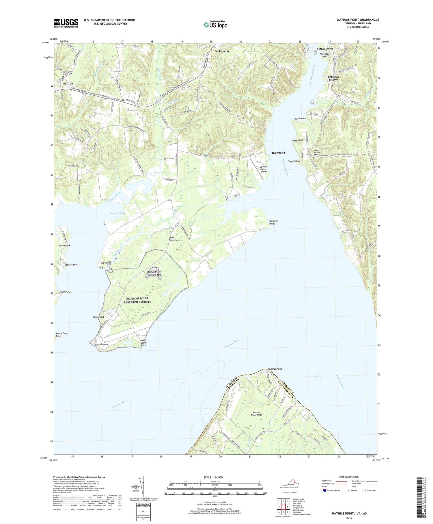
2019 topographic map quadrangle Mathias Point in the states of Maryland, Virginia. Scale: 1:24000. Based on the newly updated USGS 7.5' US Topo map series, this map is in the following counties: King George, Charles. The map contains contour data, water features, and other items you are used to seeing on USGS maps, but also has updated roads and other features. This is the next generation of topographic maps. Printed on high-quality waterproof paper with UV fade-resistant inks.
Quads adjacent to this one:
West: Nanjemoy
Northwest: Indian Head
North: Port Tobacco
Northeast: La Plata
East: Popes Creek
Southeast: Colonial Beach North
South: Dahlgren
Southwest: King George
Contains the following named places: Balls Point, Benny Gray Point, Blossom Point, Blossom Point Proving Grounds, Bluff Point, Bluff Point Cove, Brentland, Bristol, Burgess Creek, Cedar Grove, Cedar Point Neck, Cedar Point Neck School, Chapel Point, Chapel Point State Park, Charles County, Compton, Deep Point, District 2 Hill Top, Fourth Point, Goose Bay Marina, Goose Creek, Gumtree Cove, Halls Point, Harry Diamond Laboratories, Henson Landing, Hill Top, Kings Creek, Lanseair Farms Airport, Leonardtown Volunteer Rescue Squad Company 19, Mathias Point, Mathias Point Neck, Melody Acres, Mill Run, Mount Air, Mount Bethel Recreation Center, Nanjemoy Creek, Penn Manor, Port Tobacco Marina, Port Tobacco River, Potomac Shores, Saint Ignatius Cemetery, Saint Ignatius Church, Simms Landing, Sutton Acres, Tanners Point, The Welcome Mission, Upper Cedar Point, Warehouse Point, Welcome, Welcome Acres, Welcome Post Office, Wills Branch, Wills Island, Windmill Point, Zion Baptist Church Cemetery, Zion Church, ZIP Codes: 20677, 20693


