MyTopo
McDowell Virginia US Topo Map
Couldn't load pickup availability
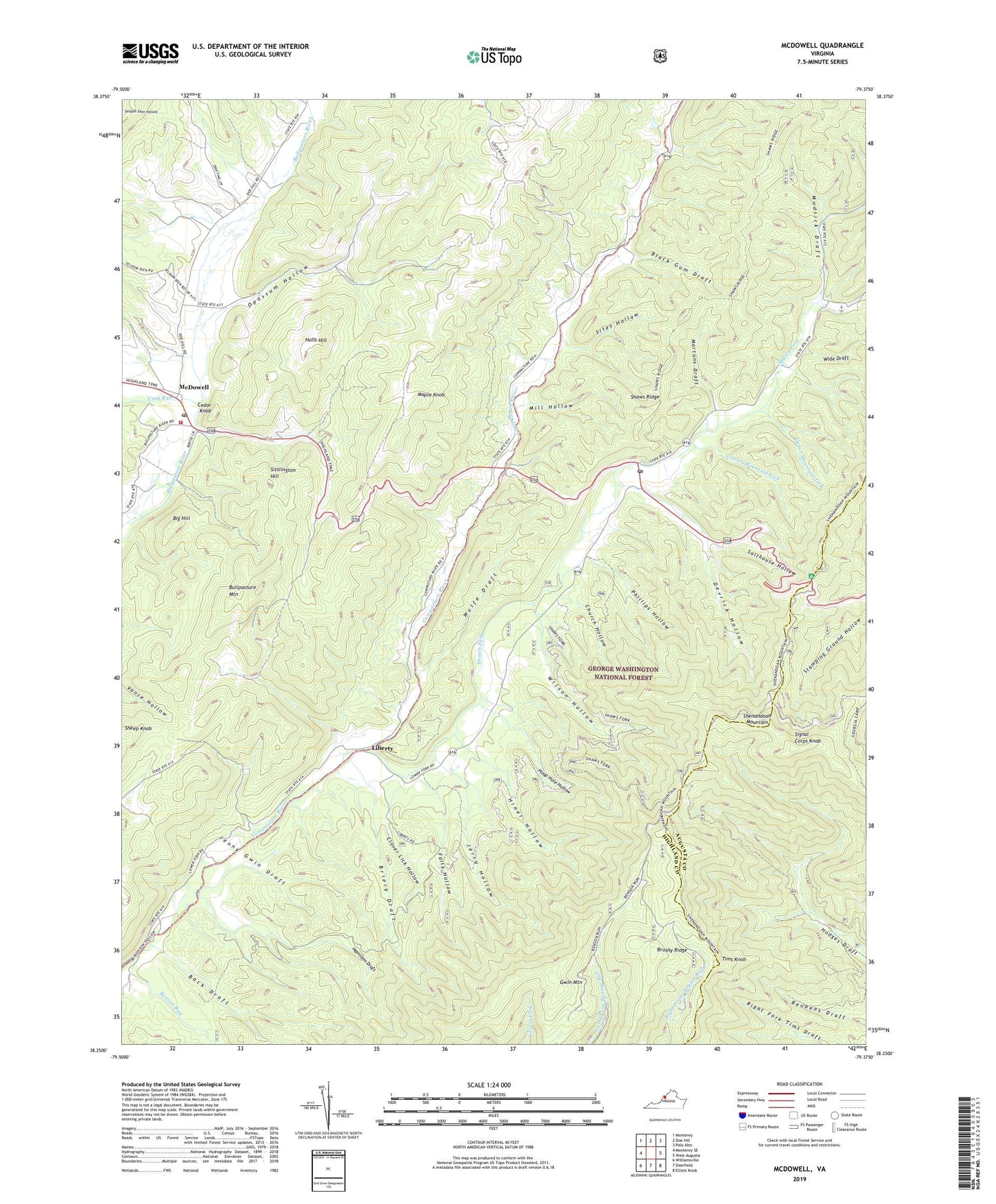
2019 topographic map quadrangle McDowell in the state of Virginia. Scale: 1:24000. Based on the newly updated USGS 7.5' US Topo map series, this map is in the following counties: Highland, Augusta. The map contains contour data, water features, and other items you are used to seeing on USGS maps, but also has updated roads and other features. This is the next generation of topographic maps. Printed on high-quality waterproof paper with UV fade-resistant inks.
Quads adjacent to this one:
West: Monterey SE
Northwest: Monterey
North: Doe Hill
East: West Augusta
Southeast: Elliott Knob
South: Deerfield
Southwest: Williamsville
Contains the following named places: Back Draft, Benson Run, Big Hill, Black Gum Draft, Briery Draft, Brushy Ridge, Cedar Knob, Church Hollow, Clover Lick Hollow, Columbia Union College Biological Station, Confederate Breastworks, Crab Run, Devrick Hollow, Falls Hollow, Gwin Mountain, Hamilton Draft, Head Waters, Head Waters Post Office, Headwaters Brethren Church, Headwaters Presbyterian Church, Headwaters School, Hiner Church, Hiner Hollow, Hoop Hole Hollow, Hulls Hill, Jenny Gwin Draft, Jerry Hollow, Liberty, Lower Mountain Lick, Maple Knob, McDowell, McDowell Census Designated Place, McDowell High School, McDowell Post Office, McDowell Volunteer Fire Department, Mill Hollow, Mortons Draft, Mudlick Draft, Opossum Hollow, Phillips Hollow, Salthouse Hollow, Shaws Fork, Shaws Ridge, Sheep Knob, Signal Corps Knob, Sites Hollow, Sittlington Hill, Stonewall District, Tims Knob, Upper Mountain Lick, Wide Draft, Wilson Hollow, Wolfe Draft, ZIP Code: 24442