MyTopo
Williamsville Virginia US Topo Map
Couldn't load pickup availability
Also explore the Williamsville Forest Service Topo of this same quad for updated USFS data
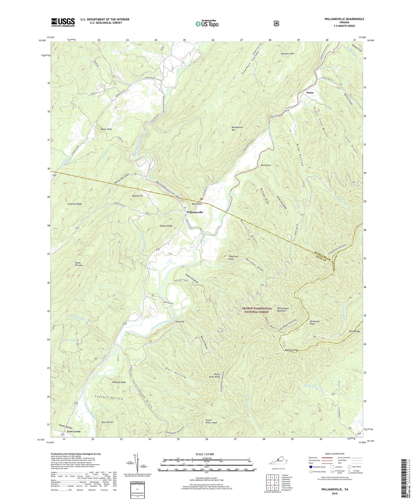
2022 topographic map quadrangle Williamsville in the state of Virginia. Scale: 1:24000. Based on the newly updated USGS 7.5' US Topo map series, this map is in the following counties: Bath, Highland, Augusta. The map contains contour data, water features, and other items you are used to seeing on USGS maps, but also has updated roads and other features. This is the next generation of topographic maps. Printed on high-quality waterproof paper with UV fade-resistant inks.
Quads adjacent to this one:
West: Burnsville
Northwest: Mustoe
North: Monterey SE
Northeast: McDowell
East: Deerfield
Southeast: Craigsville
South: Green Valley
Southwest: Bath Alum
This map covers the same area as the classic USGS quad with code o38079b5.
Contains the following named places: Alum Rock, Barracks Draft, Bath - Highland Volunteer Fire Department, Browns Pond, Brushy Fork, Buck Lick Hollow, Bullpasture Gorge, Bullpasture River, Byrd Point, Campbell Run, Chesnut Ridge, Coursey Springs State Fish Hatchery, Flood, Flood School, Fort Lewis, Foxtail Hollow, Hulit Draft, Hupman Valley, Hupman Valley Trail, Jerkemtight Trail, Knox Lick Draft, Laurel Gap Church, Lick Draft, Lockridge Memorial Church, Marshall Draft, Marshall Draft Trail, McCrays Draft, Meadow Knob, Mill Run, Mount Zion Church, Nelson Draft, North Sister Knob, Northeast Peak, Patna, Persimmon Pond, Pheasanty Run, Poplar Hollow, Rail Hollow, Ratcliff Hill, Rock Hill, Round Hill, Scotchtown Draft, Shanty Ridge, Short Ridge, Sinking Creek, Slaty Lick Draft, South Sister Knob, Sugar Tree Draft, Sugarloaf Knob, Summers Mountain, Tower Hill Mountain, Wallace Peak, Water Sinks, White Oak Draft, Wide Hollow, Williamsville, Williamsville Elementary School, Williamsville Post Office, ZIP Code: 24487