MyTopo
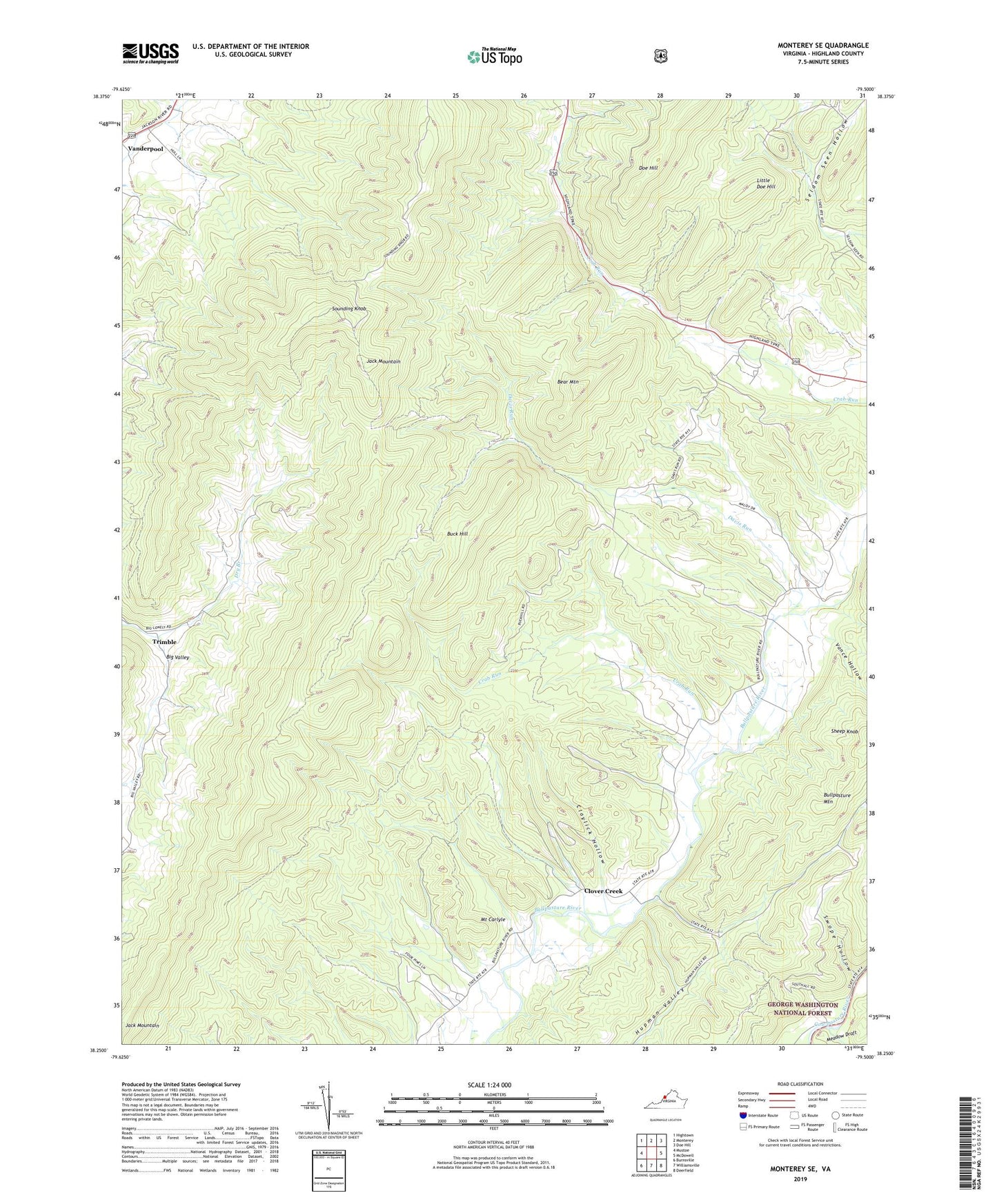
Monterey SE Virginia US Topo Map
Couldn't load pickup availability
Also explore the Monterey SE Forest Service Topo of this same quad for updated USFS data
2022 topographic map quadrangle Monterey SE in the state of Virginia. Scale: 1:24000. Based on the newly updated USGS 7.5' US Topo map series, this map is in the following counties: Highland. The map contains contour data, water features, and other items you are used to seeing on USGS maps, but also has updated roads and other features. This is the next generation of topographic maps. Printed on high-quality waterproof paper with UV fade-resistant inks.
Quads adjacent to this one:
West: Mustoe
Northwest: Hightown
North: Monterey
Northeast: Doe Hill
East: McDowell
Southeast: Deerfield
South: Williamsville
Southwest: Burnsville
This map covers the same area as the classic USGS quad with code o38079c5.
Contains the following named places: Bear Mountain, Buck Hill, Claylick Hollow, Clover Creek, Clover Creek Presbyterian Church, Crab Run, Davis Run, Hamilton Chapel, Highland County, Highland Wildlife Management Area, Jack Mountain, Little Doe Hill, Meadow Draft, Monterey District, Mount Carlyle, New Salem Church, Seldom Seen Hollow, Smith Field, Sounding Knob, Southall Chapel, Stillhouse Run, Swope Hollow, Trimble, Vance Hollow, ZIP Code: 24458