MyTopo
McKenney Virginia US Topo Map
Couldn't load pickup availability
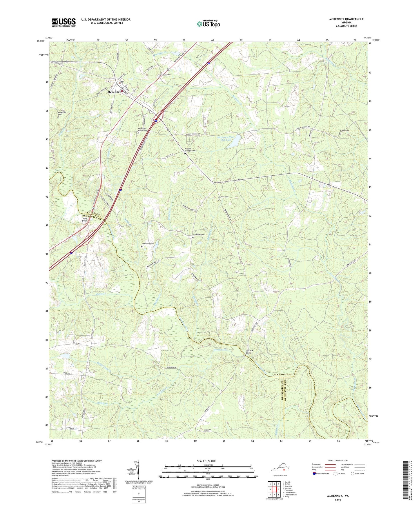
2019 topographic map quadrangle McKenney in the state of Virginia. Scale: 1:24000. Based on the newly updated USGS 7.5' US Topo map series, this map is in the following counties: Dinwiddie, Brunswick, Greensville. The map contains contour data, water features, and other items you are used to seeing on USGS maps, but also has updated roads and other features. This is the next generation of topographic maps. Printed on high-quality waterproof paper with UV fade-resistant inks.
Quads adjacent to this one:
West: Warfield
Northwest: Darvills
North: DeWitt
Northeast: Dinwiddie
East: Cherry Hill
Southeast: Purdy
South: Smoky Ordinary
Southwest: Lawrenceville
Contains the following named places: Abernathy Cemetery, All Saints Church, Appomattox Regional Library System McKenney Library, Asbury Cemetery, Asbury Memorial United Methodist Church, Avery Bridge, Beaver Branch, Beaver Pond Creek, Big Bethel Baptist Cemetery, Big Bethel Church, Bourdon Creek, Bridgestone School, Buckskin Creek, Cut Banks Baptist Church, Cut Banks Cemetery, Cutbank Bridge, Cutbank School, Drumgoole School, Duane School, Emerson Millpond, Fitzgerald Cemetery, Great Creek, Harrisons Dam, Harrisons Pond, Indian Creek, Long Bridge, Madison Cemetery, McKenney, McKenney Baptist Church, McKenney Fire Department Fire Marshal, Mckenney Hunt Club Dam, Mckenney Hunt Club Lake, McKenney Police Department, McKenney Post Office, McKenney Volunteer Fire Department Station 3, Rainey Creek, Sapony Cemetery, Sappony Church, Sappony School, Short School, Smith Creek, Sturgeon Creek, Sunnyside Elementary School, Town of McKenney, Waqua Creek, Williams and Epps Cemetery, ZIP Codes: 23872, 23889