MyTopo
Dinwiddie Virginia US Topo Map
Couldn't load pickup availability
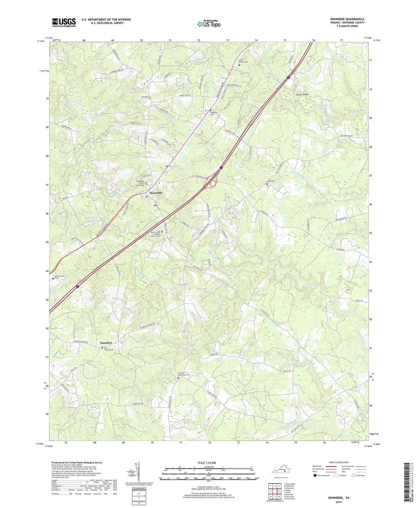
2022 topographic map quadrangle Dinwiddie in the state of Virginia. Scale: 1:24000. Based on the newly updated USGS 7.5' US Topo map series, this map is in the following counties: Dinwiddie. The map contains contour data, water features, and other items you are used to seeing on USGS maps, but also has updated roads and other features. This is the next generation of topographic maps. Printed on high-quality waterproof paper with UV fade-resistant inks.
Quads adjacent to this one:
West: DeWitt
Northwest: Church Road
North: Sutherland
Northeast: Petersburg
East: Carson
Southeast: Stony Creek
South: Cherry Hill
Southwest: McKenney
This map covers the same area as the classic USGS quad with code o37077a5.
Contains the following named places: Ampy Cemetery, Appomattox Regional Library System Dinwiddie Library, Bonneville, Butterworth Cemetery, Calvary Episcopal Church, Chamberlains Bed, Colina, Confederate Woods, Crawford Church, Dinwiddie, Dinwiddie Acres, Dinwiddie Census Designated Place, Dinwiddie County Courthouse, Dinwiddie County Division of Fire / Emergency Medical Services, Dinwiddie County Office of Public Safety, Dinwiddie County Sheriff's Office, Dinwiddie Elementary School, Dinwiddie High School, Dinwiddie Middle School, Dinwiddie Post Office, Dinwiddie Volunteer Fire and Emergency Medical Services Station 1, District 4, Glendoyle, Hamilton, Hawkins Memorial Cemetery, Hawkins Memorial Church, Hawkins Run, Jericho Church, Jessup Store, Laird, Lebanon Church, Mount Level Baptist Church Cemetery, Mount Level Church, Mount Level School, Olive Branch Cemetery, Olive Branch Church, Quaker Bridge, Richardsons Pond, Saint Thomas Cemetery, Saint Thomas Church, Seat Island Branch, Smyrna Baptist Church, Stony Springs, Waldemar, Wilkinson Pond, Wittbuish Cemetery, ZIP Code: 23841