MyTopo
Darvills Virginia US Topo Map
Couldn't load pickup availability
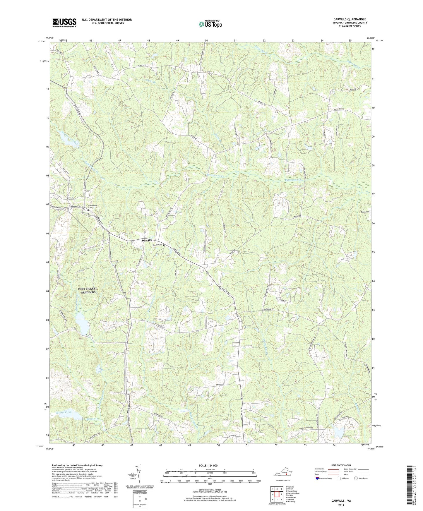
2022 topographic map quadrangle Darvills in the state of Virginia. Scale: 1:24000. Based on the newly updated USGS 7.5' US Topo map series, this map is in the following counties: Dinwiddie. The map contains contour data, water features, and other items you are used to seeing on USGS maps, but also has updated roads and other features. This is the next generation of topographic maps. Printed on high-quality waterproof paper with UV fade-resistant inks.
Quads adjacent to this one:
West: Blackstone East
Northwest: Wellville
North: Hebron
Northeast: Church Road
East: DeWitt
Southeast: McKenney
South: Warfield
Southwest: Danieltown
This map covers the same area as the classic USGS quad with code o37077a7.
Contains the following named places: Bethel Bear School, Birchin Creek, Butterwood Cemetery, Butterwood Church, Cooks Branch, Darvills, Darvills Community Center, Dickerson Store, Era, Good Shepherd Church, Hawkins Memorial Church, Hebron School, Mansons Church, Oldenplace, Sharon Cemetery, Sharon Church, Shiloh Church, Tommeheton Lake, Tommeheton Lake Dam, Worshams Mill, ZIP Code: 23894