MyTopo
Midland Virginia US Topo Map
Couldn't load pickup availability
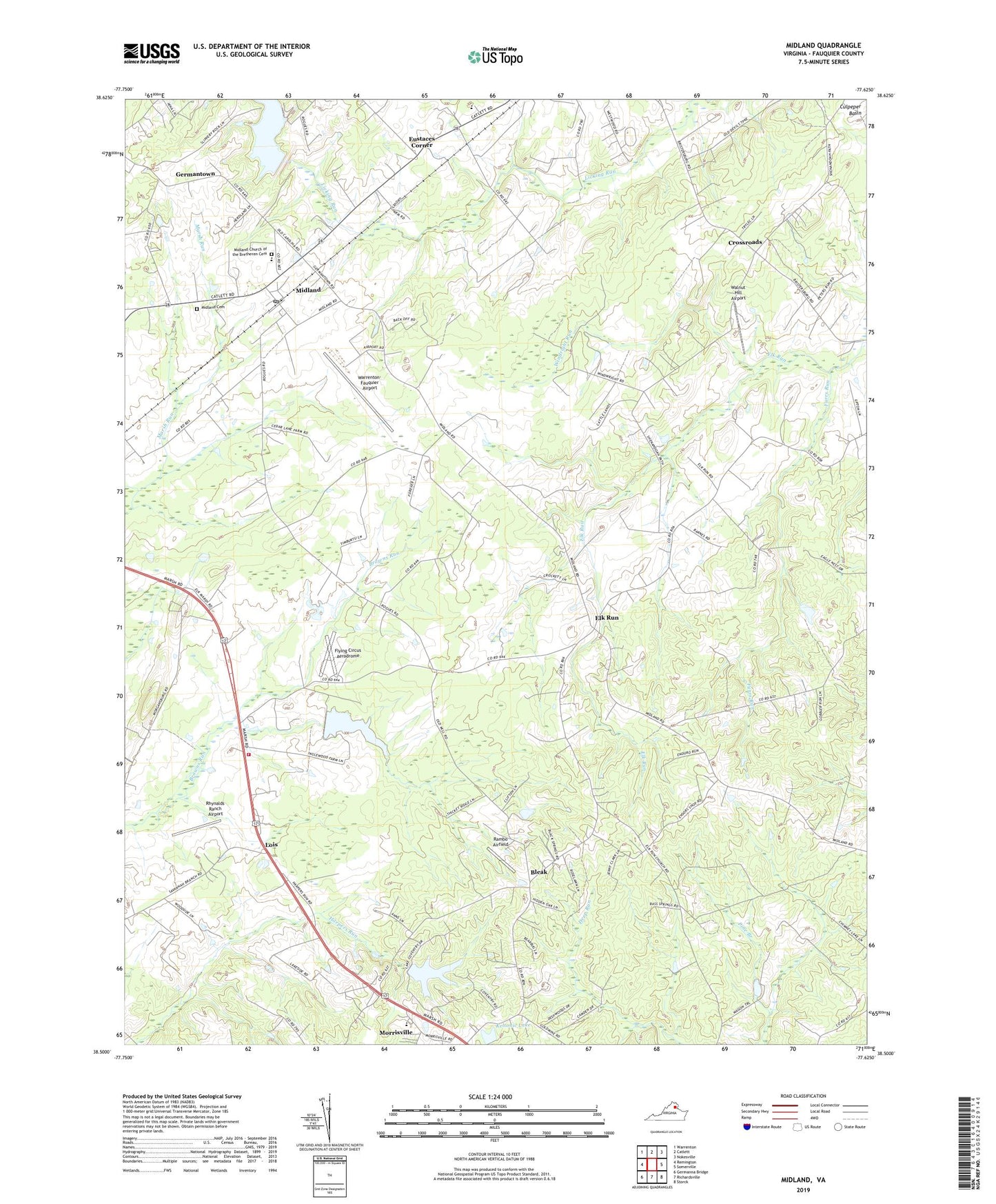
2019 topographic map quadrangle Midland in the state of Virginia. Scale: 1:24000. Based on the newly updated USGS 7.5' US Topo map series, this map is in the following counties: Fauquier. The map contains contour data, water features, and other items you are used to seeing on USGS maps, but also has updated roads and other features. This is the next generation of topographic maps. Printed on high-quality waterproof paper with UV fade-resistant inks.
Quads adjacent to this one:
West: Remington
Northwest: Warrenton
North: Catlett
Northeast: Nokesville
East: Somerville
Southeast: Storck
South: Richardsville
Southwest: Germanna Bridge
Contains the following named places: Auburn Pentecostal Church, Blackwell Town, Blackwell Town School, Bleak, Calverton Church, Cedar Run District, Cross Road Church, Crossroads, Danton Dam, Danton Pond, Dayspring Mennonite Church, Ebenezer Church, Elk Run, Ensors Shop, Eustaces Corner, Eustacestown, Fauquier County Southeastern Alternative School, Flying Circus Aerodrome, Franklin Mine, Furrs Run, Germantown, Germantown Lake, John Marshall Birthplace, Keltonic Lake, Keltonic Lake Dam, Lois, Lois Volunteer Fire Department Company 13, Mary Walter Elementary School, Merry School, Midland, Midland Brethren Church, Midland Cemetery, Midland Census Designated Place, Midland Christian Academy, Midland Church of the Bretheren Cemetery, Midland Methodist Church, Midland Post Office, Midland School, Morgansburg, Morrisville, Morrisville Methodist Church, Mount Carmel Church, Mount Hermon Church, Mount Pleasant Church, Oak Grove Church, Rambo Airfield, Rhynalds Ranch Airport, Striblings Corner, Walnut Hill Airport, Warrenton-Fauquier Airport, Weimertown, Windright Run, ZIP Code: 22728