MyTopo
Somerville Virginia US Topo Map
Couldn't load pickup availability
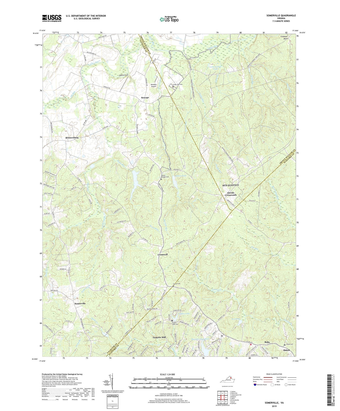
2022 topographic map quadrangle Somerville in the state of Virginia. Scale: 1:24000. Based on the newly updated USGS 7.5' US Topo map series, this map is in the following counties: Fauquier, Stafford, Prince William. The map contains contour data, water features, and other items you are used to seeing on USGS maps, but also has updated roads and other features. This is the next generation of topographic maps. Printed on high-quality waterproof paper with UV fade-resistant inks.
Quads adjacent to this one:
West: Midland
Northwest: Catlett
North: Nokesville
Northeast: Independent Hill
East: Joplin
Southeast: Stafford
South: Storck
Southwest: Richardsville
This map covers the same area as the classic USGS quad with code o38077e5.
Contains the following named places: Anderson Branch, Aquia Creek Estates, Beaver Lodge Estate Heliport, Big Lake Arrowhead, Big Lake Arrowhead Dam, Breeden Airport, Brent Town, Bridwells Corner, Bristersburg, Calvary Church, Camp Goettge, Camp Upshur Pond, Carver Cemetery, Cedar Run Cemetery, Chestnut Branch, Courage Creek, Cromwell, Dalton Dam, Dalton Pond, Davids Crossroads, Dorrells Run, Elk Run, Good Hope Church, Good Hope School, Goose Run, Goslin Run, Hearts Delight Cemetery, Hearts Delight Church, Hidden Lake, Hidden Lake Cemetery, Hidden Lake Dam, Johns Branch, Lake Arrowhead, Lucky Run, Maples Field, Millbrook, Mount Horeb Church, Mountainview, R-6 Pond, Rock Hill Estates, Rock Hill Manors, Rolling Hills, Ruby, Ruby Post Office, Shiloh, Shiloh Baptist Church, Shiloh Cemetery, Somerville, Sowego, Stafford County Fire Department Station 8 Rockhill, Stafford Station, Tacketts Mill, Town Run, Walnut Ridge, Walnut Ridge Estates, Winslow Dam, Zoar Church, ZIP Code: 20119