MyTopo
Passapatanzy Virginia US Topo Map
Couldn't load pickup availability
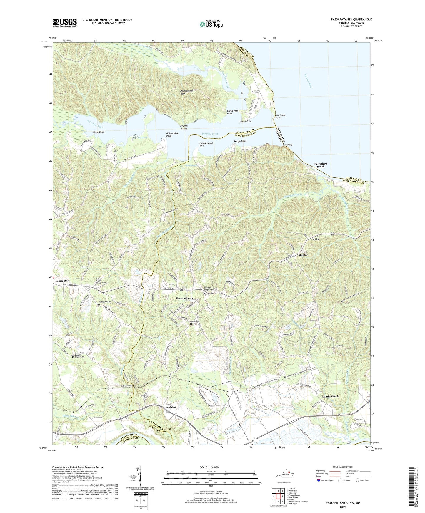
2019 topographic map quadrangle Passapatanzy in the state of Virginia. Scale: 1:24000. Based on the newly updated USGS 7.5' US Topo map series, this map is in the following counties: King George, Stafford, Charles, Caroline. The map contains contour data, water features, and other items you are used to seeing on USGS maps, but also has updated roads and other features. This is the next generation of topographic maps. Printed on high-quality waterproof paper with UV fade-resistant inks.
Quads adjacent to this one:
West: Fredericksburg
Northwest: Stafford
North: Widewater
Northeast: Nanjemoy
East: King George
Southeast: Port Royal
South: Rappahannock Academy
Southwest: Guinea
Contains the following named places: Accokeek Creek, Battery Ridge Estates, Beaverdam Run, Belle Harbor Yacht Club, Belle Plains, Belvedere Beach, Bethel Baptist Church Cemetery, Bethel Church, Bethlehem Cemetery, Bethlehem Church, Big Marsh, Birchwood Run, Biscoe, Black Swamp, Black Swamp Branch, Boykins Island, Bull Bluff, Butzner Corner, Chapel Heights, Colbert Walker Estates, Cox Corner, Crows Nest Harbor, Crows Nest Point, Dartmoor, Dirt Bridge Run, Fines Corner, Fletchers Chapel, Fletchers Chapel Cemetery, Foxberry, Gayles, Goby, Graves Corner, Howes Bluff, Igo, Indian Point, James Madison District, Japazaws, Johnsons Corner, Knotsmythes Landing, Lambs Creek, Lambs Creek Church, Lambs Creek School, Lyons Den, Marlboro, Marlboro Point, Marlborough Neck, Marshall Woods, Montague Landing, Mount Moriah Church, Mountain View Church, Mustoe, Oakland Cemetery, Old Landing Point, Passapatanzy, Passapatanzy Census Designated Place, Passapatanzy Creek, Popcastle Creek, Potomac Creek, Potomac Creek Estates, Potomac Knolls, Potomac Overlook, River Bend, Sandy Ridge, Sealston, Sealston Elementary School, Sealston Post Office, Sealston Station, Shea Estates, Spillmans Landing, Stafford County Fire Department Station 7 White Oak, Stone Point, Sycamore Ridge, Taylors Dam, Taylors Pond, The Holly Woods, Union Belle Baptist Church Cemetery, Union Belle Church, Waugh Point, Waugh Point Marina, Whipsawason Club House, Whipsawasons Point, Whitaker, White Oak Run, Willamsburg on the Potomac, Woodlanding Village, Yendor Landing