MyTopo
Patterson Virginia US Topo Map
Couldn't load pickup availability
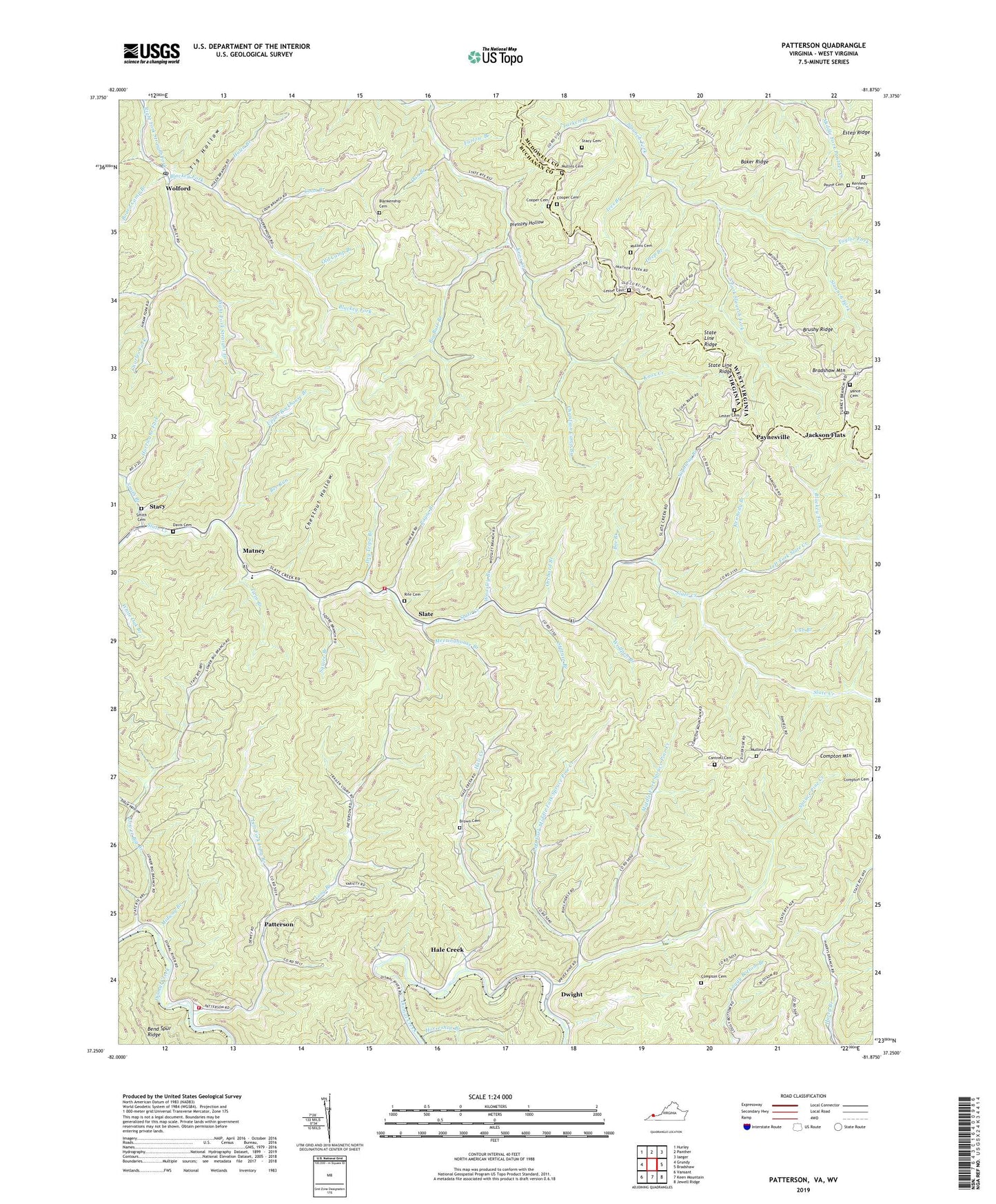
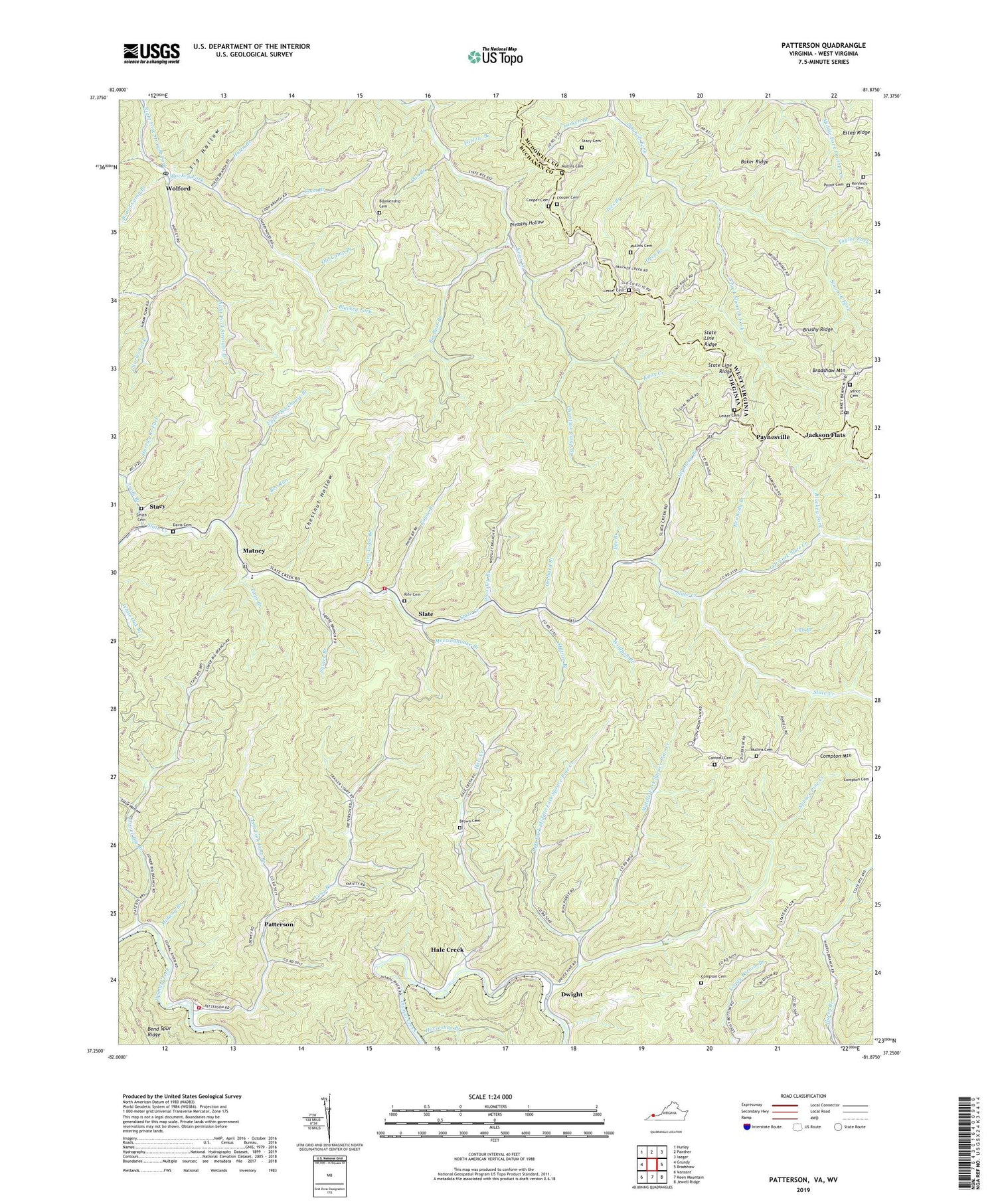
2019 topographic map quadrangle Patterson in the states of Virginia, West Virginia. Scale: 1:24000. Based on the newly updated USGS 7.5' US Topo map series, this map is in the following counties: Buchanan, McDowell. The map contains contour data, water features, and other items you are used to seeing on USGS maps, but also has updated roads and other features. This is the next generation of topographic maps. Printed on high-quality waterproof paper with UV fade-resistant inks.
Quads adjacent to this one:
West: Grundy
Northwest: Hurley
North: Panther
Northeast: Iaeger
East: Bradshaw
Southeast: Jewell Ridge
South: Keen Mountain
Southwest: Vansant
Contains the following named places: Baker Ridge, Baker Ridge School, Bee Branch, Bee Run, Bee Run Church, Bend Spur Ridge, Big Butt Branch, Big Butt School, Blackey Fork, Blankenship Cemetery, Board Camp Branch, Bradshaw Mountain, Brown Cemetery, Brushy Ridge, Brushy School, Cantrell Cemetery, Charles Fork, Chestnut Hollow, Christian Camp Branch, Compton Cemetery, Compton Mountain Cemetery, Coon Branch, Cooper Cemetery, Cub Branch, Dan Branch, Davis Cemetery, Deep Branch, Dry Tripe Branch, Dwight, Estep School, Farlow Branch, Hale Creek, Horseshoe Branch, Hulen Branch, Hurricane Fork, Ives Branch, Jackson Flats, Johns Branch, Justice School, Kennedy Branch, Kennedy Cemetery, Larken Branch, Left Fork Long Branch, Left Fork Middle Fork Spruce Pine Creek, Left Fork Slate Creek, Lester Cemetery, Lester School, Long Branch, Lower Big Branch, Lower Big Branch Church, Mary Lou Church, Matney, Meetinghouse Branch, Middle Fork Spruce Pine Creek, Midway Branch, Mullins Cemetery, Mullins School, Nighway Branch, North Side Church, Old Camp Branch, Orchard Branch, Orchard Fork, Patterson, Patterson Volunteer Fire Department - Patterson Rescue Squad, Payne Branch, Payne Cemetery, Paynesville, Paynesville Post Office, Pressley Hollow, Rife Cemetery, Slate, Slate Creek Volunteer Fire Department, Smith Branch, Smith Cemetery, South Fork Slaunch Fork, Spruce Pine Creek, Squire Branch, Stacy, Stacy Cemetery, State Line Ridge, Stiltner Branch, Stonecoal Branch, Taylor Fork, Tig Hollow, Toms Branch, Trace Hollow, Twin Branch, Upper Rockhouse Branch, Vance Cemetery, Walnut Grove School, Wolford, Wolford Post Office, Wolfpen Branch, Woosley Branch, ZIP Codes: 24634, 24873