MyTopo
Iaeger West Virginia US Topo Map
Couldn't load pickup availability
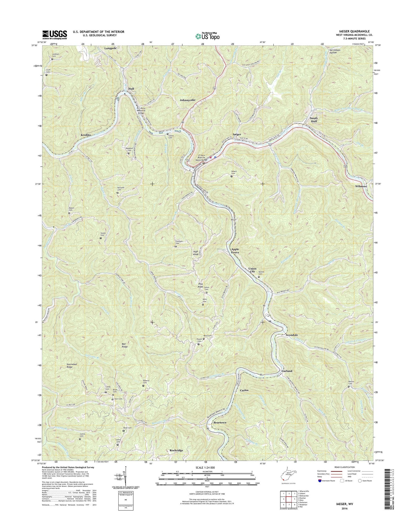
2023 topographic map quadrangle Iaeger in the state of West Virginia. Scale: 1:24000. Based on the newly updated USGS 7.5' US Topo map series, this map is in the following counties: McDowell. The map contains contour data, water features, and other items you are used to seeing on USGS maps, but also has updated roads and other features. This is the next generation of topographic maps. Printed on high-quality waterproof paper with UV fade-resistant inks.
Quads adjacent to this one:
West: Panther
Northwest: Wharncliffe
North: Gilbert
Northeast: Baileysville
East: Davy
Southeast: War
South: Bradshaw
Southwest: Patterson
This map covers the same area as the classic USGS quad with code o37081d7.
Contains the following named places: Adkins Branch, Apple Grove, Avondale, Avondale Post Office, Beartown, Beartown Branch, Bee Ridge, Betsy Branch, Blevins Cemetery, Bowles Cemetery, Brant Cemetery, Calvary Church, Candy Cemetery, Carlos, Carlos School, Cline Cemetery, Collins Cemetery, Collins School, Coon Branch, Crane Creek, Cub Branch, Cub Creek, D C Perry Memorial Bridge, Desolate Branch, Dry Branch, Dry Fork, Fishtrap Branch, Garland, George Branch, Grapevine Branch, Grapevine School, Harman Branch, High Knob, High Knob Church, High Knob School, Horn Cemetery, Horse Creek, Hull, Hurricane Branch, Iaeger, Iaeger Elementary School, Iaeger High School, Iaeger Police Department, Iaeger Post Office, Iaeger Public Library, Iaeger Volunteer Fire Department, Johnnycake, Johnnycake Branch, Kelly Cemetery, Kennedy Cemetery, Krollitz, Laeger Elementary School, Laurel Fork, Left Fork Crane Creek, Lick Branch, Little Slaunch Branch, Litwar, Lockhart Cemetery, LT Sara Blanche Vance Bridge, Meadows Cemetery, Mile Branch, Mountain Home Church, Nacols, Negro Branch, Oldhouse Branch, Orchard Branch, Pine Knob, Powell Cemetery, Reed Cemetery, Right Fork Crane Creek, Right Fork Harman Branch, Right Fork Sandy Huff Branch, Robert Cemetery, Roberts Cemetery, Roberts School, Rock Branch, Rockridge, Rowe Cemetery, Sal Gibson Hollow, Sandy Huff, Sandy Huff Branch, Sandy River Middle School, Slaunch Branch, Snipe Branch, Sourwood Ridge, Steele Cemetery, Straight Branch, Town of Iaeger, Union City, War Branch, War Branch School, Wilmore, ZIP Codes: 24811, 24844