MyTopo
Raynor Virginia US Topo Map
Couldn't load pickup availability
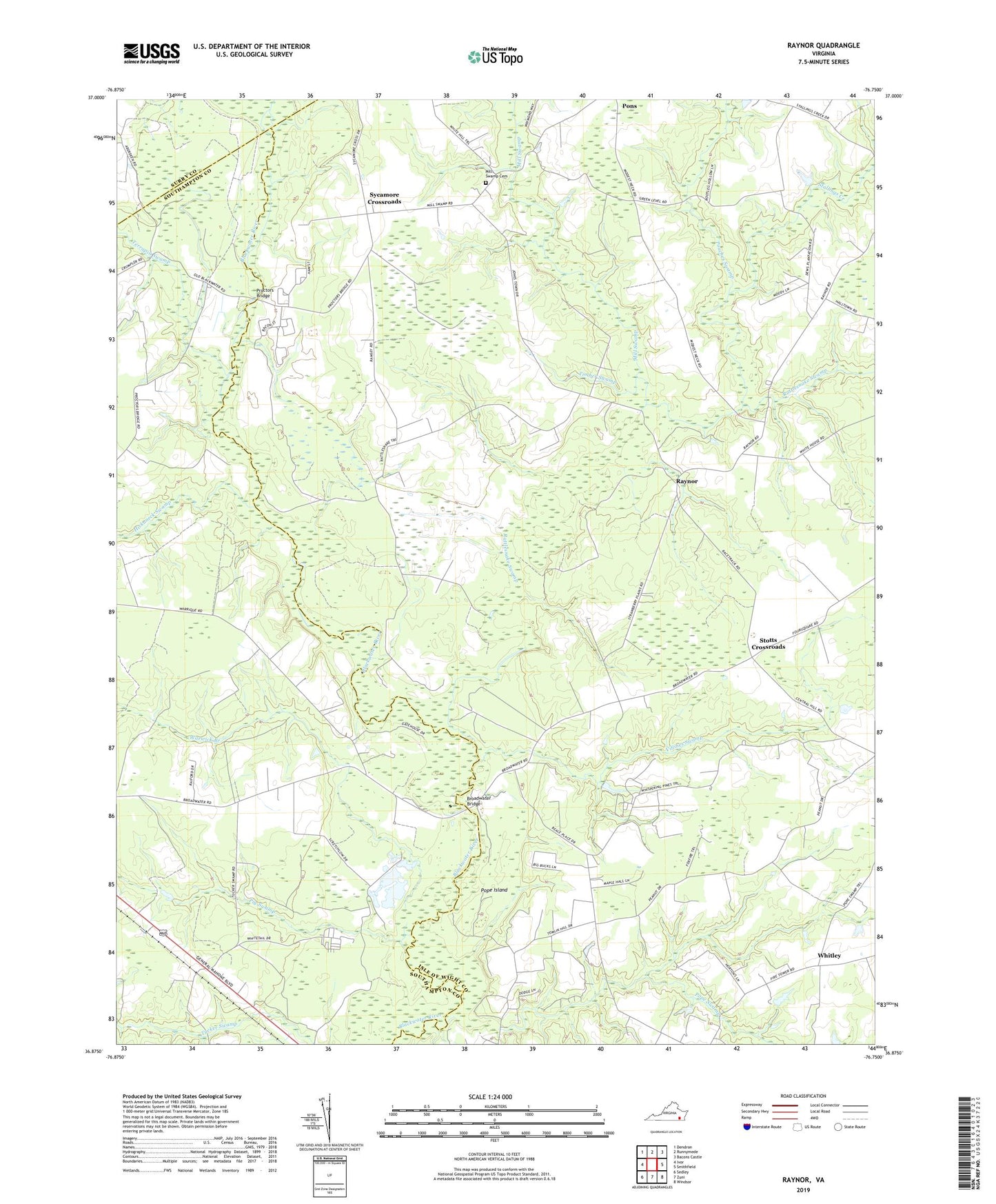
2019 topographic map quadrangle Raynor in the state of Virginia. Scale: 1:24000. Based on the newly updated USGS 7.5' US Topo map series, this map is in the following counties: Isle of Wight, Southampton, Surry. The map contains contour data, water features, and other items you are used to seeing on USGS maps, but also has updated roads and other features. This is the next generation of topographic maps. Printed on high-quality waterproof paper with UV fade-resistant inks.
Quads adjacent to this one:
West: Ivor
Northwest: Dendron
North: Runnymede
Northeast: Bacons Castle
East: Smithfield
Southeast: Windsor
South: Zuni
Southwest: Sedley
Contains the following named places: Broadwater Bridge, Comet Swamp, Goodwin School, Gwaltney Crossroads, Hickaneck Swamp, Johnson Corner, McClelland School, Mill Swamp, Mill Swamp Cemetery, Mill Swamp Church, Pig Swamp, Pinegrove Tabernacle, Pope Island, Pope Swamp, Pouches Swamp, Proctors Bridge, Rattlesnake Swamp, Raynor, Shiloh Church, Stallings Creek, Stotts Crossroads, Sycamore Crossroads, Terrapin Swamp, Timber Swamp, Villines Swamp, Warwick Branch, Warwick Corner, Whitley, ZIP Code: 23866