MyTopo
Ivor Virginia US Topo Map
Couldn't load pickup availability
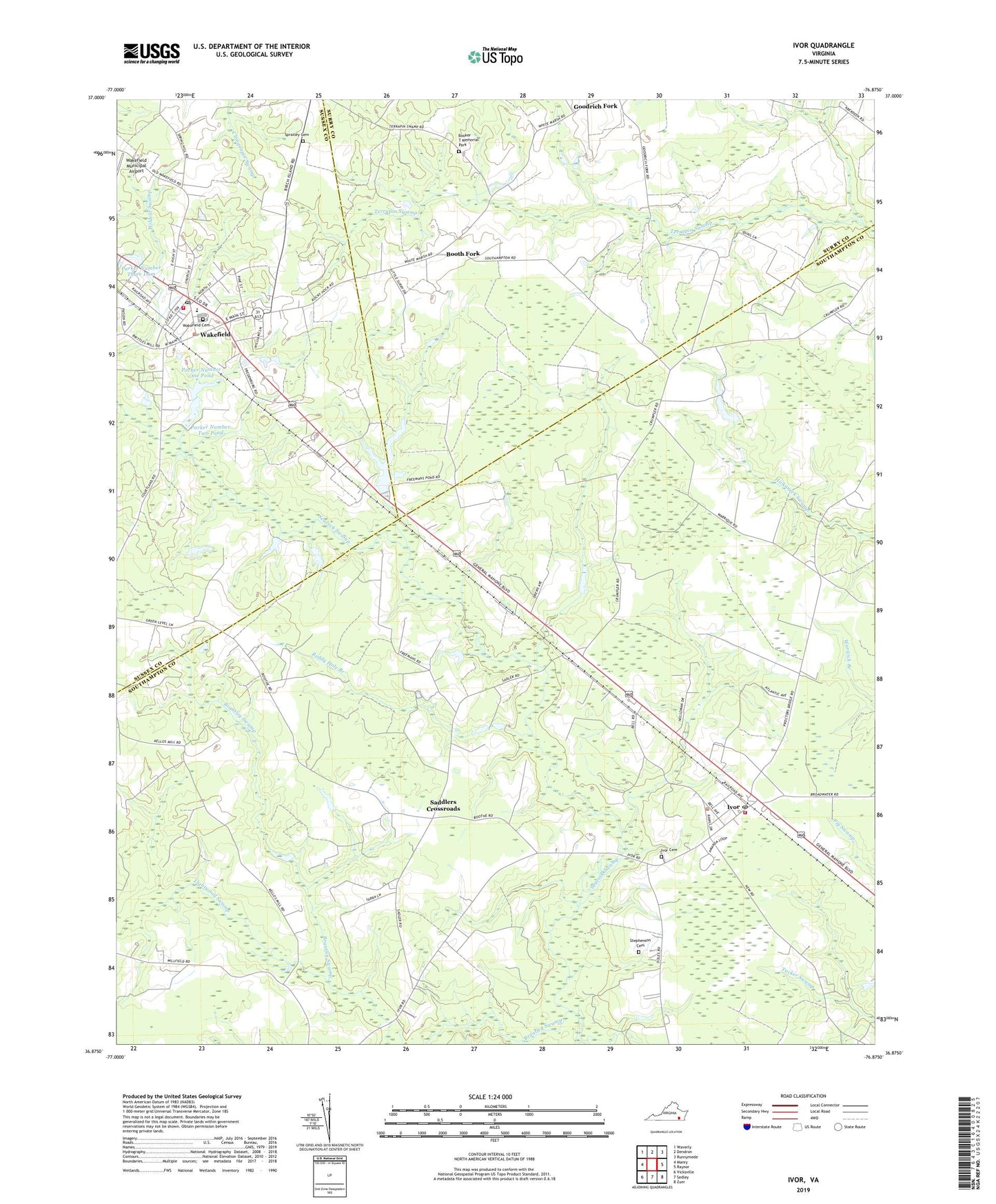
2022 topographic map quadrangle Ivor in the state of Virginia. Scale: 1:24000. Based on the newly updated USGS 7.5' US Topo map series, this map is in the following counties: Southampton, Surry, Sussex. The map contains contour data, water features, and other items you are used to seeing on USGS maps, but also has updated roads and other features. This is the next generation of topographic maps. Printed on high-quality waterproof paper with UV fade-resistant inks.
Quads adjacent to this one:
West: Manry
Northwest: Waverly
North: Dendron
Northeast: Runnymede
East: Raynor
Southeast: Zuni
South: Sedley
Southwest: Vicksville
This map covers the same area as the classic USGS quad with code o36076h8.
Contains the following named places: Berlin and Ivor District, Booker T Memorial Park, Booth Fork, Brantley Swamp, Camp Corner, Carroll Dam, Carroll Lake, Coppahaunk School, Crumplers School, Ebenezer Church, Ellen W Chambliss Elementary School, Freemans Dam, Freemans Millpond, Guildfield Corner, Holiness Church, Ivor, Ivor Baptist Church, Ivor Cemetery, Ivor Elementary School, Ivor Faith Temple, Ivor Post Office, Ivor School, Ivor Volunteer Fire Department, Ivor Volunteer Rescue Squad, Kellos Dam, Kellos Mill, Mars Hill Church, Millfield Church, Mount Hope Church, New Branch Church, Parker Number One Dam, Parker Number One Pond, Parker Number Three Dam, Parker Number Two Dam, Parker Number Two Pond, Pentecost Church, Reddy Hole Branch, Rocky Hock Church, Saddlers Crossroads, Shady Hill Church, Southeastern Public Service Authority Ivor Transfer Station, Spratley Cemetery, Stephenson Cemetery, Tidewater Academy, Town of Ivor, Town of Wakefield, Wakefield, Wakefield Cemetery, Wakefield Police Department, Wakefield Post Office, Wakefield Volunteer Fire Department, Wildcat Swamp, ZIP Code: 23888