MyTopo
Dendron Virginia US Topo Map
Couldn't load pickup availability
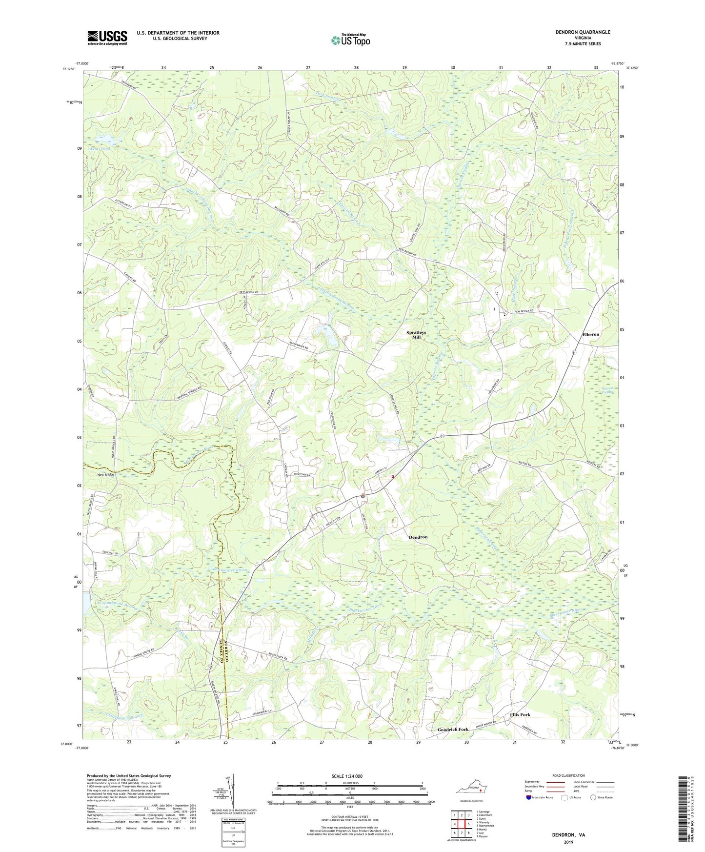
2022 topographic map quadrangle Dendron in the state of Virginia. Scale: 1:24000. Based on the newly updated USGS 7.5' US Topo map series, this map is in the following counties: Surry, Sussex. The map contains contour data, water features, and other items you are used to seeing on USGS maps, but also has updated roads and other features. This is the next generation of topographic maps. Printed on high-quality waterproof paper with UV fade-resistant inks.
Quads adjacent to this one:
West: Waverly
Northwest: Savedge
North: Claremont
Northeast: Surry
East: Runnymede
Southeast: Raynor
South: Ivor
Southwest: Manry
This map covers the same area as the classic USGS quad with code o37076a8.
Contains the following named places: Atkins Dam, Atkins Pond, Birchen Island Bridge, Birdsongs Mill, Carsley District, Cedar Grove School, Coppahaunk Swamp, County Academy, Cypress Swamp, Dark Swamp, Dendron, Dendron District, Dendron Post Office, Dendron Volunteer Fire Department Surry County Station 2, Elberon, Ellis Fork, Elwood Swamp, Goodrich Fork, Harrison Grove Church, Hazel Swamp, Hazelbush School, Johnchecohunk Swamp, Lazy Oak Corner, Luther P Jackson Middle School, Milltail Creek, New Bridge, New Lebannon Church, Newby Run Church, Newby Run School, Oak Grove Church, Pigeonroost Swamp, Rocky Branch, Rough School, Saint Marys Church, Salisbury School, Sexton, Spratleys Mill, Spring Hill Church, Spring Hill Dam, Surry County, Surry County High School, Surry Elementary School, Surry Lookout Tower, Town of Dendron, Union Church, ZIP Code: 23839