MyTopo
Rileyville Virginia US Topo Map
Couldn't load pickup availability
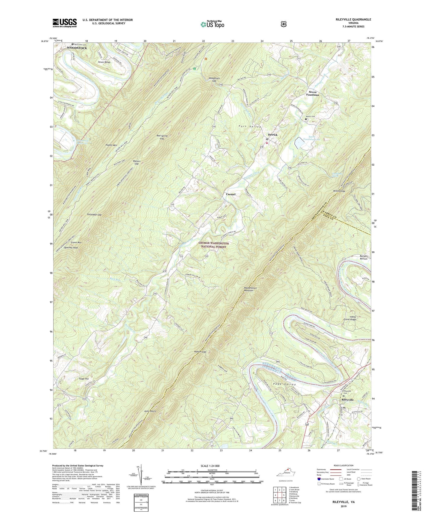
2019 topographic map quadrangle Rileyville in the state of Virginia. Scale: 1:24000. Based on the newly updated USGS 7.5' US Topo map series, this map is in the following counties: Shenandoah, Page, Warren. The map contains contour data, water features, and other items you are used to seeing on USGS maps, but also has updated roads and other features. This is the next generation of topographic maps. Printed on high-quality waterproof paper with UV fade-resistant inks.
Quads adjacent to this one:
West: Edinburg
Northwest: Woodstock
North: Toms Brook
Northeast: Strasburg
East: Bentonville
Southeast: Thornton Gap
South: Luray
Southwest: Hamburg
Contains the following named places: Buck Run, Camp Lupton, Carmel, Chalybeate Spring, Chapman Dam, Chapman Reservoir, Detrick, District 4, Dry Run, Dry Run Church, Fort Valley Church, Fort Valley Elementary School, Fort Valley Overlook, Fort Valley Post Office, Fosters Landing, Golladays Gap, Goods Falls, Goods Landing, Goods Mill, Green Mountain, Habron Gap, High Cliff Come Camp, Indian Grave Ridge, Jacks Notch, Jeremys Run, Joppa Church, Keyser Path, Kings Crossing, Little Fort Recreation Area, Massanutten Mountain Trail, Milford Gap, Moody Creek, Mount Zion Church, Munch Cemetery, Nelson Run, Oak Hill Church, Opechee Peak, Peters Mill Run, Powell Mountain Trail, Red Spring Gap, Rileyville, Rileyville Cemetery, Rileyville Post Office, Riverview Cemetery, Saint David Church, Saint Davids Church, Seak Ford Landing, Seven Bends, Seven Fountains, Seven Fountains Dam, Seven Fountains Lake, Shenandoah County Fire and Rescue Station 14 - Fort Valley Volunteer Fire Department, Stage Hill, Trinity Church, Walters Gap, White Chapel, Woodstock Gap, Woodstock Lookout Tower, Woodstock Recreational Area, Woodstock Reservoir, ZIP Code: 22652