MyTopo
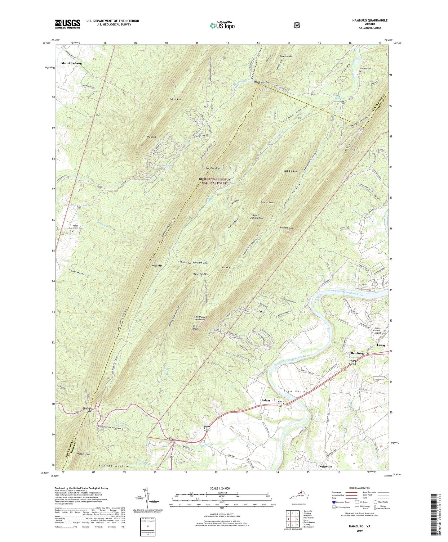
Hamburg Virginia US Topo Map
Couldn't load pickup availability
Also explore the Hamburg Forest Service Topo of this same quad for updated USFS data
2022 topographic map quadrangle Hamburg in the state of Virginia. Scale: 1:24000. Based on the newly updated USGS 7.5' US Topo map series, this map is in the following counties: Page, Shenandoah. The map contains contour data, water features, and other items you are used to seeing on USGS maps, but also has updated roads and other features. This is the next generation of topographic maps. Printed on high-quality waterproof paper with UV fade-resistant inks.
Quads adjacent to this one:
West: New Market
Northwest: Conicville
North: Edinburg
Northeast: Rileyville
East: Luray
Southeast: Big Meadows
South: Stanley
Southwest: Tenth Legion
This map covers the same area as the classic USGS quad with code o38078f5.
Contains the following named places: Big Run, Big Spring, Browns Hollow, Browns Run, Burners Gap, Camp Roosevelt Recreation Area, Caroline Furnace Camp, Catback Mountain, Crisman Hollow, Duncan Hollow, Duncan Hollow Trail, Duncan Knob, Egypt Bend Estates, Furnace Cemetery, Gap Creek Trail, Gap Trail, Georges Run, Hamburg, Hiden Spring, Intersections, Jawbone Gap, Kerns Mountain, Leaksville, Lick Bottom Hollow, Lions Tale Trail, Little Fort Valley, Luray Caverns Golf Course, Massanutten Mountain, Massanutten Visitor Center, Middle Mountain, Mill Creek, Mill Creek Church, Mooreland Gap, Mount Carmel Christian Academy, Mountain Run, New Market Gap, New Market Gap Picnic Area, New Market Gap Recreation Site, Peach Orchard Gap, Salem, Scothorn Gap, Scothorn Gap Trail, Shenandoah Forest, Story Book Trail, Strickler Knob, The Knob, Waterfall Mountain, White House, Whitehouse Landing, Woods Chapel, Woods Chapel Cemetery, Yellow Cliffs