MyTopo
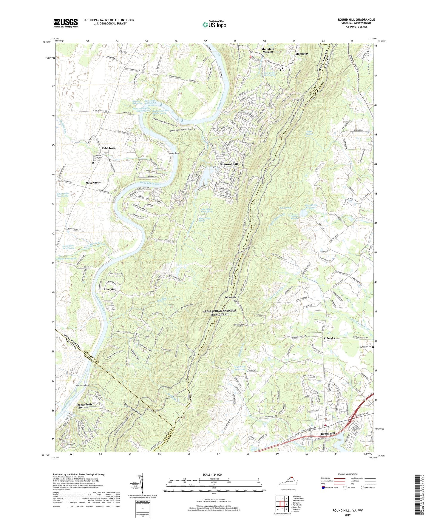
Round Hill Virginia US Topo Map
Couldn't load pickup availability
2019 topographic map quadrangle Round Hill in the states of West Virginia, Virginia. Scale: 1:24000. Based on the newly updated USGS 7.5' US Topo map series, this map is in the following counties: Loudoun, Jefferson, Clarke. The map contains contour data, water features, and other items you are used to seeing on USGS maps, but also has updated roads and other features. This is the next generation of topographic maps. Printed on high-quality waterproof paper with UV fade-resistant inks.
Quads adjacent to this one:
West: Berryville
Northwest: Middleway
North: Charles Town
Northeast: Harpers Ferry
East: Purcellville
Southeast: Lincoln
South: Bluemont
Southwest: Ashby Gap
Contains the following named places: Avon Bend, Birch Hollow Airport, Blue Ridge Elementary School, Blue Ridge Mountain Volunteer Fire Company 5 - 1, Boyds Ferry, Bullskin Run, Coolspring Estate, Cooper Springs, Dunthorpe Farms, Edgegrove, Eubanks, Fairmont School, Furnace Run, Furnace Run Dam Site, Harris Springs, Hog Run, J.T. Hirst Dam, John Bayles Farm Spring, Kabletown, Kabletown Church, Kabletown Churchyard Cemetery, Kabletown Mills, Kabletown School, Ketoctin Cemetery, Long Marsh Run, Loudoun County Fire and Rescue Round Hill Station 4, Loudoun County Sheriff's Office Western Loudoun Station, Maisie Ware Farm Spring, Mannings, Meyers Farm Spring, Meyerstown, Miller, Mission Tabernacle, Mount Zion Baptist Church, Mountain Mission, Mountain Mission Spring, Murrill Hill Church, Parker Island, Parkers Ford, Potts Springs, Purcellville Reservoir, Raven Rocks, Raven Rocks Hollow, Riverside, Robert Smith Farm Spring, Rocks Mill, Rocky Branch, Round Hill, Round Hill Baptist Church, Round Hill Dam, Round Hill Elementary School, Round Hill Post Office, Round Hill Reservoir, Round Hill Support Center, Round Hill United Methodist Church, Saint Andrews Church, Shannon Hill Spring, Shannondale, Shannondale Blue Sulphur Spring, Shannondale Census Designated Place, Shannondale Ferry, Shannondale Red Sulphur Spring, Shannondale Road Dam, Shannondale Springs Wildlife Management Area, Shannondale White Sulphur Spring, Shenandoah Retreat, Shenandoah Retreat Census Designated Place, Simpsons Creek, Sunny Ridge, Sunny Ridge School, Tom Painter Farm Spring, Town of Round Hill, Valley View, Wilson Gap, Wood Grove, Woodgrove Park, ZIP Code: 25414