
MyTopo
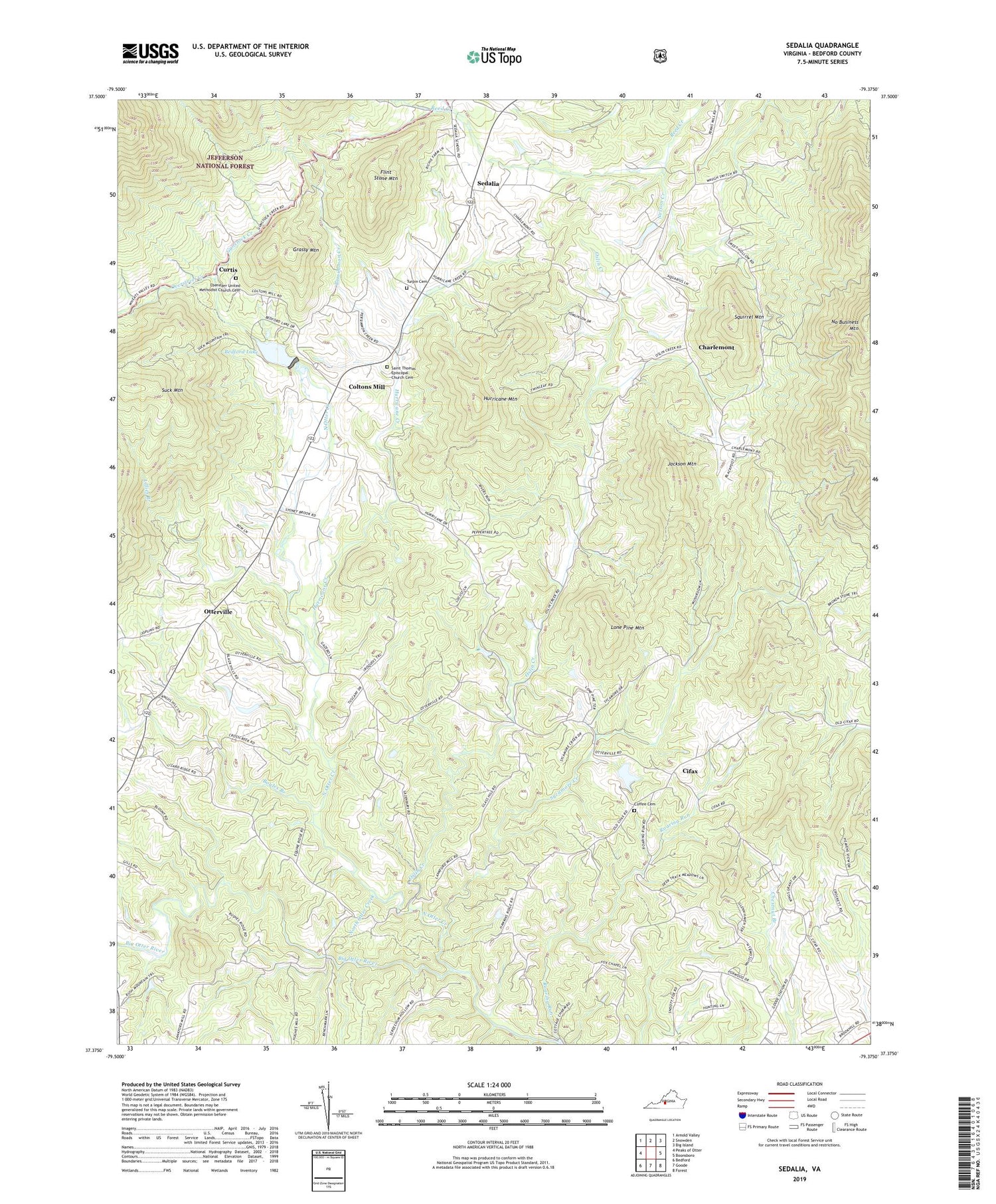
Sedalia Virginia US Topo Map
Couldn't load pickup availability
2019 topographic map quadrangle Sedalia in the state of Virginia. Scale: 1:24000. Based on the newly updated USGS 7.5' US Topo map series, this map is in the following counties: Bedford. The map contains contour data, water features, and other items you are used to seeing on USGS maps, but also has updated roads and other features. This is the next generation of topographic maps. Printed on high-quality waterproof paper with UV fade-resistant inks.
Quads adjacent to this one:
West: Peaks of Otter
Northwest: Arnold Valley
North: Snowden
Northeast: Big Island
East: Boonsboro
Southeast: Forest
South: Goode
Southwest: Bedford
Contains the following named places: Bedford County Park, Bedford Lake, Bedford Lake Dam, Boyles Branch, Brookhill School, Charlemont, Cifax, Coffee Cemetery, Coltons Mill, Counter Ridge School, Curtis, District 5, Ebenezer United Methodist Church Cemetery, Enenezer Church, Evington Volunteer Fire Department, Flint Stone Mountain, Grassy Mountain, Gunstock Creek, Hurricane Creek, Hurricane Mountain, Jackson Mountain, Kyanite Mine Waste Dam Number Two, Lillies Branch, Lone Pine, Lone Pine Mountain, Mount Hermon Baptist Church, Mount Rock Church, Mountain Valley School, Nazareth Church, Nelson Creek, No Business Mountain, North Otter Creek, Oak Grove Baptist Church, Oslin Creek, Otterville, Overstreet Creek, Persimmon Creek, Poplar Springs Church, Popular Springs School, Roaring Run, Saint Thomas Church, Saint Thomas Episcopal Church Cemetery, Sedalia, Squirrel Mountain, Sycamore Creek, Turpin Cemetery, ZIP Code: 24556


