MyTopo
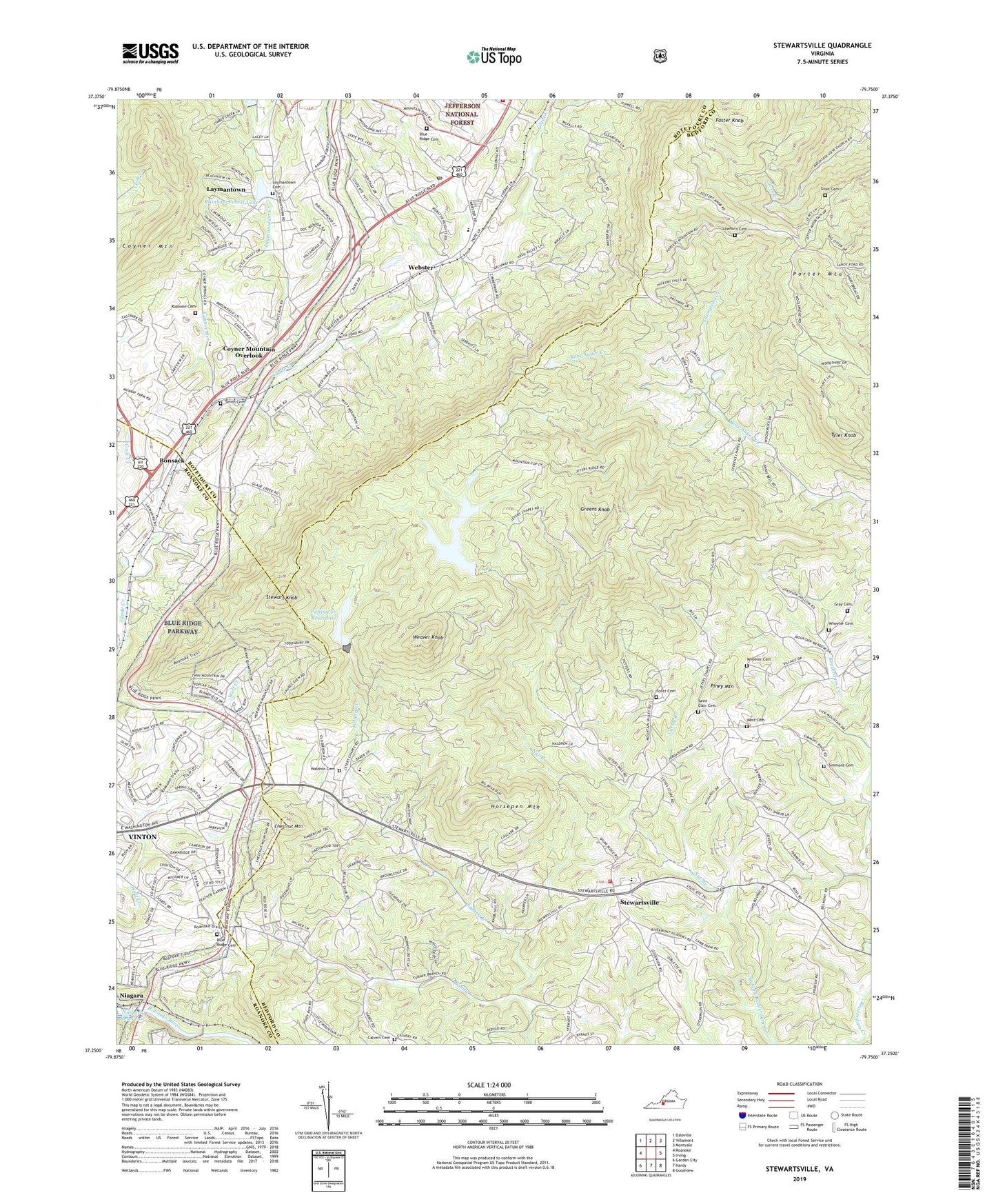
Stewartsville Virginia US Topo Map
Couldn't load pickup availability
2019 topographic map quadrangle Stewartsville in the state of Virginia. Scale: 1:24000. Based on the newly updated USGS 7.5' US Topo map series, this map is in the following counties: Bedford, Botetourt, Roanoke. The map contains contour data, water features, and other items you are used to seeing on USGS maps, but also has updated roads and other features. This is the next generation of topographic maps. Printed on high-quality waterproof paper with UV fade-resistant inks.
Quads adjacent to this one:
West: Roanoke
Northwest: Daleville
North: Villamont
Northeast: Montvale
East: Irving
Southeast: Goodview
South: Hardy
Southwest: Garden City
Contains the following named places: Barnhardt Church, Basham Church, Beaverdam Creek Dam, Beaverdam Reservoir, Blue Ridge Cemetery, Blue Ridge Church, Blue Ridge District, Blue Ridge Post Office, Blue Ridge Volunteer Fire and Rescue Company 1, Bonsack, Bonsack Baptist Church, Bore Auger Church, Bush Valley Swim Club, Calvert Cemetery, Carvin House, Chestnut Mountain, Colonial Church, Colonial Elementary School, Cook Creek, Coyner Branch, Coyner Mountain, Coyner Mountain Overlook, Coyner Springs, Crofton, Curby Branch, East Vinton Plaza Shopping Center, Explore Park, Falling Creek, Falling Creek Dam, Falling Creek Reservoir, Foster Knob, Foutz Cemetery, Foxfire, Giles Cemetery, Glade Creek Church, Glade Creek Lutheran Church, Goodview Elementary School, Gray Cemetery, Greens Knob, Heatherstone, Horsepen Mountain, Jeters Chapel, Jordontown Church, Knollwood, Lawhorn Cemetery, Laymantown, Laymantown Cemetery, Laymantown Census Designated Place, Laymantown Community Church, Laymantown Creek, Lindenwood, Little Tree Acres, Lynn Haven, Lynn Haven Church, Mays Memorial Church, Mineral Springs Christian School, Montgomery Village, Mount View Church, Muse, Nat Branch, Niagara, Niagara Dam, Niagara Reservoir, Norfolk and Western Overlook, Peachtree, Piney Mountain, Rainbow Forest, Rainbow Forest Lake, Read Mountain Overlook, River Edge, Roanoke Basin Overlook, Roanoke Cemetery, Roanoke Juvenile Home, Roanoke Nursing Home, Roanoke Valley Juvenile Detention Center, Roanoke Valley Juvenile Detention Center School, Saint Clair Cemetery, Sandy Creek, Simmons Cemetery, Smith Cemetery, Spring Grove, Stepping Stone, Stevens Chapel, Stewart Knob, Stewart Knob Overlook, Stewartsville, Stewartsville - Chamblissburg Volunteer Fire Department Company 13 Station 1, Stewartsville Census Designated Place, Stewartsville Elementary School, Stewartsville First Aid and Rescue Squad, Stonebridge Acres, The Church of Jesus Christ of Latter Day Saints, Thompson Creek, Tyler Knob, Vinton Family Medical Center, Waldron Cemetery, Weaver Knob, Webster, West Cemetery, Wheeler Cemetery, William Byrd High School, William Byrd Middle School, ZIP Code: 24179