MyTopo
Sugarloaf Mountain Virginia US Topo Map
Couldn't load pickup availability
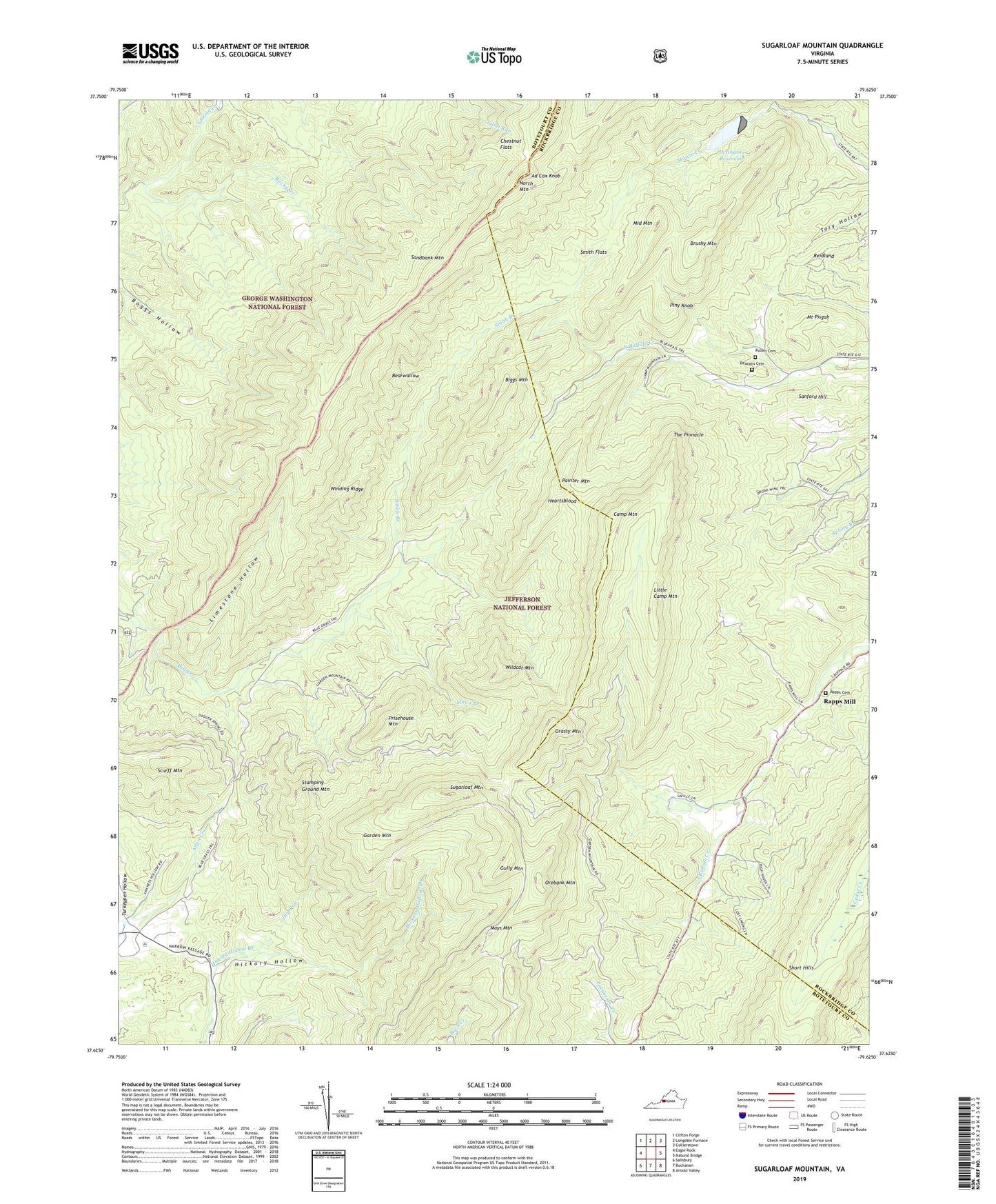
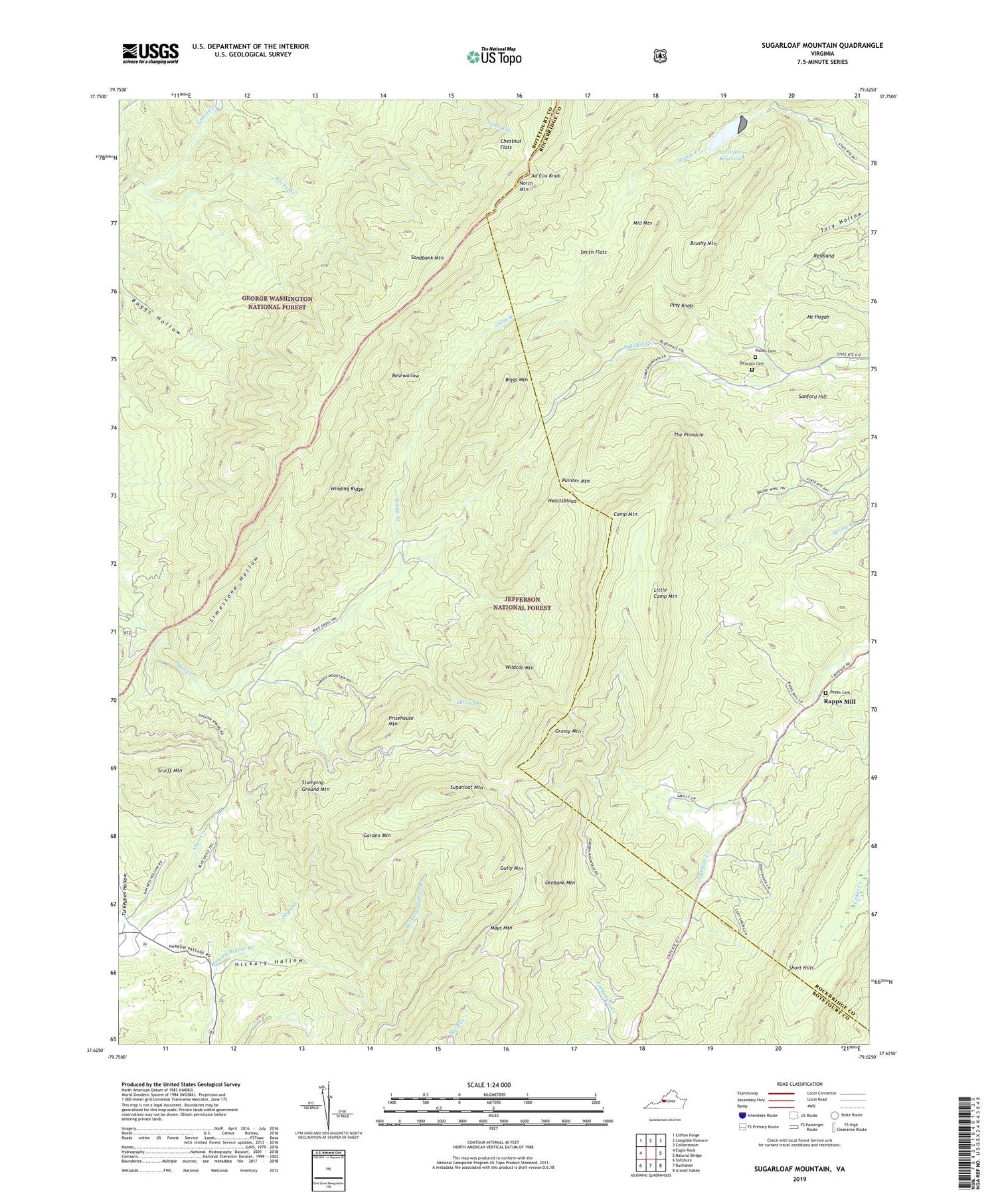
2019 topographic map quadrangle Sugarloaf Mountain in the state of Virginia. Scale: 1:24000. Based on the newly updated USGS 7.5' US Topo map series, this map is in the following counties: Botetourt, Rockbridge. The map contains contour data, water features, and other items you are used to seeing on USGS maps, but also has updated roads and other features. This is the next generation of topographic maps. Printed on high-quality waterproof paper with UV fade-resistant inks.
Quads adjacent to this one:
West: Eagle Rock
Northwest: Clifton Forge
North: Longdale Furnace
Northeast: Collierstown
East: Natural Bridge
Southeast: Arnold Valley
South: Buchanan
Southwest: Salisbury
Contains the following named places: Ad Cox Knob, Ad Cox Knob Dam, Bearwallow, Biggs Mountain, Brushy Mountain, Camp Mountain, Chestnut Flats, Deacon Cemetery, Dry Run, Garden Mountain, Grassy Mountain, Gully Mountain, Heartsblood, Hickory Hollow, Jane Furnace, Lexington Reservoir, Limestone Hollow, Little Camp Mountain, Mays Mountain, Middle Mountain, Moores Creek Dam, Mount Bethel Church, Mount Horeb Church, Mount Pisgah, North Mountain, Orebank Mountain, Painter Mountain, Piny Knob, Prisehouse Mountain, Pullen Cemetery, Rapps Cemetery, Rapps Church, Rapps Mill, Rebecca Furnace, Reidland, Rocky Creek, Rocky Ford, Sandbank Mountain, Sanford Hill, Scurff Mountain, Sloan Branch, Smith Branch, Smith Flats, Stamping Ground Mountain, Sugarloaf Mountain, The Pinnacle, Wildcat Mountain, Winding Ridge