MyTopo
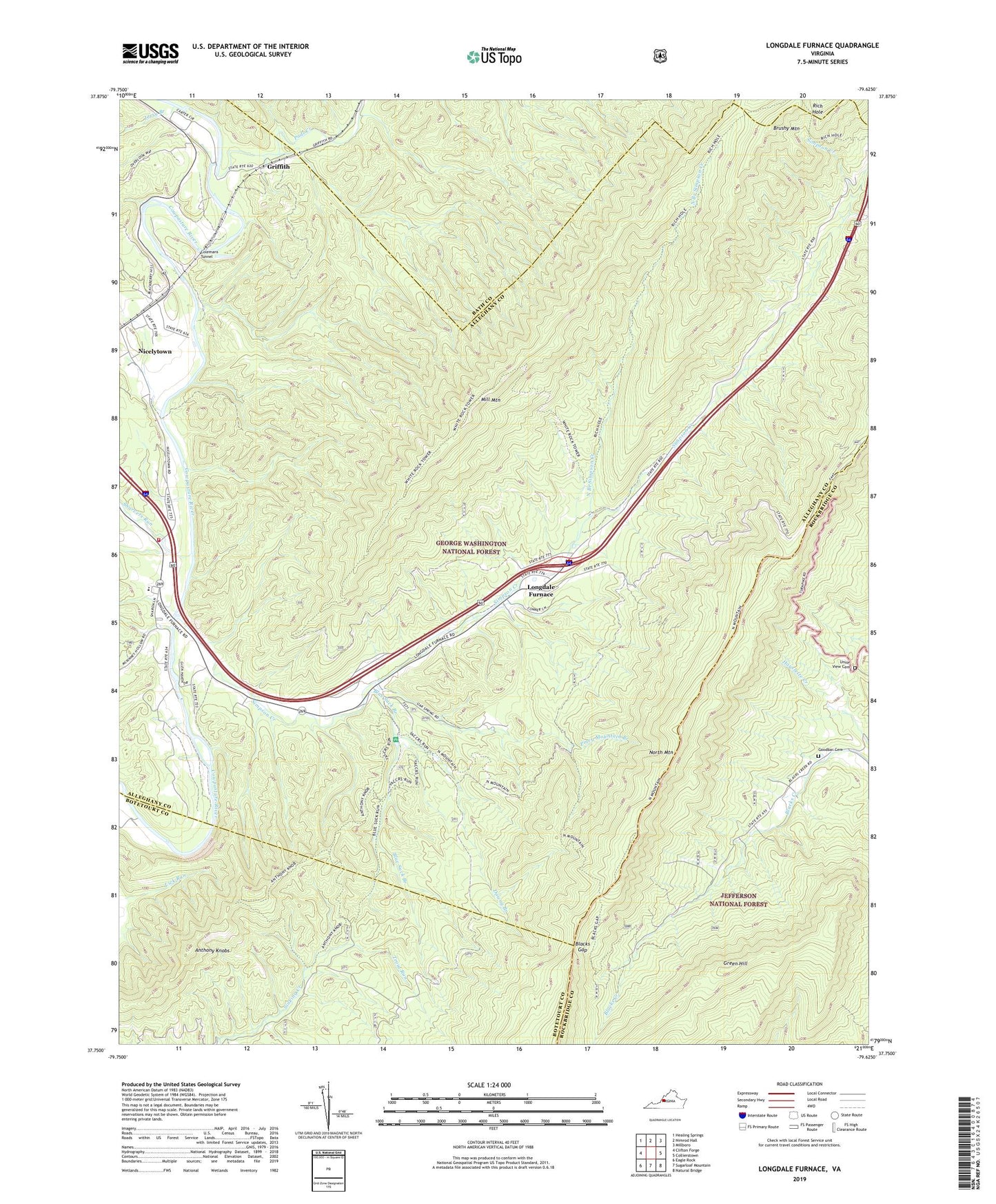
Longdale Furnace Virginia US Topo Map
Couldn't load pickup availability
Also explore the Longdale Furnace Forest Service Topo of this same quad for updated USFS data
2022 topographic map quadrangle Longdale Furnace in the state of Virginia. Scale: 1:24000. Based on the newly updated USGS 7.5' US Topo map series, this map is in the following counties: Alleghany, Rockbridge, Botetourt, Bath. The map contains contour data, water features, and other items you are used to seeing on USGS maps, but also has updated roads and other features. This is the next generation of topographic maps. Printed on high-quality waterproof paper with UV fade-resistant inks.
Quads adjacent to this one:
West: Clifton Forge
Northwest: Healing Springs
North: Nimrod Hall
Northeast: Millboro
East: Collierstown
Southeast: Natural Bridge
South: Sugarloaf Mountain
Southwest: Eagle Rock
This map covers the same area as the classic USGS quad with code o37079g6.
Contains the following named places: Anthony Knobs, Blacks Gap, Blue Suck Branch, Brushy Mountain, Cedar Grove Church, Clifton District, Colemans Tunnel, Downy Branch, Goodbar Cemetery, Green Hill, Griffith, Jerry Branch, Lone Star Church, Longdale Furnace, Longdale Recreation Area, Mill Mountain, Nicelytown, North Branch Simpson Creek, North Branch Trail, North Mountain Trail, Oakland Grove Church, Pads Creek, Piney Mountain Branch, Rich Hole, Rich Hole Trail, Rich Hole Wilderness, Sharon Church, Sharon District, Sharon Elementary School, Sharon Volunteer Fire Department and First Responders, Sharvers Run, Simpson Creek, Trout Run, Union View Cemetery, Union View Church, White Rock Tower Trail