MyTopo
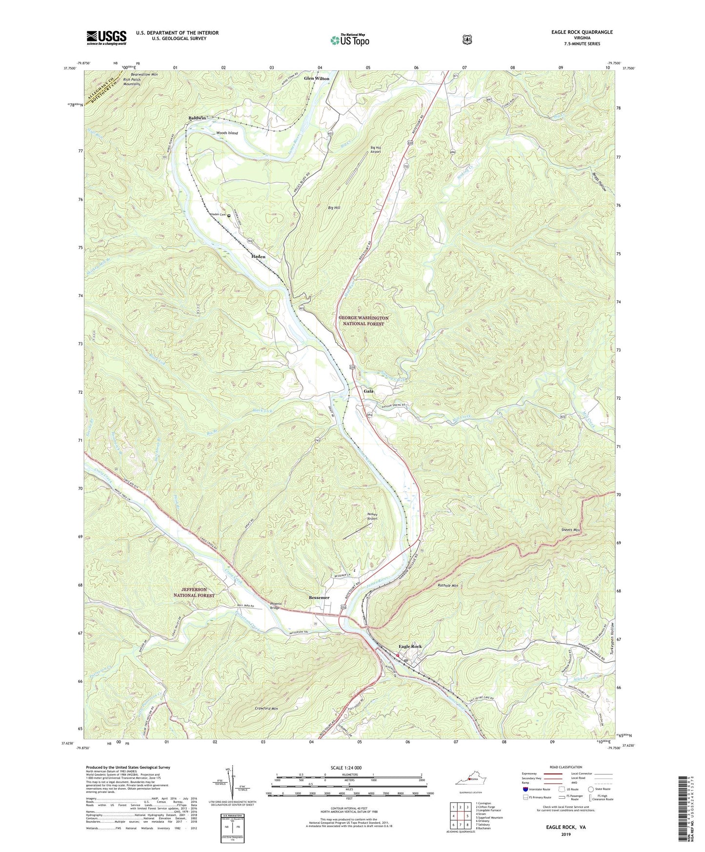
Eagle Rock Virginia US Topo Map
Couldn't load pickup availability
Also explore the Eagle Rock Forest Service Topo of this same quad for updated USFS data
2022 topographic map quadrangle Eagle Rock in the state of Virginia. Scale: 1:24000. Based on the newly updated USGS 7.5' US Topo map series, this map is in the following counties: Botetourt, Alleghany. The map contains contour data, water features, and other items you are used to seeing on USGS maps, but also has updated roads and other features. This is the next generation of topographic maps. Printed on high-quality waterproof paper with UV fade-resistant inks.
Quads adjacent to this one:
West: Strom
Northwest: Covington
North: Clifton Forge
Northeast: Longdale Furnace
East: Sugarloaf Mountain
Southeast: Buchanan
South: Salisbury
Southwest: Oriskany
This map covers the same area as the classic USGS quad with code o37079f7.
Contains the following named places: Baldwin, Bessemer, Bethel Church, Big Branch, Big Creek, Big Hill, Big Hill Airport, Black Lick, Boggs Hollow, Craig Creek, Crawford Mountain, Daggers Springs, Dutchman Branch, Eagle Mountain Lookout, Eagle Mountain Station, Eagle Rock, Eagle Rock Census Designated Place, Eagle Rock Elementary School, Eagle Rock Post Office, Eagle Rock Volunteer Fire and Rescue Company 5, Eagle Rock Volunteer Rescue Squad Headquarters, Emmanuel Church, Fincastle District, Gala, Galatia Church, Grange School, Haden, Haden Cemetery, Hombarck Branch, Hook Branch, Junction School, Little Patterson Creek, Locust Bottom Church, Mill Creek, Mount Zion Church, Mud Run, Patterson Creek, Perkey Airport, Phoenix Bridge, Rathole Mountain, Saville Branch, Sheets Mountain, Shiloh Church, Shiloh School, Shirkey Mill Branch, Sinking Creek, Stull Run, Turkeypen Hollow, Whitten Station, Woods Island, ZIP Code: 24085