
MyTopo
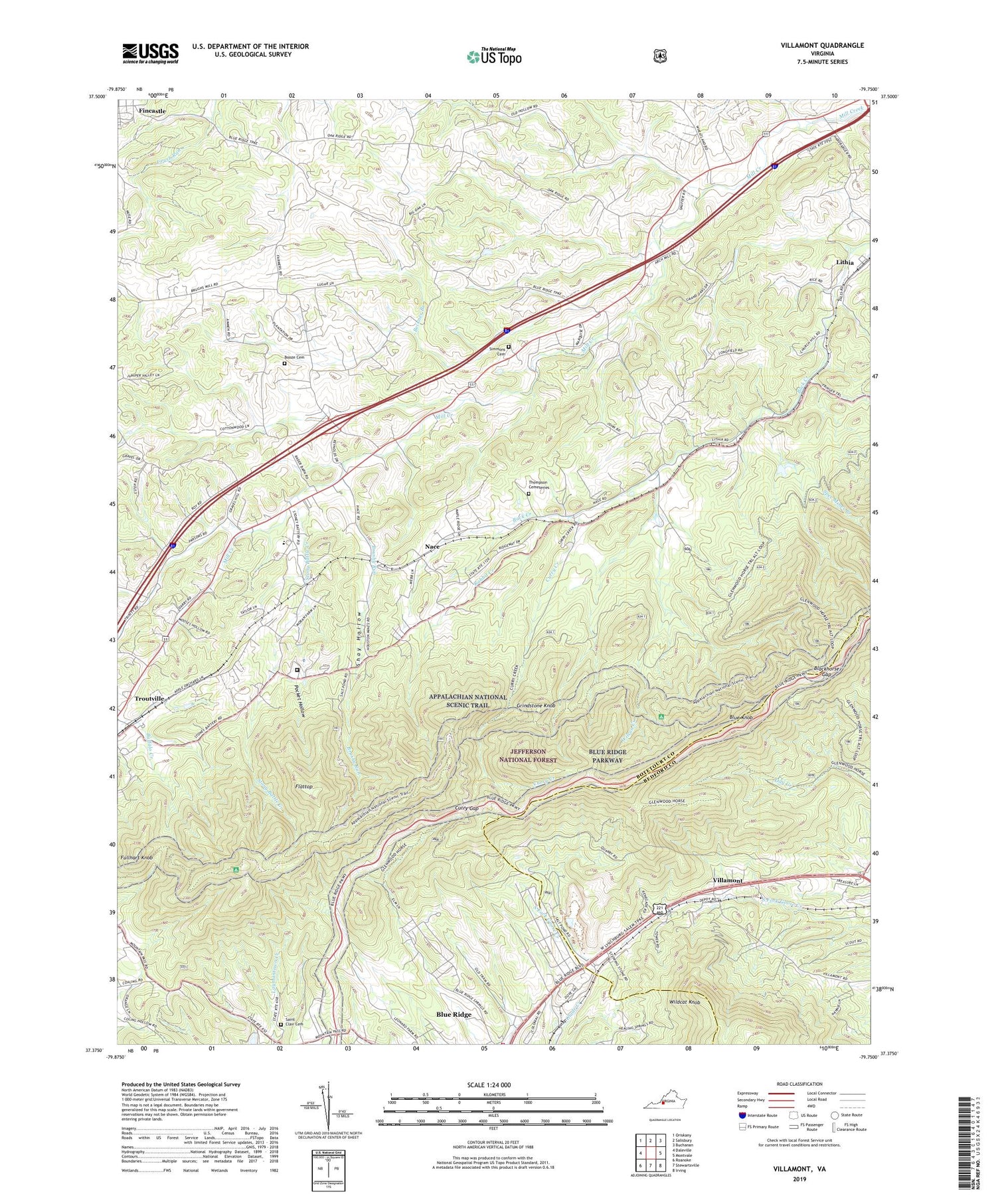
Villamont Virginia US Topo Map
Couldn't load pickup availability
2019 topographic map quadrangle Villamont in the state of Virginia. Scale: 1:24000. Based on the newly updated USGS 7.5' US Topo map series, this map is in the following counties: Botetourt, Bedford. The map contains contour data, water features, and other items you are used to seeing on USGS maps, but also has updated roads and other features. This is the next generation of topographic maps. Printed on high-quality waterproof paper with UV fade-resistant inks.
Quads adjacent to this one:
West: Daleville
Northwest: Oriskany
North: Salisbury
Northeast: Buchanan
East: Montvale
Southeast: Irving
South: Stewartsville
Southwest: Roanoke
Contains the following named places: Back Creek Church, Beaverdam Creek, Beckner Branch, Blackhorse Gap, Blue Knob, Blue Ridge, Blue Ridge Census Designated Place, Blue Ridge Quarry, Booze Cemetery, Botetourt Correctional Center, Brushy Run, Camp Bethel, Curry Creek, Curry Creek Trail, Curry Gap, Ebenezer Church, Flattop, Fullhart Knob, Fullhart Knob Shelter, Gravel Hill Church, Great Valley Overlook, Grindstone Knob, Lithia, Lynchburg Mines, Mill Creek Church, Nace, New Bethel Church, Pocket Hollow, Quarry Overlook, Rabbit Creek, Saint Clair Cemetery, Salt Pond, Shay Hollow, Simmons Cemetery, Spec, Spec Mines Branch, Stony Battle Creek, Thompson Cemeteries, Troutville, Troutville Elementary School, Valley District, Victory Mission Church, Villamont, Wildcat Knob, Wilson Creek, Wilson Creek Shelter, ZIP Code: 24064


