MyTopo
Warfield Virginia US Topo Map
Couldn't load pickup availability
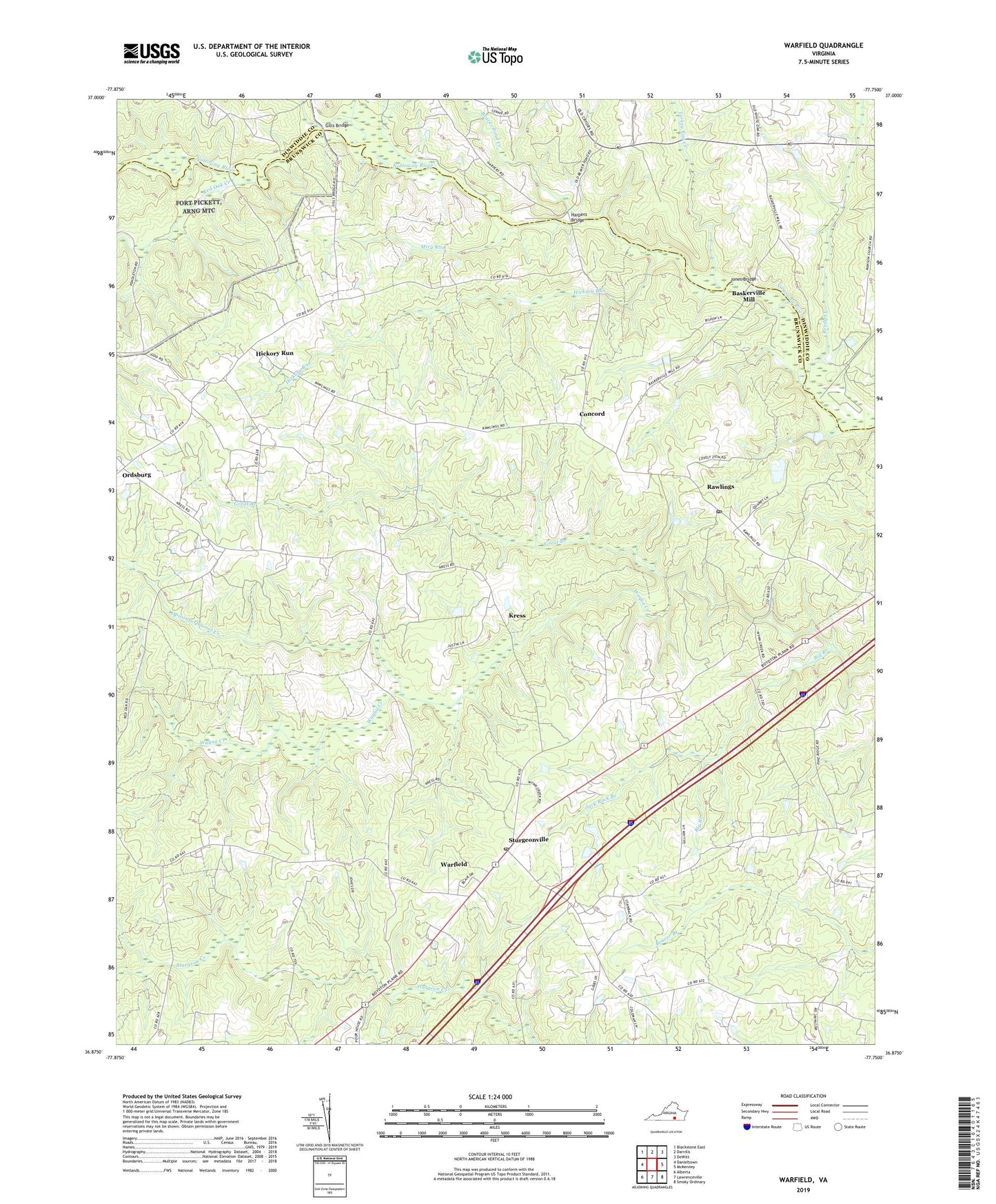
2019 topographic map quadrangle Warfield in the state of Virginia. Scale: 1:24000. Based on the newly updated USGS 7.5' US Topo map series, this map is in the following counties: Brunswick, Dinwiddie. The map contains contour data, water features, and other items you are used to seeing on USGS maps, but also has updated roads and other features. This is the next generation of topographic maps. Printed on high-quality waterproof paper with UV fade-resistant inks.
Quads adjacent to this one:
West: Danieltown
Northwest: Blackstone East
North: Darvills
Northeast: DeWitt
East: McKenney
Southeast: Smoky Ordinary
South: Lawrenceville
Southwest: Alberta
Contains the following named places: Antioch Church, Baskerville Airport, Baskerville Mill, Beaver Pond Creek, Big Branch, Central School, Champ, Clifton High School, Concord, Concord-Brunswick Church, Ebenezer Church, Gilliam School, Gills Bridge, Graves School, Great Branch, Harpers, Harpers Bridge, Harpers Mill, Hickory Run, Hickory Run School, Jack Rock Branch, Jones Bridge, Kress, Lebanon Church, Mercy See Church, Miry Run, Mount Zion Church, Opossum Quarter Creek, Rawlings, Rawlings Post Office, Red Oak Creek, Reedy Creek, Saint James Church, Saint James School, Sturgeonville, Sunnyside High School, Tommeheton Creek, Turkey Egg Creek, Warfield, Warfield Baptist Church, Warfield Census Designated Place, Warfield Post Office, Warfield School, ZIP Code: 23876