MyTopo
Blackstone East Virginia US Topo Map
Couldn't load pickup availability
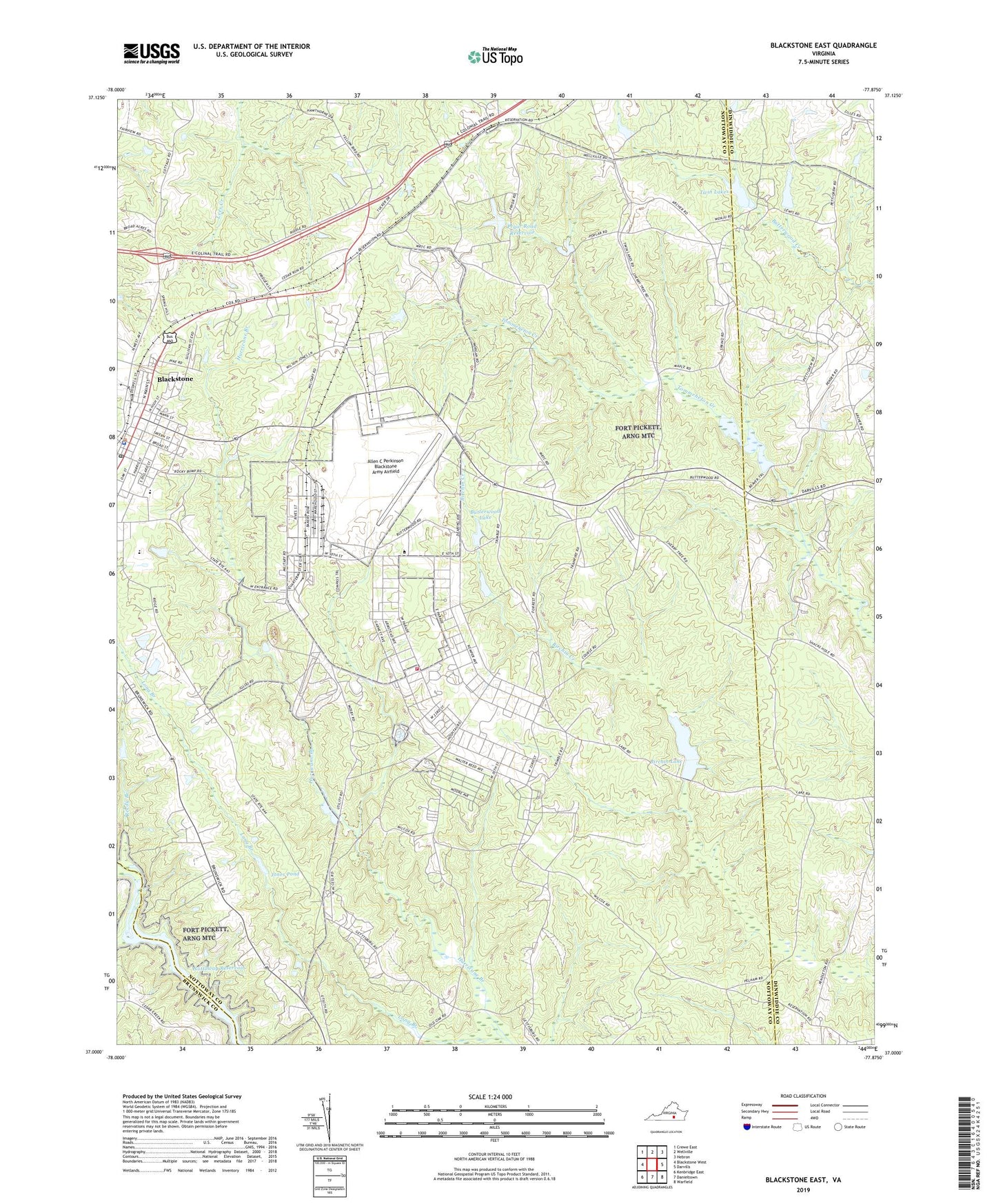
2022 topographic map quadrangle Blackstone East in the state of Virginia. Scale: 1:24000. Based on the newly updated USGS 7.5' US Topo map series, this map is in the following counties: Nottoway, Dinwiddie, Brunswick. The map contains contour data, water features, and other items you are used to seeing on USGS maps, but also has updated roads and other features. This is the next generation of topographic maps. Printed on high-quality waterproof paper with UV fade-resistant inks.
Quads adjacent to this one:
West: Blackstone West
Northwest: Crewe East
North: Wellville
Northeast: Hebron
East: Darvills
Southeast: Warfield
South: Danieltown
Southwest: Kenbridge East
This map covers the same area as the classic USGS quad with code o37077a8.
Contains the following named places: Allen C Perkinson Blackstone Army Airfield, Birchin Dam, Birchin Lake, Blackstone, Blackstone Army Air Base, Blackstone Baptist Church, Blackstone City Hall, Blackstone Elementary School, Blackstone Health Center, Blackstone High School, Blackstone Police Department, Blackstone Post Office, Blackstone Primary School, Butterwood Lake, Butterwood Lake Upper Dam, Butterwood Lower Dam, District 5, Dominy Corner, Faith Church, Forkland, Fort Pickett, Fort Pickett Fire Department, Jones Church, Jones Pond, Kenston Forest School, Long Branch, Louis Spencer Epes Memorial Library, Nottoway County Training School, Pryor Road Reservoir, Reedy Branch, Richardson School, Southside Community College - Pickett Park, Spring Hill Church, Tactical Bridge Dam, Tommeheton Creek Dam, Tree Church, Twin Lakes, Westboro, ZIP Code: 23824