MyTopo
Wilton Virginia US Topo Map
Couldn't load pickup availability
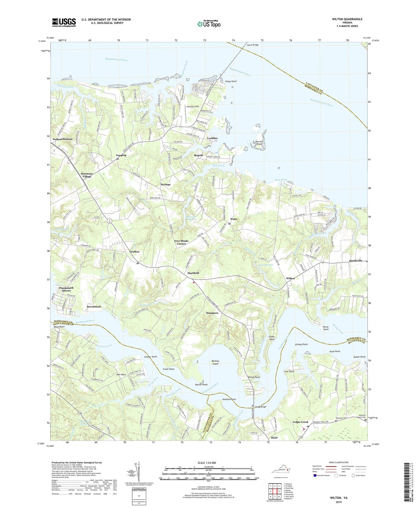
2019 topographic map quadrangle Wilton in the state of Virginia. Scale: 1:24000. Based on the newly updated USGS 7.5' US Topo map series, this map is in the following counties: Middlesex, Gloucester, Mathews, Lancaster. The map contains contour data, water features, and other items you are used to seeing on USGS maps, but also has updated roads and other features. This is the next generation of topographic maps. Printed on high-quality waterproof paper with UV fade-resistant inks.
Quads adjacent to this one:
West: Saluda
Northwest: Urbanna
North: Irvington
Northeast: Fleets Bay
East: Deltaville
Southeast: Mathews
South: Ware Neck
Southwest: Gloucester
Contains the following named places: Barretts, Barricks Dam, Barricks Millpond, Berkley Island, Blands Wharf, Bush Park Creek, Bushy, Cheaden, Coach Point Landing, Cobbs Creek, Cobbs Creek Post Office, Conrad Pond, Conrad Wharf, Conrads Dam, Cooper Point, Creek Point, Dancing Creek, Deep Point, Deep Point Landing Boat Ramp, Dixie, Doctor Point, Duck Pond, Ebenezer Cemetery, Ebenezer Church, Elm Bank School, Fairfield Landing, Ferry Creek, Free Shade Corner, French Creek, Garlands Landing, Ginney Point, Ginney Point Marina, Gleaning Baptist Church, Glebe Neck, Grafton, Great Point Wharf, Grey Point-White Stone Ferry, Greys Point, Hardyville Post Office, Harmony Grove Church, Harmony Village, Hartfield, Hartfield Post Office, Hartfield Volunteer Fire Department, Healy Creek, Hell Neck, Hickory Gate School, Holland Point, Horse Point, Hummel Field, Iron Point, Lancaster Training School, Locklies, Locklies Creek, Locklies Marina, Mathews Chapel, Mathews Chapel Cemetery, Mathews Volunteer Fire Department Station 4, Meachim Creek, Mill Creek, Mill Creek Boat Ramp, Mount Olive Church, New Mill Creek Wharf, Nohead Bottom, Norris Bridge, Old Brick Church, Parrott Island, Piankatank River Golf Club, Piankatank Shores, Pond Point, Prowler Marina, Quarter Landing, Regent, Regent Point Marina, Roane Point, Roanes Point Landing, Royal Ambassador Camp, Saint Clare Walker Middle School, Scoggins Creek, Segars Landing, Shipleys Ferry, Silver Hill School, Stamper Landing, Stampers, Stampers Wharf, Syringa, Topping, Topping Post Office, Twigg Bridge, Wadinger Creek, Wake, Wake Launching Ramp, Wake Post Office, Wilton, Wilton Creek, Wilton Point, Wilton School, Woods Creek, Woodstock, ZIP Codes: 23070, 23071, 23169, 23176