MyTopo
Gloucester Virginia US Topo Map
Couldn't load pickup availability
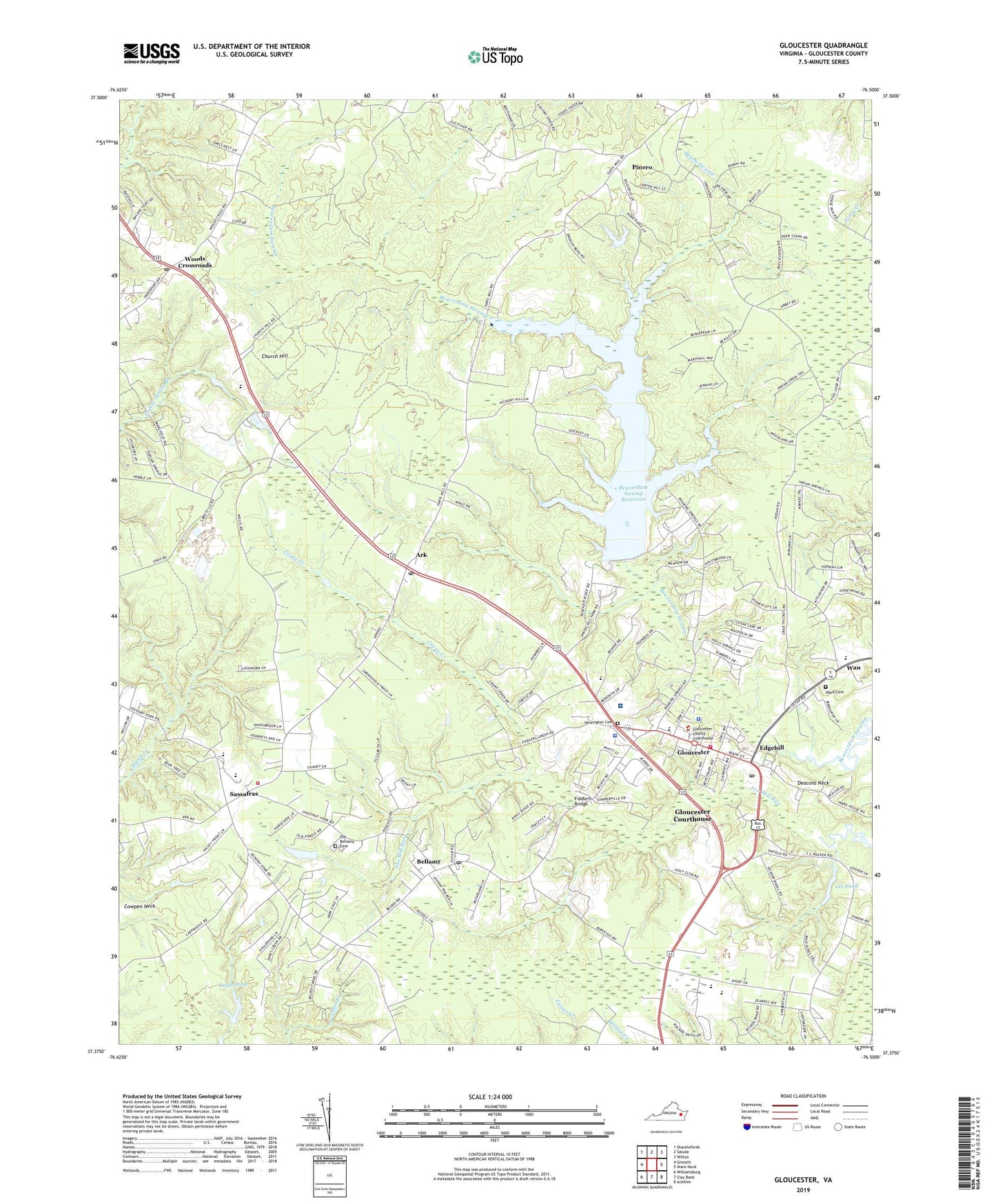
2022 topographic map quadrangle Gloucester in the state of Virginia. Scale: 1:24000. Based on the newly updated USGS 7.5' US Topo map series, this map is in the following counties: Gloucester. The map contains contour data, water features, and other items you are used to seeing on USGS maps, but also has updated roads and other features. This is the next generation of topographic maps. Printed on high-quality waterproof paper with UV fade-resistant inks.
Quads adjacent to this one:
West: Gressitt
Northwest: Shacklefords
North: Saluda
Northeast: Wilton
East: Ware Neck
Southeast: Achilles
South: Clay Bank
Southwest: Williamsburg
This map covers the same area as the classic USGS quad with code o37076d5.
Contains the following named places: Abingdon District, Ark, Ark Post Office, Bacons Quarters, Beaverdam Park Boat Ramp, Beaverdam Swamp Reservoir, Beech Swamp, Bellamy, Bellamy Church, Bellamy Post Office, Belroi, Bethel Church, Bethel Elementary School, Botetourt Elementary School, Cape Charles Rescue Service Station 19, Cappahosic Estates Mobile Home Park, Church Hill, County Day School, Crany Creek, Deacons Neck, Ebenezer Church, Edgehill, Edgehill Shopping Center, Fiddlers Bridge, First Baptist Church, Francis J Mellar Field, Gloucester, Gloucester County, Gloucester County Courthouse, Gloucester County Office Building 1, Gloucester County Office Building 2, Gloucester County Sheriff's Office, Gloucester County Social Services Building, Gloucester Courthouse, Gloucester Courthouse Census Designated Place, Gloucester Downtown Historic District, Gloucester Exchange Shopping Center, Gloucester Golf Course, Gloucester High School, Gloucester House Assisted Living Facility, Gloucester Montessori School, Gloucester Post Office, Gloucester Public Library, Gloucester Volunteer Fire and Rescue Station 1, Gloucester Volunteer Fire and Rescue Station 6, Gospel Tabernacle, Grace Bible Church, Grace City Shopping Center, Howards Mill, Iglesea Bautista El Camino Church, Lee Pond, Leigh Pond, Locust Grove Church, Majesty Christian Academy, Marlfield, Middle Penin Regional Special Education Program, Money, Newington Cemetery, Newington Church, Old Bellamy Cemetery, Page Middle School, Peasley Middle School, Petsworth Church, Petsworth District, Petsworth Elementary School, Pinero, Riverside Middle Peninsula Hospital Heliport, Riverside Walter Reed Hospital, Sanders Senior Living Community, Sassafras, Shepherdsville Church, Shoppes at Gloucester, Short Lane, Stubbs Pond, Thomas C Walker Elementary School, Tri - County Transportation, Valley Front, Virginia State Police Division 5 Area 33 Office, Voice of Victory Church, Walter Reed Convalescent Center, Walter Reed Plaza, Wan, Ware Academy, Ware Cemetery, Ware Church, Wareham, Woods Cross Roads Post Office, Woods Crossroads, WXGM-AM (Gloucester), Zion Hill Church, Zion Poplars Church, ZIP Code: 23061