MyTopo
Amber Washington US Topo Map
Couldn't load pickup availability
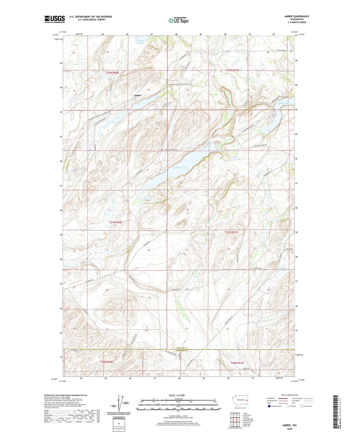
2023 topographic map quadrangle Amber in the state of Washington. Scale: 1:24000. Based on the newly updated USGS 7.5' US Topo map series, this map is in the following counties: Spokane, Whitman. The map contains contour data, water features, and other items you are used to seeing on USGS maps, but also has updated roads and other features. This is the next generation of topographic maps. Printed on high-quality waterproof paper with UV fade-resistant inks.
Quads adjacent to this one:
West: Fishtrap Lake
Northwest: Tyler
North: Lance Hills
Northeast: Cheney
East: Chapman Lake
Southeast: Pine City
South: Rock Lake
Southwest: Lamont NE
This map covers the same area as the classic USGS quad with code o47117c6.
Contains the following named places: Amber, Amber Lake, Badger Lake, Captain J Mullan Historic Monument, Cherry Springs, Spokane County Fire District 3 Station 310 Amber / Williams Lake, Williams Lake