MyTopo
Bassett Junction Washington US Topo Map
Couldn't load pickup availability
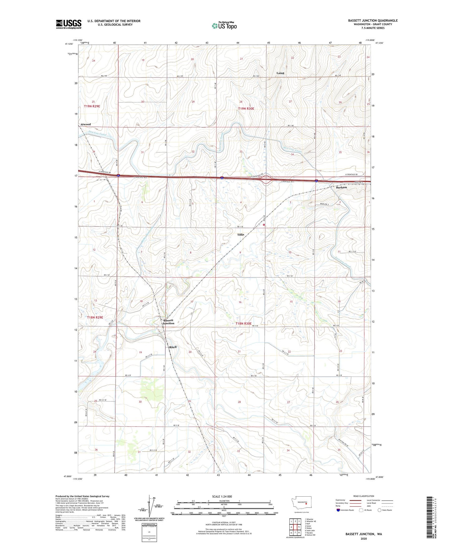
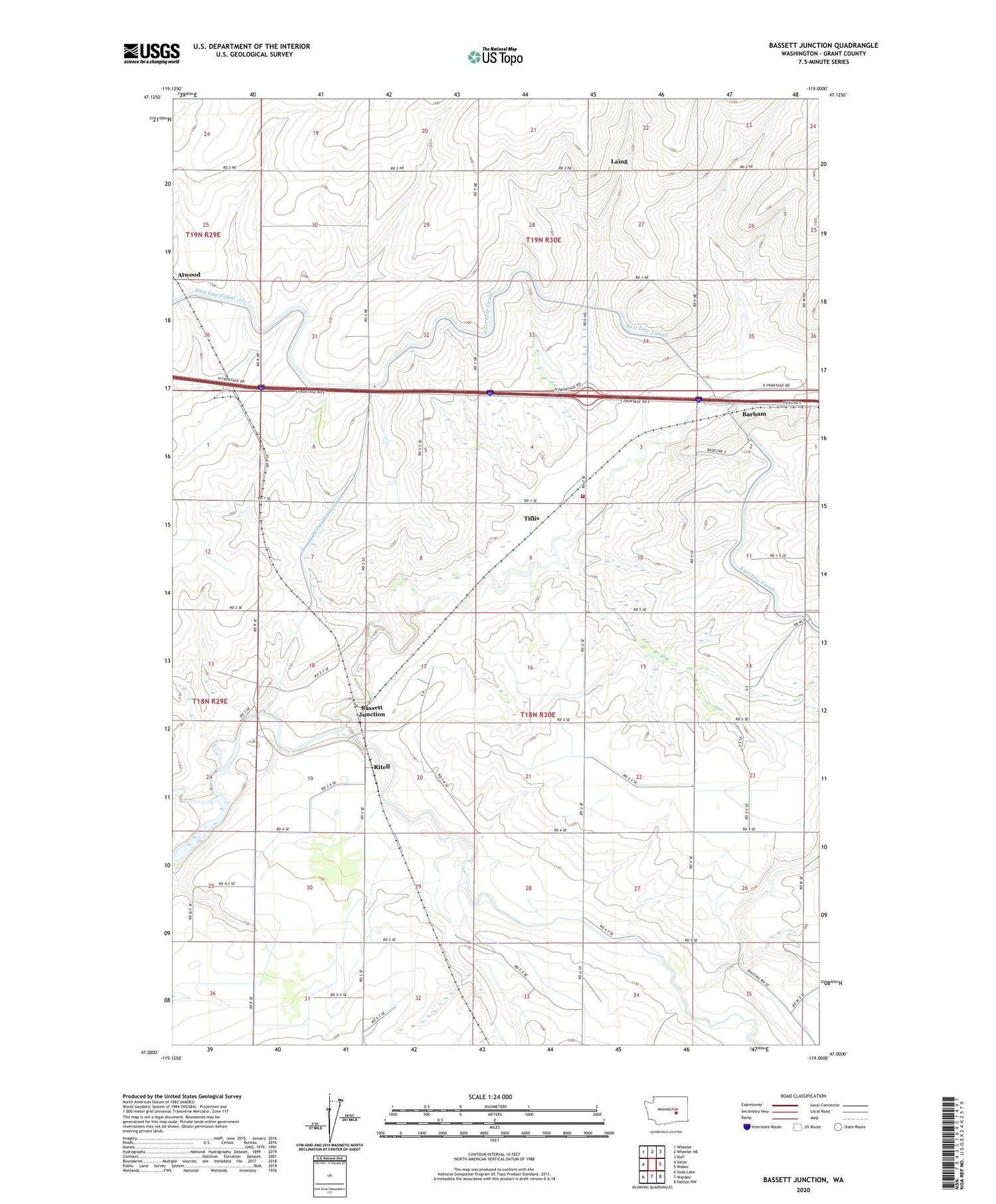
2020 topographic map quadrangle Bassett Junction in the state of Washington. Scale: 1:24000. Based on the newly updated USGS 7.5' US Topo map series, this map is in the following counties: Grant. The map contains contour data, water features, and other items you are used to seeing on USGS maps, but also has updated roads and other features. This is the next generation of topographic maps. Printed on high-quality waterproof paper with UV fade-resistant inks.
Quads adjacent to this one:
West: Sieler
Northwest: Wheeler
North: Wheeler NE
Northeast: Ruff
East: Weber
Southeast: Hatton NW
South: Warden
Southwest: Soda Lake
Contains the following named places: Atwood, Barham, Bassett Junction, Carnation Waste Pond Number Five, Carnation Waste Pond Number Five Dam, Grant County Fire District 4 Station 2, Laing, Raugust Station, Ritell, Tiflis, Weber Branch Syphon, Weber Coulee, Weber Coulee Syphon, Weber Wasteway