MyTopo
Soda Lake Washington US Topo Map
Couldn't load pickup availability
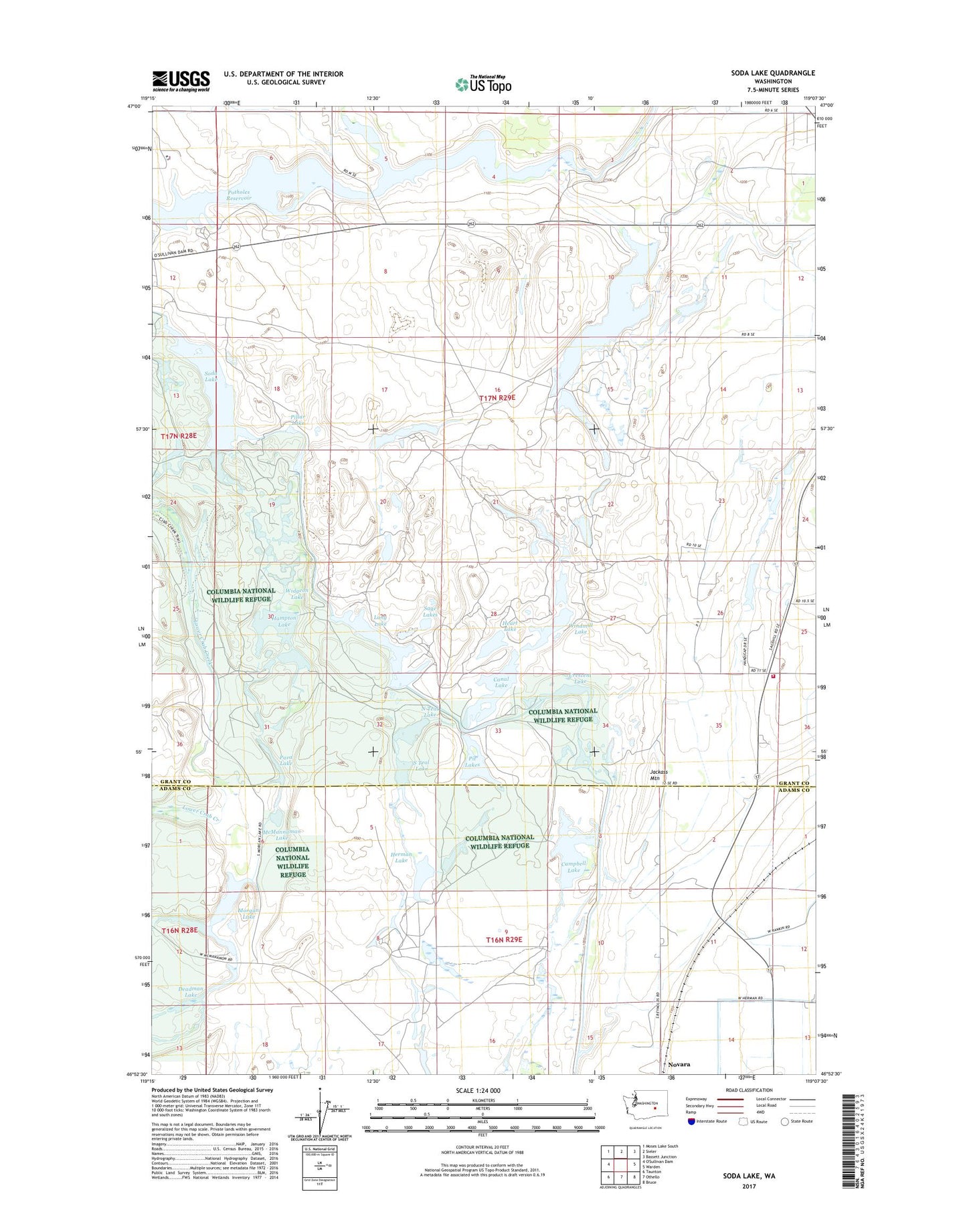
2023 topographic map quadrangle Soda Lake in the state of Washington. Scale: 1:24000. Based on the newly updated USGS 7.5' US Topo map series, this map is in the following counties: Grant, Adams. The map contains contour data, water features, and other items you are used to seeing on USGS maps, but also has updated roads and other features. This is the next generation of topographic maps. Printed on high-quality waterproof paper with UV fade-resistant inks.
Quads adjacent to this one:
Northwest: Moses Lake South
North: Sieler
Northeast: Bassett Junction
East: Warden
Southeast: Bruce
South: Othello
Southwest: Taunton
This map covers the same area as the classic USGS quad with code o46119h2.
Contains the following named places: Bar E Dairy, Campbell Lake, Canal Lake, Crescent Lake, Deadman Lake, Grant County Fire District 4 Station 3, Halfmoon Lake, Hampton Lake, Heart Lake, Herman Lake, Jackass Mountain, Long Lake, McMannaman Lake, Morgan Lake, North Teal Lake, Novara, Para Lake, Pillar Lake, Pit Lakes, Rock Check IV-14 Dam, Sage Lakes, Soda Lake, Soda Lake Dike Dam, South Teal Lake, Widgeon Lake, Windmill Lake