MyTopo
Beverly SE Washington US Topo Map
Couldn't load pickup availability
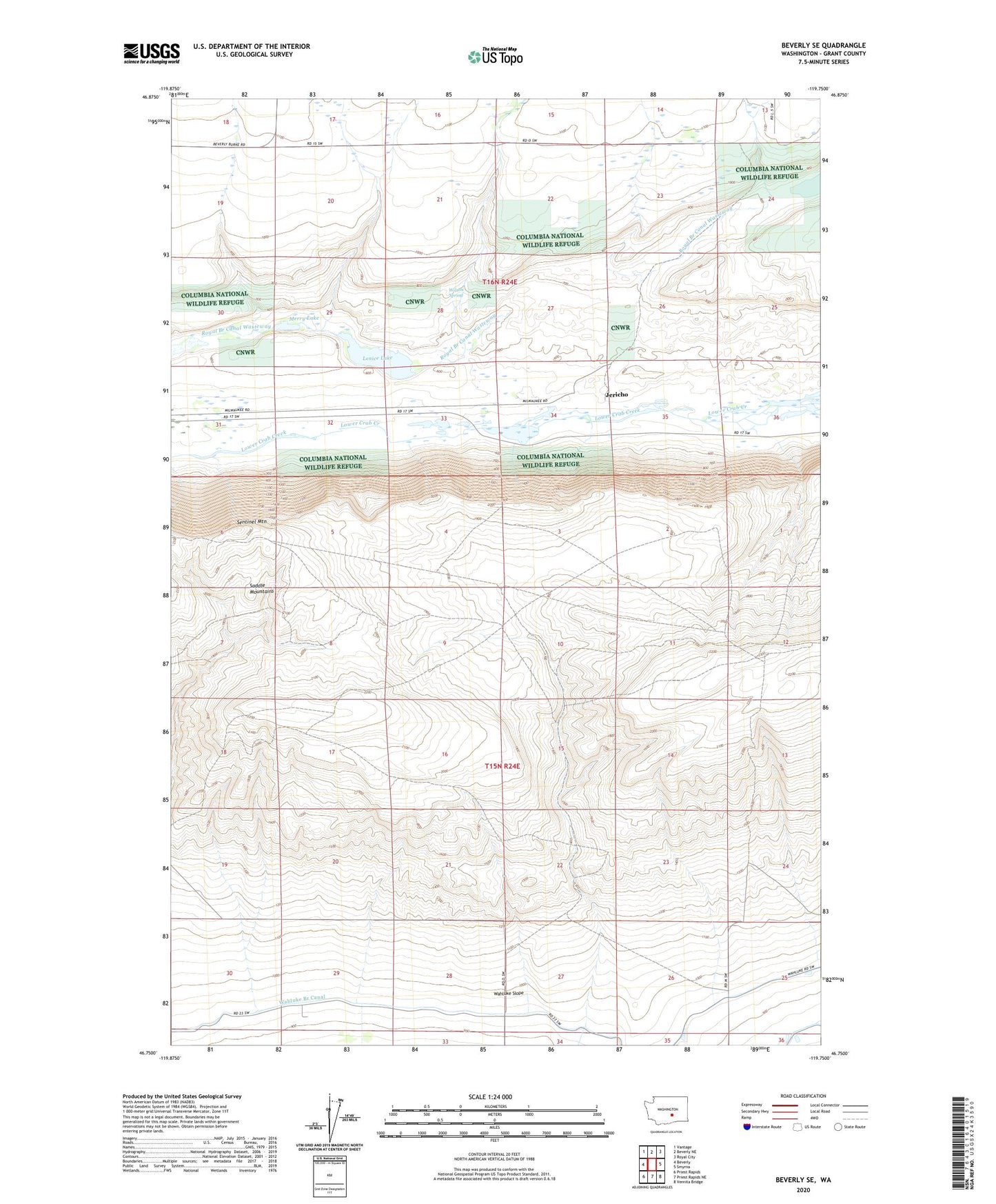
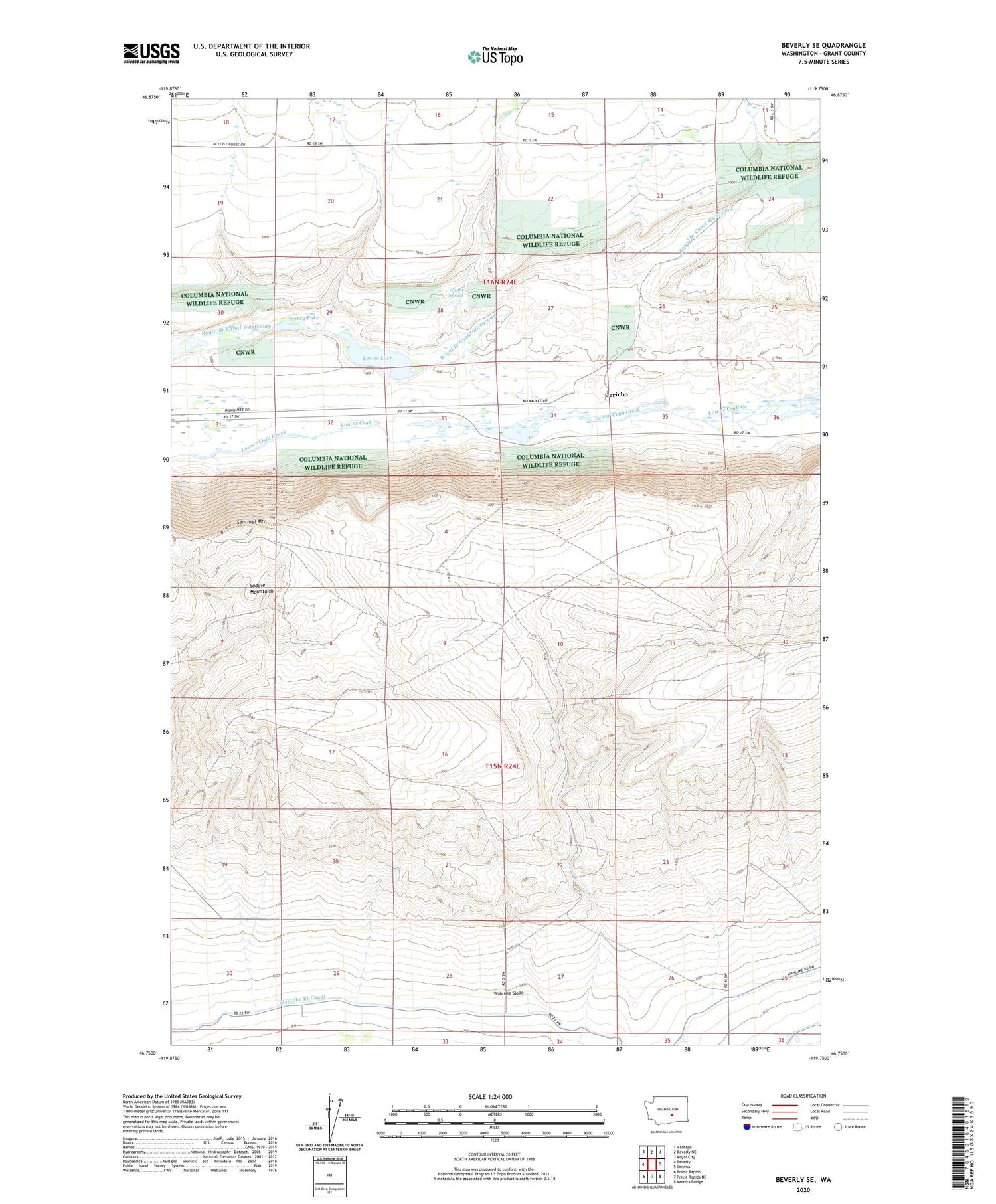
2020 topographic map quadrangle Beverly SE in the state of Washington. Scale: 1:24000. Based on the newly updated USGS 7.5' US Topo map series, this map is in the following counties: Grant. The map contains contour data, water features, and other items you are used to seeing on USGS maps, but also has updated roads and other features. This is the next generation of topographic maps. Printed on high-quality waterproof paper with UV fade-resistant inks.
Quads adjacent to this one:
West: Beverly
Northwest: Vantage
North: Beverly NE
Northeast: Royal City
East: Smyrna
Southeast: Vernita Bridge
South: Priest Rapids NE
Southwest: Priest Rapids
Contains the following named places: Jericho, Lenice Dam, Lenice Lake, Merry Dam, Merry Lake, Sentinel Mountain, Wilson Spring