MyTopo
Smyrna Washington US Topo Map
Couldn't load pickup availability
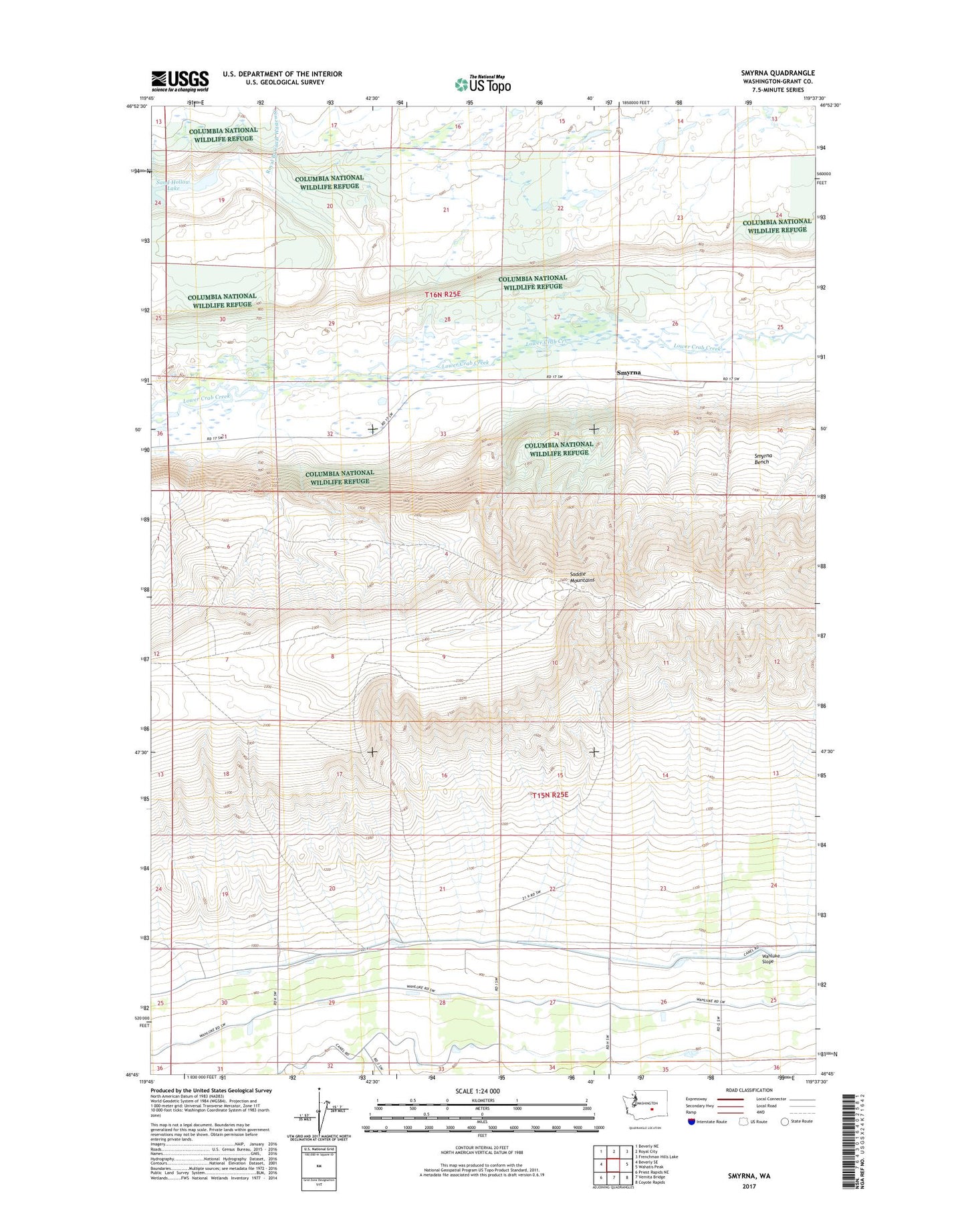
2023 topographic map quadrangle Smyrna in the state of Washington. Scale: 1:24000. Based on the newly updated USGS 7.5' US Topo map series, this map is in the following counties: Grant. The map contains contour data, water features, and other items you are used to seeing on USGS maps, but also has updated roads and other features. This is the next generation of topographic maps. Printed on high-quality waterproof paper with UV fade-resistant inks.
Quads adjacent to this one:
West: Beverly SE
Northwest: Beverly NE
North: Royal City
Northeast: Frenchman Hills Lake
East: Wahatis Peak
Southeast: Coyote Rapids
South: Vernita Bridge
Southwest: Priest Rapids NE
This map covers the same area as the classic USGS quad with code o46119g6.
Contains the following named places: Crab Creek Habitat Management Area, Crab Creek Lateral Extension, Dry Island, Mattawa-Royal City Division, Royal Branch Canal Wasteway, Sand Hollow Lake, Schrum Ranch, Smyrna